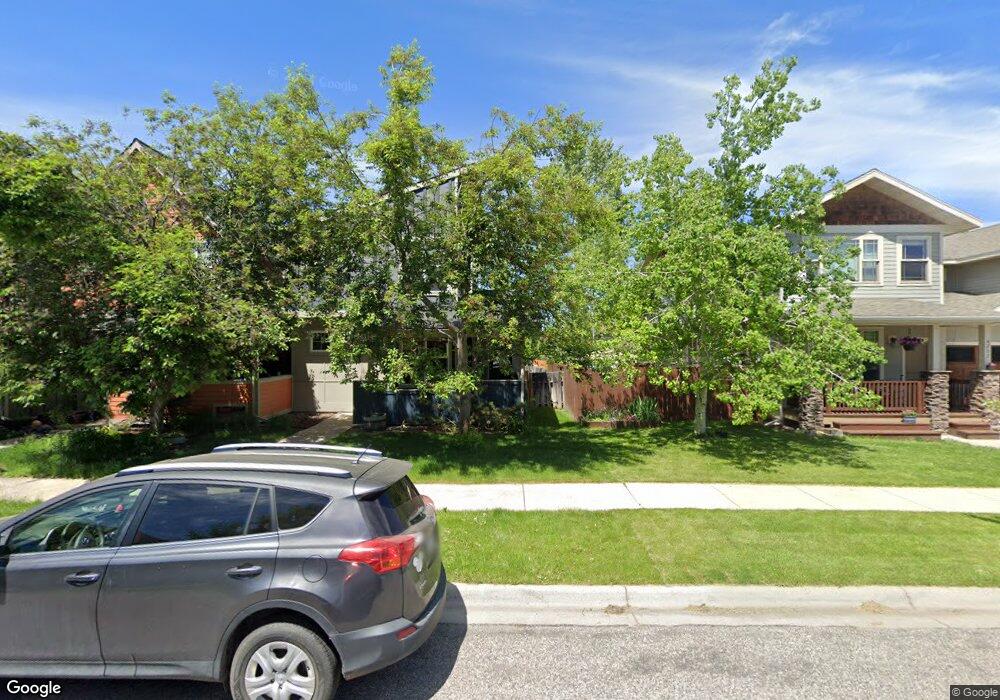
4207 Cover St Bozeman, MT 59718
Valley West NeighborhoodEstimated Value: $516,300 - $579,000
3
Beds
3
Baths
1,520
Sq Ft
$360/Sq Ft
Est. Value
About This Home
This home is located at 4207 Cover St, Bozeman, MT 59718 and is currently estimated at $547,767, approximately $360 per square foot. 4207 Cover St is a home located in Gallatin County with nearby schools including Meadowlark Elementary School, Chief Joseph Middle School, and Gallatin High School.
Ownership History
Date
Name
Owned For
Owner Type
Purchase Details
Closed on
Jan 25, 2007
Sold by
Palmer Brian R
Bought by
Birrell Steven E and Birrell Sandra K
Current Estimated Value
Home Financials for this Owner
Home Financials are based on the most recent Mortgage that was taken out on this home.
Original Mortgage
$154,900
Outstanding Balance
$92,520
Interest Rate
6.11%
Mortgage Type
Purchase Money Mortgage
Estimated Equity
$455,247
Purchase Details
Closed on
Oct 27, 2005
Sold by
Tribitt Justin
Bought by
Palmer Brian R
Home Financials for this Owner
Home Financials are based on the most recent Mortgage that was taken out on this home.
Original Mortgage
$173,520
Interest Rate
5.68%
Mortgage Type
Fannie Mae Freddie Mac
Create a Home Valuation Report for This Property
The Home Valuation Report is an in-depth analysis detailing your home's value as well as a comparison with similar homes in the area
Home Values in the Area
Average Home Value in this Area
Purchase History
| Date | Buyer | Sale Price | Title Company |
|---|---|---|---|
| Birrell Steven E | -- | It | |
| Palmer Brian R | -- | Security Title Company |
Source: Public Records
Mortgage History
| Date | Status | Borrower | Loan Amount |
|---|---|---|---|
| Open | Birrell Steven E | $154,900 | |
| Previous Owner | Palmer Brian R | $173,520 |
Source: Public Records
Tax History Compared to Growth
Tax History
| Year | Tax Paid | Tax Assessment Tax Assessment Total Assessment is a certain percentage of the fair market value that is determined by local assessors to be the total taxable value of land and additions on the property. | Land | Improvement |
|---|---|---|---|---|
| 2025 | $2,383 | $552,000 | $0 | $0 |
| 2024 | $3,396 | $510,200 | $0 | $0 |
| 2023 | $3,288 | $510,200 | $0 | $0 |
| 2022 | $2,463 | $321,200 | $0 | $0 |
| 2021 | $2,718 | $321,200 | $0 | $0 |
| 2020 | $2,376 | $277,900 | $0 | $0 |
| 2019 | $2,430 | $277,900 | $0 | $0 |
| 2018 | $2,295 | $243,100 | $0 | $0 |
| 2017 | $2,146 | $243,100 | $0 | $0 |
| 2016 | $1,883 | $199,300 | $0 | $0 |
| 2015 | $1,885 | $199,300 | $0 | $0 |
| 2014 | $1,985 | $123,543 | $0 | $0 |
Source: Public Records
Map
Nearby Homes
- 4276 Cascade St Unit D
- 4271 Cover St
- 228 N Hanley Unit A
- 336 N Hanley Ave
- 4490 Cascade St
- 4239 W Babcock St Unit 7
- 4277 W Babcock St Unit 6
- 4442 Alexander St
- 4468 Alexander St
- 4619 Cascade St
- 205 Teton Ave
- 268 Pine Creek Dr
- 404 Flathead Ave
- TBD (Lot 5) N Cottonwood Rd
- TBD (Lot 2) N Cottonwood Rd
- TBD (Lot 3) N Cottonwood Rd
- TBD (Lot 1) N Cottonwood Rd
- 10 N Cottonwood Rd
- 234 Stillwater Creek Dr
- 332 N Cottonwood Rd Unit F
- 4215 Cover St
- 4223 Cover St
- 215 Kimball Ave
- 215 Kimball Ave Unit 2
- 257 Kimball Ave Unit B
- 257 Kimball Ave Unit A
- 257 Kimball Ave
- 257 Kimball Ave Unit 18-A
- 4231 Cover St
- 4237D Cover St
- 4243C Cover St
- 4243C Cover St
- 275 Kimball Ave
- 275 Kimball Ave
- 275 Kimball Ave Unit A
- 275 Kimball Ave Unit B
- 4249 Cover St
- 4249B Cover St
- 150 Covery Ct Unit D
- 275 Kimball A Ave