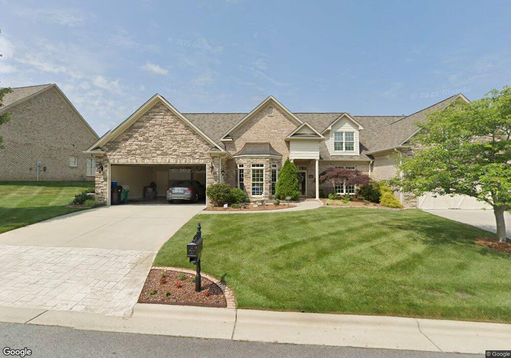
4207 Pennfield Way High Point, NC 27262
Estimated Value: $576,241 - $696,000
3
Beds
3
Baths
4,801
Sq Ft
$133/Sq Ft
Est. Value
About This Home
This home is located at 4207 Pennfield Way, High Point, NC 27262 and is currently estimated at $636,310, approximately $132 per square foot. 4207 Pennfield Way is a home with nearby schools including Friendship Elementary School, Ledford Middle School, and Ledford High School.
Ownership History
Date
Name
Owned For
Owner Type
Purchase Details
Closed on
Aug 8, 2006
Sold by
Phd Enterprises Inc
Bought by
Walker Mickey R and Walker Terri N
Current Estimated Value
Home Financials for this Owner
Home Financials are based on the most recent Mortgage that was taken out on this home.
Original Mortgage
$124,000
Outstanding Balance
$10,022
Interest Rate
6.74%
Mortgage Type
Purchase Money Mortgage
Estimated Equity
$626,288
Create a Home Valuation Report for This Property
The Home Valuation Report is an in-depth analysis detailing your home's value as well as a comparison with similar homes in the area
Home Values in the Area
Average Home Value in this Area
Purchase History
| Date | Buyer | Sale Price | Title Company |
|---|---|---|---|
| Walker Mickey R | $369,500 | None Available |
Source: Public Records
Mortgage History
| Date | Status | Borrower | Loan Amount |
|---|---|---|---|
| Open | Walker Mickey R | $124,000 |
Source: Public Records
Tax History Compared to Growth
Tax History
| Year | Tax Paid | Tax Assessment Tax Assessment Total Assessment is a certain percentage of the fair market value that is determined by local assessors to be the total taxable value of land and additions on the property. | Land | Improvement |
|---|---|---|---|---|
| 2025 | $4,257 | $363,940 | $0 | $0 |
| 2024 | $4,257 | $363,940 | $0 | $0 |
| 2023 | $4,213 | $363,940 | $0 | $0 |
| 2022 | $4,149 | $363,940 | $0 | $0 |
| 2021 | $4,257 | $363,940 | $0 | $0 |
| 2020 | $3,762 | $321,600 | $0 | $0 |
| 2019 | $3,819 | $321,600 | $0 | $0 |
| 2018 | $3,819 | $321,600 | $0 | $0 |
| 2017 | $3,819 | $321,600 | $0 | $0 |
| 2016 | $3,819 | $321,600 | $0 | $0 |
| 2015 | $3,827 | $321,600 | $0 | $0 |
| 2014 | $4,429 | $367,880 | $0 | $0 |
Source: Public Records
Map
Nearby Homes
- 2729 Croquet Cir
- 2731 Croquet Cir
- 2801 Swan Lake Dr
- 2809 Churchill Ct
- 1706 Windsor Dr
- 2908 Maggie Ct
- 1629 Appaloosa Place
- 1629 Appaloosa Place Unit Lot 11
- 4099 Stallion St
- Bailey Plan at Canter Creek
- Seagrove Plan at Canter Creek
- Richmond Plan at Canter Creek
- 4106 Stallion St
- 4095 Stallion St
- 4090 Stallion St
- 4098 Stallion St Unit Lot 76
- 4094 Stallion St Unit lot 75
- Stoddard Plan at Canter Creek
- 4094 Stallion St
- Cameron Plan at Canter Creek
- 4205 Pennfield Way
- 4203 Pennfield Way
- 4206 Pennfield Way
- 4210 Pennfield Way
- 4204 Pennfield Way
- 4121 Pennfield Way
- 2739 Croquet Cir
- 4215 Pennfield Way
- 2737 Croquet Cir
- 2733 Croquet Cir
- 2735 Croquet Cir
- 2725 Croquet Cir
- 4120 Pennfield Way
- 4119 Pennfield Way
- 4214 Pennfield Way
- 2716 Croquet Cir
- 4217 Pennfield Way
- 2721 Croquet Cir
- 4118 Pennfield Way
- 2719 Croquet Cir