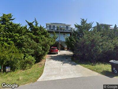
42073 Pheasant Cir Unit 5 Avon, NC 27915
Avon NeighborhoodEstimated Value: $580,525 - $692,000
4
Beds
3
Baths
1,838
Sq Ft
$352/Sq Ft
Est. Value
About This Home
This home is located at 42073 Pheasant Cir Unit 5, Avon, NC 27915 and is currently estimated at $647,631, approximately $352 per square foot. 42073 Pheasant Cir Unit 5 is a home located in Dare County with nearby schools including Cape Hatteras Elementary School and Cape Hatteras Secondary School.
Ownership History
Date
Name
Owned For
Owner Type
Purchase Details
Closed on
Feb 17, 2010
Sold by
Thiel Enterprises Llc
Bought by
Norman Elliot E and Norman Jeanne S
Current Estimated Value
Home Financials for this Owner
Home Financials are based on the most recent Mortgage that was taken out on this home.
Original Mortgage
$256,000
Interest Rate
4.97%
Mortgage Type
New Conventional
Purchase Details
Closed on
Sep 17, 2008
Sold by
Kuntne Donald J and Kuntne Elizabeth I
Bought by
Thiel Enterprises Llc
Create a Home Valuation Report for This Property
The Home Valuation Report is an in-depth analysis detailing your home's value as well as a comparison with similar homes in the area
Home Values in the Area
Average Home Value in this Area
Purchase History
| Date | Buyer | Sale Price | Title Company |
|---|---|---|---|
| Norman Elliot E | $320,000 | None Available | |
| Thiel Enterprises Llc | $325,000 | None Available |
Source: Public Records
Mortgage History
| Date | Status | Borrower | Loan Amount |
|---|---|---|---|
| Open | Norman Elliot R | $233,000 | |
| Closed | Norman Elliot E | $256,000 |
Source: Public Records
Tax History Compared to Growth
Tax History
| Year | Tax Paid | Tax Assessment Tax Assessment Total Assessment is a certain percentage of the fair market value that is determined by local assessors to be the total taxable value of land and additions on the property. | Land | Improvement |
|---|---|---|---|---|
| 2024 | $2,112 | $330,700 | $95,200 | $235,500 |
| 2023 | $2,112 | $335,700 | $95,200 | $240,500 |
| 2022 | $2,047 | $330,700 | $95,200 | $235,500 |
| 2021 | $1,908 | $313,300 | $95,200 | $218,100 |
| 2020 | $1,747 | $313,300 | $95,200 | $218,100 |
| 2019 | $1,845 | $274,500 | $80,300 | $194,200 |
| 2018 | $1,851 | $274,500 | $80,300 | $194,200 |
| 2017 | $1,851 | $274,500 | $80,300 | $194,200 |
| 2016 | $1,731 | $274,500 | $80,300 | $194,200 |
| 2014 | $1,731 | $274,500 | $80,300 | $194,200 |
Source: Public Records
Map
Nearby Homes
- 42169 Askins Creek Dr Unit Lot 65
- 42196 Pheasant Ct Unit Lot 129
- 42077 Ocean Dune Loop
- 0 Askins Creek Dr Unit 124488
- 42023 Greenwood Place Unit Lot 60
- 42170 Askins Creek Dr Unit Lot 45
- 42082 Ocean View Dr Unit Lot 67
- 42191 Shallow Point Dr Unit Lot 27
- 42187 Shallow Point Dr Unit Lot 25
- 42075 Ocean View Dr Unit Lot 3
- 42105 Creekside Dr
- 42105 Creekside Dr Unit Lot 39
- 41196 Shoals Ct Unit Lot 1810
- 42156 Askins Creek Dr
- 0 Portside Dr Unit 100489623
- 41074 Portside Dr
- 41060 Portside Dr
- 41088 Portside Dr
- 41096 Portside Dr
- 41436 Portside Dr Unit Lot 20
- 42073 Pheasant Cir Unit 5
- 42069 Pheasant Cir Unit 4
- 42087 Pheasant Cir Unit Lot 6-1
- 42087 Pheasant Cir
- 42040 Pheasant Cir
- 42099 Pheasant Cir
- 42041 Pheasant Cir
- 42041 Pheasant Cir Unit Lot 3
- 42072 Pheasant Cir Unit 22
- 42113 Pheasant Cir
- 42086 Pheasant Cir
- 42264 Greenwood Place
- 42256 Greenwood Place
- 42100 Pheasant Cir
- 42114 Pheasant Cir
- 42278 Greenwood Place Unit Lot 92
- 42278 Greenwood Place
- 42292 Greenwood Place
- 42127 Pheasant Cir
- 42234 Greenwood Place