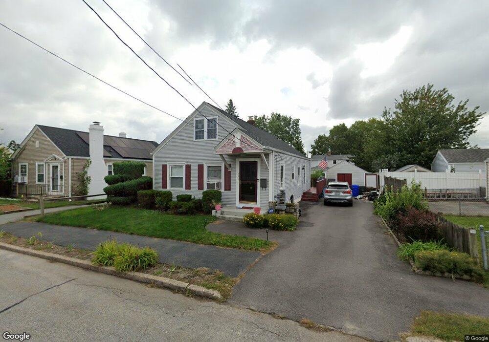
421 Carter Ave Pawtucket, RI 02861
Darlington NeighborhoodEstimated Value: $388,000 - $407,301
2
Beds
1
Bath
1,860
Sq Ft
$214/Sq Ft
Est. Value
About This Home
This home is located at 421 Carter Ave, Pawtucket, RI 02861 and is currently estimated at $397,325, approximately $213 per square foot. 421 Carter Ave is a home located in Providence County with nearby schools including St Cecilia School and Saint Teresa Catholic Elementary School.
Ownership History
Date
Name
Owned For
Owner Type
Purchase Details
Closed on
Jul 31, 2006
Sold by
Thibeault 3Rd Charles
Bought by
Garcia Ana I
Current Estimated Value
Home Financials for this Owner
Home Financials are based on the most recent Mortgage that was taken out on this home.
Original Mortgage
$185,600
Outstanding Balance
$109,727
Interest Rate
6.67%
Mortgage Type
Purchase Money Mortgage
Estimated Equity
$287,598
Purchase Details
Closed on
Sep 4, 1998
Sold by
Mcnally Lawrence R
Bought by
Thibeault Charles
Create a Home Valuation Report for This Property
The Home Valuation Report is an in-depth analysis detailing your home's value as well as a comparison with similar homes in the area
Home Values in the Area
Average Home Value in this Area
Purchase History
| Date | Buyer | Sale Price | Title Company |
|---|---|---|---|
| Garcia Ana I | $261,000 | -- | |
| Thibeault Charles | $70,000 | -- |
Source: Public Records
Mortgage History
| Date | Status | Borrower | Loan Amount |
|---|---|---|---|
| Open | Thibeault Charles | $185,600 | |
| Closed | Thibeault Charles | $46,400 | |
| Previous Owner | Thibeault Charles | $114,650 | |
| Previous Owner | Thibeault Charles | $97,950 |
Source: Public Records
Tax History
| Year | Tax Paid | Tax Assessment Tax Assessment Total Assessment is a certain percentage of the fair market value that is determined by local assessors to be the total taxable value of land and additions on the property. | Land | Improvement |
|---|---|---|---|---|
| 2025 | $4,418 | $336,000 | $136,500 | $199,500 |
| 2024 | $4,146 | $336,000 | $136,500 | $199,500 |
| 2023 | $3,900 | $230,200 | $80,900 | $149,300 |
| 2022 | $3,817 | $230,200 | $80,900 | $149,300 |
| 2021 | $3,817 | $230,200 | $80,900 | $149,300 |
| 2020 | $4,015 | $192,200 | $77,500 | $114,700 |
| 2019 | $4,015 | $192,200 | $77,500 | $114,700 |
| 2018 | $3,869 | $192,200 | $77,500 | $114,700 |
| 2017 | $3,633 | $159,900 | $55,600 | $104,300 |
| 2016 | $3,500 | $159,900 | $55,600 | $104,300 |
| 2015 | $3,500 | $159,900 | $55,600 | $104,300 |
| 2014 | $3,281 | $142,300 | $49,700 | $92,600 |
Source: Public Records
Map
Nearby Homes
- 250 Pullen Ave
- 30 Eddington St
- 3 Hutchinson Ave
- 252 Vine St
- 43 Warwick Rd
- 70 Whittier Rd
- 76 London Ave
- 214 Grand Ave
- 148 Sweet Ave
- 27 Hyde Ave
- 141 Hanover Ave
- 139 Suffolk Ave
- 115 Bellevue Ave
- 15 Draper St
- 882 Central Ave
- 886 Central Ave
- 884 Central Ave
- 888 Central Ave
- 105 Metropolitan Park Ave
- 140 Robinson Ave
Your Personal Tour Guide
Ask me questions while you tour the home.