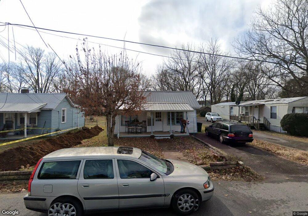
421 Forrest St Franklin, TN 37064
Central Franklin NeighborhoodEstimated Value: $393,000 - $518,000
--
Bed
1
Bath
1,064
Sq Ft
$426/Sq Ft
Est. Value
About This Home
This home is located at 421 Forrest St, Franklin, TN 37064 and is currently estimated at $452,875, approximately $425 per square foot. 421 Forrest St is a home located in Williamson County with nearby schools including Franklin Elementary School, Freedom Intermediate School, and Freedom Middle School.
Ownership History
Date
Name
Owned For
Owner Type
Purchase Details
Closed on
Sep 9, 2024
Sold by
Bodart Guy Paul
Bought by
Los Bosques 21 Llc
Current Estimated Value
Purchase Details
Closed on
Dec 29, 2022
Sold by
Vander Elst Ghislain
Bought by
Bodart Guy Paul
Purchase Details
Closed on
Apr 30, 2018
Sold by
Bodard Guy Paul
Bought by
Mccann Russell J
Purchase Details
Closed on
May 2, 2016
Sold by
Curtis Martha Jane and Pewitt William Clyde
Bought by
Bodart Guy Paul
Create a Home Valuation Report for This Property
The Home Valuation Report is an in-depth analysis detailing your home's value as well as a comparison with similar homes in the area
Home Values in the Area
Average Home Value in this Area
Purchase History
| Date | Buyer | Sale Price | Title Company |
|---|---|---|---|
| Los Bosques 21 Llc | -- | None Listed On Document | |
| Bodart Guy Paul | -- | -- | |
| Mccann Russell J | -- | None Available | |
| Bodart Guy Paul | $195,000 | None Available |
Source: Public Records
Tax History Compared to Growth
Tax History
| Year | Tax Paid | Tax Assessment Tax Assessment Total Assessment is a certain percentage of the fair market value that is determined by local assessors to be the total taxable value of land and additions on the property. | Land | Improvement |
|---|---|---|---|---|
| 2024 | $1,864 | $65,825 | $33,750 | $32,075 |
| 2023 | $1,791 | $65,825 | $33,750 | $32,075 |
| 2022 | $1,791 | $65,825 | $33,750 | $32,075 |
| 2021 | $1,791 | $65,825 | $33,750 | $32,075 |
| 2020 | $1,250 | $38,725 | $15,000 | $23,725 |
| 2019 | $1,250 | $38,725 | $15,000 | $23,725 |
| 2018 | $1,223 | $38,725 | $15,000 | $23,725 |
| 2017 | $1,203 | $38,725 | $15,000 | $23,725 |
| 2016 | $0 | $38,725 | $15,000 | $23,725 |
| 2015 | -- | $28,150 | $8,750 | $19,400 |
| 2014 | -- | $28,150 | $8,750 | $19,400 |
Source: Public Records
Map
Nearby Homes
- 411 Forrest St
- 1204 Brookwood Ave
- 503 N Petway St
- 504 N Petway St
- 1319 W Main St Unit 108
- 6065 Stone Cliff Ln
- 6057 Stone Cliff Ln
- 1016 Benelli Park Ct
- 107 Brilliantine Cir
- 601 Boyd Mill Ave Unit J1
- 601 Boyd Mill Ave Unit Q5
- 422 Battle Ave
- 1027 Harmony Hills Dr
- 9031 Headwaters Dr
- 7148 Bonterra Dr
- 5611 Carney Ln
- 1022 Conar St
- 9006 Headwaters Dr
- 2054 Township Dr
- 2008 Eliot Rd
- 419 Forrest St
- 417 Forrest St #B Unit B
- 417 Forrest St Unit B
- 417 Forrest St Unit A
- 415 Forrest St
- 415 Forrest St Unit 1
- 427 Forrest St
- 413 Forrest St
- 1203 Brookwood Ave
- 1205 Brookwood Ave # A-B
- 420 Forrest St
- 1205 Brookwood Ave
- 1209 Brookwood Ave
- 418 Forrest St
- 424 Forrest St
- 426 Forrest St
- 420 N Petway St
- 422 N Petway St
- 426 S Petway St
- 414 S Petway St