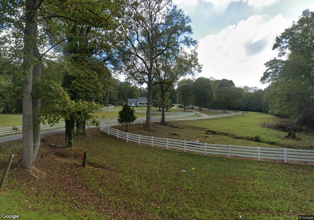
421 N Highway 100 Bowdon, GA 30108
Estimated Value: $475,000 - $773,959
3
Beds
3
Baths
3,513
Sq Ft
$178/Sq Ft
Est. Value
About This Home
This home is located at 421 N Highway 100, Bowdon, GA 30108 and is currently estimated at $624,480, approximately $177 per square foot. 421 N Highway 100 is a home located in Carroll County with nearby schools including Bowdon Elementary School, Bowdon Middle School, and Bowdon High School.
Ownership History
Date
Name
Owned For
Owner Type
Purchase Details
Closed on
Mar 7, 2025
Sold by
Lovvorn Anne Gertrud K
Bought by
Lovvorn Anne G Kasischke Tr
Current Estimated Value
Purchase Details
Closed on
Oct 1, 2018
Sold by
Lovvorn Max R
Bought by
Lovvorn Anne K
Purchase Details
Closed on
Oct 15, 2008
Sold by
Not Provided
Bought by
Lovvorn Max R and Lovvorn Anne K
Purchase Details
Closed on
Oct 6, 2008
Sold by
Not Provided
Bought by
Lovvorn Max R and Lovvorn Anne K
Purchase Details
Closed on
Dec 17, 1997
Sold by
Lovvorn
Bought by
Lovvorn Max R and Lovvorn Anne
Purchase Details
Closed on
Jul 15, 1993
Sold by
Lovvorn
Bought by
Lovvorn
Purchase Details
Closed on
Jul 11, 1985
Bought by
Lovvorn
Create a Home Valuation Report for This Property
The Home Valuation Report is an in-depth analysis detailing your home's value as well as a comparison with similar homes in the area
Home Values in the Area
Average Home Value in this Area
Purchase History
| Date | Buyer | Sale Price | Title Company |
|---|---|---|---|
| Lovvorn Anne G Kasischke Tr | -- | -- | |
| Lovvorn Anne K | -- | -- | |
| Lovvorn Max R | -- | -- | |
| Lovvorn Max R | -- | -- | |
| Lovvorn Max R | -- | -- | |
| Lovvorn | -- | -- | |
| Lovvorn | -- | -- |
Source: Public Records
Tax History Compared to Growth
Tax History
| Year | Tax Paid | Tax Assessment Tax Assessment Total Assessment is a certain percentage of the fair market value that is determined by local assessors to be the total taxable value of land and additions on the property. | Land | Improvement |
|---|---|---|---|---|
| 2024 | -- | $298,449 | $112,529 | $185,920 |
| 2023 | $0 | $259,467 | $90,024 | $169,443 |
| 2022 | $4,913 | $195,876 | $60,015 | $135,861 |
| 2021 | $4,225 | $164,811 | $48,011 | $116,800 |
| 2020 | $3,878 | $146,190 | $43,646 | $102,544 |
| 2019 | $3,626 | $136,665 | $43,646 | $93,019 |
| 2016 | $2,948 | $111,890 | $32,324 | $79,566 |
| 2015 | -- | $78,476 | $22,692 | $55,784 |
| 2014 | -- | $78,476 | $22,692 | $55,784 |
Source: Public Records
Map
Nearby Homes
- 215 Rome St
- 6.41 ac N Carroll St & Ave W
- 473 West Ave
- 485 West Ave
- 479 West Ave
- 427 E College St
- 407 E College St
- Plan 1709 at Scarlett Place
- Plan 2709 at Scarlett Place
- Plan 2316 at Scarlett Place
- Plan 1902 at Scarlett Place
- Plan 2100 at Scarlett Place
- Plan 1643 at Scarlett Place
- Plan 2307 at Scarlett Place
- Plan 2131 at Scarlett Place
- 216 Rhett Dr
- 112 Scarlett Place Dr
- 426 N Carroll St
- 430 N Carroll St
- 411 N Carroll St
- 412 N Carroll St
- 43 W Jonesville Rd
- 124 Red Barn Rd
- 16 W Jonesville Rd
- 434 N Highway 100
- 430 N Highway 100
- 71 W Jonesville Rd
- 40 W Jonesville Rd
- 451 Georgia 100
- 0 Hwy 100 N Unit 20175168
- 0 Hwy 100 N Unit 20158781
- 451 N Highway 100
- 0 Hwy 100 N Unit 7605779
- 0 Hwy 100 N Unit 7605750
- 0 Hwy 100 N Unit 7605740
- 0 Hwy 100 N Unit 3274173
- 0 Hwy 100 N Unit 7362269