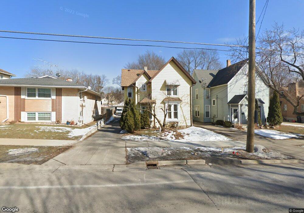
421 Raymond St Elgin, IL 60120
Elgin National Watch Historic District NeighborhoodEstimated Value: $267,000 - $290,000
4
Beds
2
Baths
1,938
Sq Ft
$143/Sq Ft
Est. Value
About This Home
This home is located at 421 Raymond St, Elgin, IL 60120 and is currently estimated at $276,692, approximately $142 per square foot. 421 Raymond St is a home located in Kane County with nearby schools including Channing Memorial Elementary School, Kenyon Woods Middle School, and South Elgin High School.
Ownership History
Date
Name
Owned For
Owner Type
Purchase Details
Closed on
Jan 12, 1995
Sold by
Schmidt Nidia
Bought by
Marquez Angel J and Marquez Ana B
Current Estimated Value
Home Financials for this Owner
Home Financials are based on the most recent Mortgage that was taken out on this home.
Original Mortgage
$104,050
Interest Rate
9.2%
Mortgage Type
FHA
Create a Home Valuation Report for This Property
The Home Valuation Report is an in-depth analysis detailing your home's value as well as a comparison with similar homes in the area
Home Values in the Area
Average Home Value in this Area
Purchase History
| Date | Buyer | Sale Price | Title Company |
|---|---|---|---|
| Marquez Angel J | $105,000 | -- |
Source: Public Records
Mortgage History
| Date | Status | Borrower | Loan Amount |
|---|---|---|---|
| Closed | Marquez Angel J | $104,050 |
Source: Public Records
Tax History
| Year | Tax Paid | Tax Assessment Tax Assessment Total Assessment is a certain percentage of the fair market value that is determined by local assessors to be the total taxable value of land and additions on the property. | Land | Improvement |
|---|---|---|---|---|
| 2024 | $4,765 | $67,536 | $12,910 | $54,626 |
| 2023 | $4,519 | $61,013 | $11,663 | $49,350 |
| 2022 | $3,949 | $51,543 | $10,635 | $40,908 |
| 2021 | $3,764 | $48,189 | $9,943 | $38,246 |
| 2020 | $3,649 | $46,004 | $9,492 | $36,512 |
| 2019 | $3,532 | $43,822 | $9,042 | $34,780 |
| 2018 | $3,488 | $41,283 | $8,518 | $32,765 |
| 2017 | $3,397 | $39,028 | $8,053 | $30,975 |
| 2016 | $3,222 | $36,207 | $7,471 | $28,736 |
| 2015 | -- | $33,187 | $6,848 | $26,339 |
| 2014 | -- | $32,777 | $6,763 | $26,014 |
| 2013 | -- | $33,641 | $6,941 | $26,700 |
Source: Public Records
Map
Nearby Homes
- 518 Raymond St
- 262 Bartlett Place
- 457 Arlington Ave
- 450 Villa St
- 483 Barrett St
- 631 Bent St
- 286 Villa St
- 277 Gifford Place
- 689 Bent St
- 462 Ashland Ave
- 7 National St Unit 7
- 3 National St Unit 3
- 162 Festival Ct
- 211 Prairie St
- 58 S Geneva St
- 331 Orange St
- 115 N Porter St
- 445 Lucile Ave
- 131 N Gifford St
- 96 S Crystal St
- 425 Raymond St
- 417 Raymond St
- 429 Raymond St
- 411 Raymond St Unit 13
- 424 Raymond St
- 420 Raymond St
- 364 Booth Ct
- 435 Raymond St
- 428 Raymond St
- 403 Raymond St
- 412 Raymond St
- 359 Yarwood St
- 363 Yarwood St Unit UPPER
- 363 Yarwood St
- 367 Yarwood St
- 432 Raymond St
- 408 Raymond St
- 365 Booth Ct
- 437 Raymond St
- 436 Raymond St
Your Personal Tour Guide
Ask me questions while you tour the home.