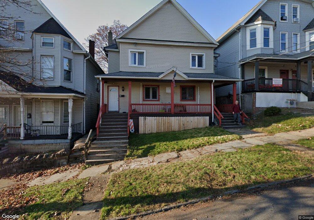
421 Taylor Ave Unit 423 Scranton, PA 18510
Hill Section NeighborhoodEstimated Value: $263,000 - $483,000
--
Bed
--
Bath
--
Sq Ft
6,360
Sq Ft Lot
About This Home
This home is located at 421 Taylor Ave Unit 423, Scranton, PA 18510 and is currently estimated at $362,428. 421 Taylor Ave Unit 423 is a home located in Lackawanna County with nearby schools including Jackson Davis Elementary School, Longdale Elementary School, and Pinchbeck Elementary School.
Ownership History
Date
Name
Owned For
Owner Type
Purchase Details
Closed on
Nov 6, 2018
Sold by
Sandrowicz Kenneth T and Sandrowicz Elizabeth
Bought by
Gori Christopher and Gori Christina
Current Estimated Value
Purchase Details
Closed on
May 30, 2006
Sold by
Premium Structures Lp
Bought by
Sandrowicz Kenneth T
Home Financials for this Owner
Home Financials are based on the most recent Mortgage that was taken out on this home.
Original Mortgage
$184,000
Interest Rate
6.62%
Mortgage Type
Commercial
Create a Home Valuation Report for This Property
The Home Valuation Report is an in-depth analysis detailing your home's value as well as a comparison with similar homes in the area
Home Values in the Area
Average Home Value in this Area
Purchase History
| Date | Buyer | Sale Price | Title Company |
|---|---|---|---|
| Gori Christopher | $245,000 | None Available | |
| Sandrowicz Kenneth T | $230,000 | None Available |
Source: Public Records
Mortgage History
| Date | Status | Borrower | Loan Amount |
|---|---|---|---|
| Previous Owner | Sandrowicz Kenneth T | $184,000 |
Source: Public Records
Tax History Compared to Growth
Tax History
| Year | Tax Paid | Tax Assessment Tax Assessment Total Assessment is a certain percentage of the fair market value that is determined by local assessors to be the total taxable value of land and additions on the property. | Land | Improvement |
|---|---|---|---|---|
| 2025 | $4,439 | $12,000 | $4,850 | $7,150 |
| 2024 | $4,095 | $12,000 | $4,850 | $7,150 |
| 2023 | $4,095 | $12,000 | $4,850 | $7,150 |
| 2022 | $4,006 | $12,000 | $4,850 | $7,150 |
| 2021 | $4,006 | $12,000 | $4,850 | $7,150 |
| 2020 | $3,942 | $12,000 | $4,850 | $7,150 |
| 2019 | $3,720 | $12,000 | $4,850 | $7,150 |
| 2018 | $3,720 | $12,000 | $4,850 | $7,150 |
| 2017 | $3,664 | $12,000 | $4,850 | $7,150 |
| 2016 | $0 | $12,000 | $4,850 | $7,150 |
| 2015 | $2,854 | $12,000 | $4,850 | $7,150 |
| 2014 | -- | $12,000 | $4,850 | $7,150 |
Source: Public Records
Map
Nearby Homes
- 432 Taylor Ave
- 316 Taylor Ave
- 329 Prescott Ave
- 560 N Webster Ave
- 550 Clay Ave Unit 8c
- 1325 Olive St
- 228 Prescott Ave
- 545 Prescott Ave
- 527 Quincy Ave
- 342 Harrison Ave
- 621 Clay Ave
- 516 Harrison Ave
- 7 Oakwood Place
- 616-618 Harrison Ave
- 715 Prescott Ave Unit L17
- 610 Moosic St
- 0 Colfax Ave
- 621 Madison Ave Unit 623
- 805-807 N Irving Ave
- 24 Stafford Ave
- 421-423 Taylor Ave
- 419 Taylor Ave
- 425 Taylor Ave Unit 425
- 425 Taylor Ave Unit 427
- 425 Taylor Ave
- 427 Taylor Ave Unit 427
- 417-419 Taylor Ave
- 413 Taylor Ave
- 429 Taylor Ave
- 409 Taylor Ave Unit 411
- 433 Taylor Ave
- 435 Taylor Ave
- 424 Taylor Ave Unit 426
- 426 Taylor Ave
- 433 Taylor Ave Unit 435
- 424-426 Taylor Ave
- 417 Taylor Ave Unit 419
- 437-439 Taylor Ave
- 437 Taylor Ave Unit 439
- 420 Taylor Ave