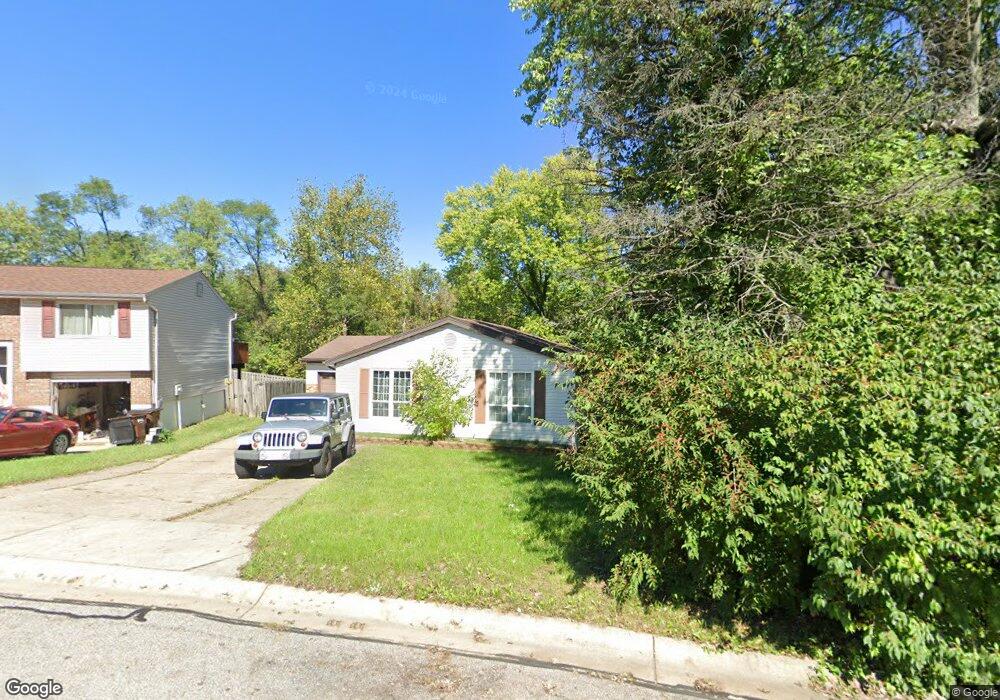
4210 Birnam Dr Independence, KY 41051
Estimated Value: $203,000 - $236,000
3
Beds
2
Baths
789
Sq Ft
$277/Sq Ft
Est. Value
About This Home
This home is located at 4210 Birnam Dr, Independence, KY 41051 and is currently estimated at $218,691, approximately $277 per square foot. 4210 Birnam Dr is a home located in Kenton County with nearby schools including Beechgrove Elementary School, Simon Kenton High School, and Zion Christian Academy.
Ownership History
Date
Name
Owned For
Owner Type
Purchase Details
Closed on
Dec 20, 2019
Sold by
Mitchell Cleta B and Shera Kristine M
Bought by
Hiles Mark A
Current Estimated Value
Home Financials for this Owner
Home Financials are based on the most recent Mortgage that was taken out on this home.
Original Mortgage
$141,391
Outstanding Balance
$124,900
Interest Rate
3.7%
Mortgage Type
FHA
Estimated Equity
$93,791
Purchase Details
Closed on
May 30, 2008
Sold by
Sester Jerry L and Sester Patsy
Bought by
Mitchell Cleta B
Create a Home Valuation Report for This Property
The Home Valuation Report is an in-depth analysis detailing your home's value as well as a comparison with similar homes in the area
Home Values in the Area
Average Home Value in this Area
Purchase History
| Date | Buyer | Sale Price | Title Company |
|---|---|---|---|
| Hiles Mark A | $144,000 | 360 American Title Svcs Llc | |
| Mitchell Cleta B | $130,000 | None Available |
Source: Public Records
Mortgage History
| Date | Status | Borrower | Loan Amount |
|---|---|---|---|
| Open | Hiles Mark A | $141,391 |
Source: Public Records
Tax History Compared to Growth
Tax History
| Year | Tax Paid | Tax Assessment Tax Assessment Total Assessment is a certain percentage of the fair market value that is determined by local assessors to be the total taxable value of land and additions on the property. | Land | Improvement |
|---|---|---|---|---|
| 2024 | $1,764 | $144,000 | $25,000 | $119,000 |
| 2023 | $1,817 | $144,000 | $25,000 | $119,000 |
| 2022 | $1,881 | $144,000 | $25,000 | $119,000 |
| 2021 | $1,909 | $144,000 | $25,000 | $119,000 |
| 2020 | $1,948 | $144,000 | $20,000 | $124,000 |
| 2019 | $1,063 | $115,000 | $20,000 | $95,000 |
| 2018 | $1,090 | $115,000 | $20,000 | $95,000 |
| 2017 | $1,062 | $115,000 | $20,000 | $95,000 |
| 2015 | $1,033 | $115,000 | $20,000 | $95,000 |
| 2014 | $1,030 | $115,000 | $20,000 | $95,000 |
Source: Public Records
Map
Nearby Homes
- 1079 Birch Tree Ln
- 4245 Briarwood Dr Unit 1
- 4187 Elder Ct Unit 5
- 1056 Oakwood Ct Unit 3
- 3913 Hunters Green Dr
- 4109 Willowview Dr
- 4101 Willowview Dr
- 4106 Willowview Dr
- 4102 Willowview Dr
- 4071 Elizabeth Dr
- 9831 Codyview Dr
- 294 Merravay Dr
- 3737 Autumn Rd
- HIALEAH Plan at Southwick - The Villas
- YAKIMA Plan at Southwick - The Villas
- KENAI Plan at Southwick - The Villas
- MCKENZIE Plan at Southwick - The Villas
- SARASOTA Plan at Southwick - The Villas
- HOLSTON Plan at Southwick - The Villas
- ALEXANDER Plan at Southwick - The Villas
- 4208 Birnam Dr
- 4212 Birnam Dr
- 4206 Birnam Dr
- 4214 Birnam Dr
- 4209 Birnam Dr
- 4215 Birnam Dr
- 4216 Birnam Dr
- 4208 Boxwood Ln
- 4206 Boxwood Ln
- 4212 Boxwood Ln
- 4217 Birnam Dr
- 4218 Boxwood Ln
- 4204 Boxwood Ln
- 4218 Birnam Dr
- 4220 Boxwood Ln
- 4219 Birnam Dr
- 4202 Boxwood Ln
- 4220 Birnam Dr
- 4222 Boxwood Ln
- 4221 Birnam Dr