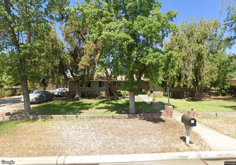
4211 N Carruth Ave Fresno, CA 93705
Bullard NeighborhoodEstimated Value: $459,451 - $603,000
3
Beds
2
Baths
2,577
Sq Ft
$212/Sq Ft
Est. Value
About This Home
This home is located at 4211 N Carruth Ave, Fresno, CA 93705 and is currently estimated at $545,613, approximately $211 per square foot. 4211 N Carruth Ave is a home located in Fresno County with nearby schools including Powers-Ginsburg Elementary, Bullard High School, and Aspen Valley Prep Academy.
Ownership History
Date
Name
Owned For
Owner Type
Purchase Details
Closed on
May 10, 2016
Sold by
Brimmer Kraig W
Bought by
Brimmer Jamie Anne
Current Estimated Value
Purchase Details
Closed on
Feb 16, 2011
Sold by
Brimmer Jaime A
Bought by
Brimmer Kraig W
Home Financials for this Owner
Home Financials are based on the most recent Mortgage that was taken out on this home.
Original Mortgage
$140,000
Interest Rate
4.67%
Mortgage Type
New Conventional
Create a Home Valuation Report for This Property
The Home Valuation Report is an in-depth analysis detailing your home's value as well as a comparison with similar homes in the area
Home Values in the Area
Average Home Value in this Area
Purchase History
| Date | Buyer | Sale Price | Title Company |
|---|---|---|---|
| Brimmer Jamie Anne | -- | None Available | |
| Brimmer Kraig W | -- | Fidelity National Title Co |
Source: Public Records
Mortgage History
| Date | Status | Borrower | Loan Amount |
|---|---|---|---|
| Closed | Brimmer Kraig W | $140,000 |
Source: Public Records
Tax History Compared to Growth
Tax History
| Year | Tax Paid | Tax Assessment Tax Assessment Total Assessment is a certain percentage of the fair market value that is determined by local assessors to be the total taxable value of land and additions on the property. | Land | Improvement |
|---|---|---|---|---|
| 2025 | $2,390 | $190,332 | $42,470 | $147,862 |
| 2023 | $2,344 | $182,943 | $40,822 | $142,121 |
| 2022 | $2,313 | $179,357 | $40,022 | $139,335 |
| 2021 | $2,249 | $175,841 | $39,238 | $136,603 |
| 2020 | $2,240 | $174,039 | $38,836 | $135,203 |
| 2019 | $2,154 | $170,627 | $38,075 | $132,552 |
| 2018 | $2,107 | $306,918 | $62,424 | $244,494 |
| 2017 | $3,778 | $300,900 | $61,200 | $239,700 |
| 2016 | $2,003 | $160,788 | $35,881 | $124,907 |
| 2015 | $1,973 | $158,374 | $35,343 | $123,031 |
| 2014 | $1,933 | $155,272 | $34,651 | $120,621 |
Source: Public Records
Map
Nearby Homes
- 4246 N Holt Ave
- 4264 N Holt Ave
- 4261 N Holt Ave
- 1028 W Holland Ave
- 4366 N Holt Ave
- 1027 W Ashcroft Ave
- 929 W Norwich Ave
- 4306 N Emerson Ave
- 638 W Rialto Ave
- 4702 N Fruit Ave
- 82 E Sussex Way
- 94 E Sussex Way
- 1550 W Ashlan Ave Unit 134
- 1550 W Ashlan Ave Unit 229
- 1550 W Ashlan Ave Unit 208
- 1550 W Ashlan Ave Unit 241
- 4156 N Warren Ave
- 1245 W Pico Ave
- 1484 W Indianapolis Ave
- 4481 N Palm Ave
- 4207 N Carruth Ave
- 4213 N Carruth Ave
- 4210 N Delno Ave
- 4268 N Delno Ave
- 4246 N Carruth Ave
- 4234 N Carruth Ave
- 4268 N Carruth Ave
- 615 W Swift Ave
- 635 W Swift Ave
- 4218 N Carruth Ave
- 535 W Swift Ave
- 4253 N Fruit Ave
- 4235 N Fruit Ave
- 4235 N Delno Ave
- 4265 N Fruit Ave
- 727 W Swift Ave
- 4217 N Fruit Ave
- 715 W Swift Ave
- 505 W Swift Ave
- 606 W Swift Ave