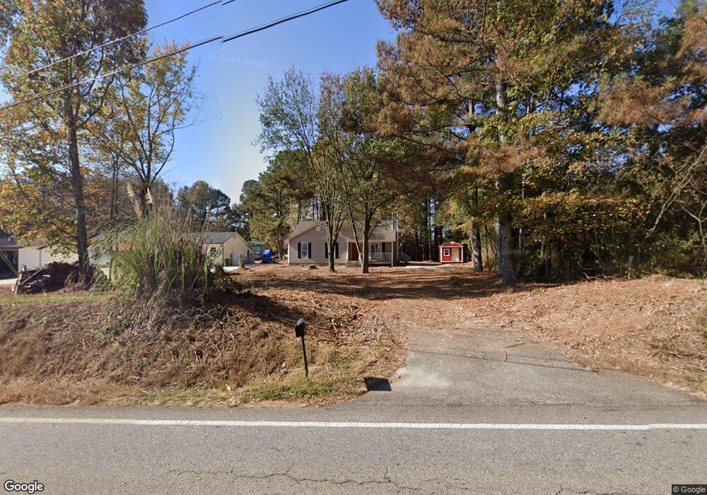
4211 Price Rd Gainesville, GA 30506
Estimated Value: $315,000 - $322,000
3
Beds
2
Baths
1,435
Sq Ft
$223/Sq Ft
Est. Value
About This Home
This home is located at 4211 Price Rd, Gainesville, GA 30506 and is currently estimated at $319,471, approximately $222 per square foot. 4211 Price Rd is a home located in Hall County with nearby schools including Lanier Elementary School, Chestatee Middle School, and Chestatee High School.
Ownership History
Date
Name
Owned For
Owner Type
Purchase Details
Closed on
Jun 2, 2025
Sold by
Wade Gloria J
Bought by
Wade William Earl
Current Estimated Value
Purchase Details
Closed on
May 31, 2023
Sold by
Stone Ronald P
Bought by
Mceachern Robert Jewett
Home Financials for this Owner
Home Financials are based on the most recent Mortgage that was taken out on this home.
Original Mortgage
$205,200
Interest Rate
6.39%
Mortgage Type
New Conventional
Purchase Details
Closed on
Sep 29, 2010
Sold by
Hsbc Mtg Svcs Inc
Bought by
Stone Ronald P
Home Financials for this Owner
Home Financials are based on the most recent Mortgage that was taken out on this home.
Original Mortgage
$77,456
Interest Rate
4.62%
Mortgage Type
FHA
Purchase Details
Closed on
Apr 6, 2010
Sold by
Anderson Glenn H and Anderson Deedra I
Bought by
Hsbc Mtg Svcs Inc
Purchase Details
Closed on
Oct 1, 1996
Create a Home Valuation Report for This Property
The Home Valuation Report is an in-depth analysis detailing your home's value as well as a comparison with similar homes in the area
Home Values in the Area
Average Home Value in this Area
Purchase History
| Date | Buyer | Sale Price | Title Company |
|---|---|---|---|
| Wade William Earl | -- | -- | |
| Wade Gloria J | $320,000 | -- | |
| Mceachern Robert Jewett | $216,000 | -- | |
| Stone Ronald P | $78,500 | -- | |
| Hsbc Mtg Svcs Inc | $86,645 | -- | |
| Hbc Mortgage Services Inc | $86,600 | -- | |
| -- | $15,600 | -- |
Source: Public Records
Mortgage History
| Date | Status | Borrower | Loan Amount |
|---|---|---|---|
| Previous Owner | Mceachern Robert Jewett | $205,200 | |
| Previous Owner | Stone Ronald P | $77,456 |
Source: Public Records
Tax History Compared to Growth
Tax History
| Year | Tax Paid | Tax Assessment Tax Assessment Total Assessment is a certain percentage of the fair market value that is determined by local assessors to be the total taxable value of land and additions on the property. | Land | Improvement |
|---|---|---|---|---|
| 2024 | $2,206 | $102,160 | $10,240 | $91,920 |
| 2023 | $2,436 | $93,720 | $10,240 | $83,480 |
| 2022 | $2,024 | $77,680 | $6,960 | $70,720 |
| 2021 | $1,622 | $61,000 | $3,520 | $57,480 |
| 2020 | $1,517 | $55,440 | $3,520 | $51,920 |
| 2019 | $1,413 | $51,120 | $3,520 | $47,600 |
| 2018 | $1,050 | $36,618 | $3,520 | $33,098 |
| 2017 | $1,039 | $36,618 | $3,520 | $33,098 |
| 2016 | $1,015 | $36,618 | $3,520 | $33,098 |
| 2015 | $1,023 | $36,618 | $3,520 | $33,098 |
| 2014 | $1,023 | $36,618 | $3,520 | $33,098 |
Source: Public Records
Map
Nearby Homes
- 4207 Price Rd
- 4203 Price Rd
- 4221 Price Rd
- 4467 Sardis Rd
- 4414 Price Way
- 4406 Price Way
- 4227 Price Rd
- 4418 Price Way
- 3754 Price Way
- 0 Price Way Unit 3264094
- 0 Price Way Unit 7283651
- 0 Price Way Unit 7040005
- 0 Price Way
- 4231 Price Rd
- 4166 Price Rd
- 4405 Price Way
- 4411 Price Way
- 4415 Price Way
- 4419 Price Way
- 4154 Price Rd