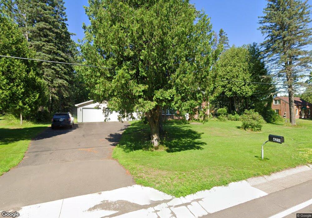
4211 Ugstad Rd Hermantown, MN 55811
Estimated Value: $335,000 - $384,000
--
Bed
2
Baths
1,487
Sq Ft
$243/Sq Ft
Est. Value
About This Home
This home is located at 4211 Ugstad Rd, Hermantown, MN 55811 and is currently estimated at $360,981, approximately $242 per square foot. 4211 Ugstad Rd is a home located in St. Louis County with nearby schools including Hermantown Elementary School, Hermantown Middle School, and Hermantown Middle - Senior High School.
Ownership History
Date
Name
Owned For
Owner Type
Purchase Details
Closed on
Dec 20, 2019
Sold by
Delanghe James and Hernesman Doreen
Bought by
Rodlund Rachel and Rodlund Aaron
Current Estimated Value
Home Financials for this Owner
Home Financials are based on the most recent Mortgage that was taken out on this home.
Original Mortgage
$190,000
Outstanding Balance
$167,151
Interest Rate
3.6%
Mortgage Type
New Conventional
Estimated Equity
$193,830
Purchase Details
Closed on
Mar 12, 2018
Sold by
Hernesman Melvin E and Hernesman Doren
Bought by
Hernesman Doreen and Delanghe James
Purchase Details
Closed on
Dec 3, 2007
Sold by
Hernesman Melvin E
Bought by
Hernesman Melvin E and Hernesman Doreen
Create a Home Valuation Report for This Property
The Home Valuation Report is an in-depth analysis detailing your home's value as well as a comparison with similar homes in the area
Home Values in the Area
Average Home Value in this Area
Purchase History
| Date | Buyer | Sale Price | Title Company |
|---|---|---|---|
| Rodlund Rachel | $200,000 | Stewart Title Company | |
| Hernesman Doreen | -- | None Available | |
| Hernesman Melvin E | -- | None Available |
Source: Public Records
Mortgage History
| Date | Status | Borrower | Loan Amount |
|---|---|---|---|
| Open | Rodlund Rachel | $190,000 |
Source: Public Records
Tax History Compared to Growth
Tax History
| Year | Tax Paid | Tax Assessment Tax Assessment Total Assessment is a certain percentage of the fair market value that is determined by local assessors to be the total taxable value of land and additions on the property. | Land | Improvement |
|---|---|---|---|---|
| 2024 | $4,794 | $302,700 | $66,900 | $235,800 |
| 2023 | $4,794 | $277,300 | $62,400 | $214,900 |
| 2022 | $3,402 | $259,900 | $61,100 | $198,800 |
| 2021 | $3,684 | $229,200 | $57,600 | $171,600 |
| 2020 | $3,638 | $251,400 | $56,800 | $194,600 |
| 2019 | $3,422 | $244,000 | $73,900 | $170,100 |
| 2018 | $3,068 | $235,300 | $65,200 | $170,100 |
| 2017 | $2,810 | $214,500 | $57,700 | $156,800 |
| 2016 | $2,564 | $203,100 | $54,100 | $149,000 |
| 2015 | $2,176 | $163,200 | $42,600 | $120,600 |
| 2014 | $2,176 | $149,700 | $39,600 | $110,100 |
Source: Public Records
Map
Nearby Homes
- 5368 Mckinley Dr
- 52XX W Arrowhead Rd
- 4320 Thielke Cir
- 4099 Maple Grove Rd
- 507X Maple Grove Rd
- 5256 Falcon Dr
- 5224 Falcon Dr
- xxxx Maple Grove Rd
- 4391 Grouse Ridge Dr
- xxx Lavaque Rd Unit 4271 Lavaque Rd
- 5241 Miller Trunk Hwy
- 47xx Miller Trunk Hwy
- xxx Miller Trunk Hwy
- 45xx - Lot B1 Norway Pines Place
- 45xx - Lot B2 Norway Pines Place
- 5014 Maple Grove Rd
- 5186 Hermantown Rd
- 4976 Maribe Dr
- 4363 Sugar Maple Dr
- 4958 Trails End Dr
- 4207 Ugstad Rd
- 4219 Ugstad Rd
- 4218 Ugstad Rd
- 4212 Ugstad Rd
- 5312 Roosevelt Dr
- 4201 Ugstad Rd
- 5314 Roosevelt Dr
- 4204 Ugstad Rd
- 4199 Ugstad Rd
- 5320 Roosevelt Dr
- 5319 Roosevelt Dr
- 4230 Ugstad Rd
- 4192 Ugstad Rd
- 4193 Ugstad Rd
- 4239 Ugstad Rd
- 4239 Ugstad Rd
- 5321 Roosevelt Dr
- 4234 Ugstad Rd
- 5324 Roosevelt Dr
- 536X Mckinley Dr