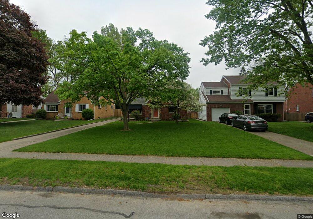
4212 Stannard Dr Toledo, OH 43613
DeVeaux NeighborhoodEstimated Value: $205,000 - $218,000
3
Beds
2
Baths
1,695
Sq Ft
$126/Sq Ft
Est. Value
About This Home
This home is located at 4212 Stannard Dr, Toledo, OH 43613 and is currently estimated at $213,075, approximately $125 per square foot. 4212 Stannard Dr is a home located in Lucas County with nearby schools including Elmhurst Elementary School, Start High School, and Horizon Science Academy - Toledo High School.
Ownership History
Date
Name
Owned For
Owner Type
Purchase Details
Closed on
Jul 10, 2018
Sold by
Verhoff Joan M
Bought by
Verhoff Joan M and Slicker Stacy A
Current Estimated Value
Purchase Details
Closed on
Mar 31, 2004
Sold by
Wirth John R
Bought by
Verhoff Joan M
Home Financials for this Owner
Home Financials are based on the most recent Mortgage that was taken out on this home.
Original Mortgage
$105,600
Outstanding Balance
$33,511
Interest Rate
1%
Mortgage Type
Purchase Money Mortgage
Estimated Equity
$179,564
Purchase Details
Closed on
Feb 10, 2000
Sold by
Wirth Robert L and Wirth Beatrice D
Bought by
Wirth Robert L and The Robert L Wirth Living Trust
Purchase Details
Closed on
Nov 3, 1988
Sold by
Miller Elnora D
Purchase Details
Closed on
Aug 12, 1988
Sold by
Miller W D and E D
Create a Home Valuation Report for This Property
The Home Valuation Report is an in-depth analysis detailing your home's value as well as a comparison with similar homes in the area
Home Values in the Area
Average Home Value in this Area
Purchase History
| Date | Buyer | Sale Price | Title Company |
|---|---|---|---|
| Verhoff Joan M | -- | None Available | |
| Verhoff Joan M | $132,000 | -- | |
| Wirth Robert L | -- | -- | |
| -- | $68,500 | -- | |
| -- | -- | -- |
Source: Public Records
Mortgage History
| Date | Status | Borrower | Loan Amount |
|---|---|---|---|
| Open | Verhoff Joan M | $105,600 |
Source: Public Records
Tax History Compared to Growth
Tax History
| Year | Tax Paid | Tax Assessment Tax Assessment Total Assessment is a certain percentage of the fair market value that is determined by local assessors to be the total taxable value of land and additions on the property. | Land | Improvement |
|---|---|---|---|---|
| 2024 | $1,473 | $48,685 | $8,505 | $40,180 |
| 2023 | $2,681 | $42,455 | $7,490 | $34,965 |
| 2022 | $2,681 | $42,455 | $7,490 | $34,965 |
| 2021 | $2,751 | $42,455 | $7,490 | $34,965 |
| 2020 | $2,622 | $35,805 | $6,230 | $29,575 |
| 2019 | $2,560 | $35,805 | $6,230 | $29,575 |
| 2018 | $2,564 | $35,805 | $6,230 | $29,575 |
| 2017 | $2,654 | $35,315 | $5,215 | $30,100 |
| 2016 | $2,642 | $100,900 | $14,900 | $86,000 |
| 2015 | $2,615 | $100,900 | $14,900 | $86,000 |
| 2014 | $2,221 | $35,320 | $5,220 | $30,100 |
| 2013 | $2,221 | $35,320 | $5,220 | $30,100 |
Source: Public Records
Map
Nearby Homes
- 4121 Drummond Rd
- 4211 Elmhurst Rd
- 4024 Crary Dr
- 3822 Seckinger Dr
- 3806 Doty Dr
- 2728 Castleton Ave
- 2724 Castleton Ave
- 2624 Grantwood Dr
- 2647 Lambert Dr
- 3823 Woodmont Rd
- 4315 Bales Rd
- 3036 Wyndale Rd
- 3905 Rushland Ave
- 4807 Brott Rd
- 3748 Bowen Rd
- 4823 Cedarhurst Rd
- 2629 Oak Grove Place
- 3647 Elmhurst Rd
- 2560 Charlestown Ave
- 3622 Drummond Rd
- 4208 Stannard Dr
- 4218 Stannard Dr
- 4202 Stannard Dr
- 4222 Stannard Dr
- 4211 Kingsmoor Dr
- 4207 Kingsmoor Dr
- 4217 Kingsmoor Dr
- 4158 Stannard Dr
- 4228 Stannard Dr
- 4223 Kingsmoor Dr
- 4201 Kingsmoor Dr
- 4211 Stannard Dr
- 4152 Stannard Dr
- 4232 Stannard Dr
- 4207 Stannard Dr
- 4217 Stannard Dr
- 4201 Stannard Dr
- 4229 Kingsmoor Dr
- 4151 Kingsmoor Dr
- 4148 Stannard Dr