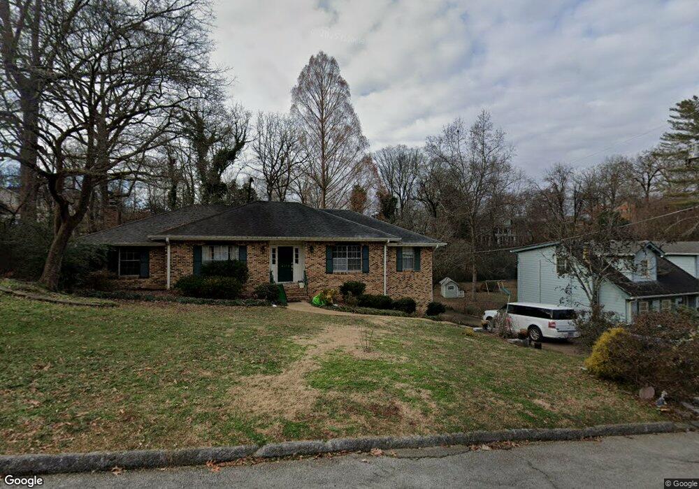
4213 Highwood Dr Unit 2 Chattanooga, TN 37415
Dupont NeighborhoodEstimated Value: $450,453 - $520,000
--
Bed
1
Bath
2,790
Sq Ft
$175/Sq Ft
Est. Value
About This Home
This home is located at 4213 Highwood Dr Unit 2, Chattanooga, TN 37415 and is currently estimated at $487,113, approximately $174 per square foot. 4213 Highwood Dr Unit 2 is a home located in Hamilton County with nearby schools including DuPont Elementary School, Hixson Middle School, and Hixson High School.
Ownership History
Date
Name
Owned For
Owner Type
Purchase Details
Closed on
Mar 2, 2018
Sold by
Pettross Bobby D and Pettross Janice P
Bought by
Hart Karen K and Hart Gordon E
Current Estimated Value
Home Financials for this Owner
Home Financials are based on the most recent Mortgage that was taken out on this home.
Original Mortgage
$228,950
Outstanding Balance
$194,586
Interest Rate
4.04%
Mortgage Type
New Conventional
Estimated Equity
$292,527
Purchase Details
Closed on
Feb 27, 2012
Sold by
Price Breland Walker L and Price Breland June
Bought by
Pettross Bobby D and Pettross Janice P
Home Financials for this Owner
Home Financials are based on the most recent Mortgage that was taken out on this home.
Original Mortgage
$160,817
Interest Rate
3.89%
Mortgage Type
FHA
Create a Home Valuation Report for This Property
The Home Valuation Report is an in-depth analysis detailing your home's value as well as a comparison with similar homes in the area
Home Values in the Area
Average Home Value in this Area
Purchase History
| Date | Buyer | Sale Price | Title Company |
|---|---|---|---|
| Hart Karen K | $241,000 | None Available | |
| Pettross Bobby D | $165,000 | Milligan Reynolds Guaranty T |
Source: Public Records
Mortgage History
| Date | Status | Borrower | Loan Amount |
|---|---|---|---|
| Open | Hart Karen K | $228,950 | |
| Previous Owner | Pettross Bobby D | $160,817 |
Source: Public Records
Tax History Compared to Growth
Tax History
| Year | Tax Paid | Tax Assessment Tax Assessment Total Assessment is a certain percentage of the fair market value that is determined by local assessors to be the total taxable value of land and additions on the property. | Land | Improvement |
|---|---|---|---|---|
| 2024 | $1,535 | $68,625 | $0 | $0 |
| 2023 | $1,535 | $68,625 | $0 | $0 |
| 2022 | $1,535 | $68,625 | $0 | $0 |
| 2021 | $1,535 | $68,625 | $0 | $0 |
| 2020 | $1,549 | $56,025 | $0 | $0 |
| 2019 | $1,549 | $56,025 | $0 | $0 |
| 2018 | $1,402 | $56,025 | $0 | $0 |
| 2017 | $1,264 | $45,725 | $0 | $0 |
| 2016 | $1,148 | $0 | $0 | $0 |
| 2015 | $2,222 | $41,525 | $0 | $0 |
| 2014 | $2,222 | $0 | $0 | $0 |
Source: Public Records
Map
Nearby Homes
- 1237 Cranbrook Dr
- 955 Brynwood Dr
- 1716 Strawberry Ln
- 3909 Memphis Dr
- 3944 Azalean Dr
- 1360 Highland Rd
- 1328 Highland Rd
- 1325 Highland Rd
- 410 Bardwood Ln
- 3609 Forest Highland Dr
- 1422 Cloverdale Cir
- 4507 Delashmitt Rd
- 945 Sherry Cir
- 3816 Azalean Dr
- 1331 Cloverdale Cir
- 3906 Forest Highland Cir
- 4609 Plaza Hills Ln
- 4706 Eldridge Rd
- 1328 Michael Ln
- 810 Forest Dale Ln
- 4213 Highwood Dr
- 1 Hamill Rd
- 4217 Highwood Dr
- 4217 Highwood Dr Unit 2
- 4207 Highwood Dr
- 4203 Highwood Dr
- 4203 Highwood Dr Unit 1
- 4214 Highwood Dr
- 4212 Highwood Dr
- 4103 Highwood Dr Unit 1
- 4219 Highwood Dr
- 4105 Highwood Dr
- 4104 Oakmont St
- 4206 Highwood Dr
- 4206 Highwood Dr Unit 1
- 4204 Highwood Dr
- 4101 Highwood Dr
- 4291 Highwood Dr
- 4202 Highwood Dr
- 4202 Highwood Dr Unit 1