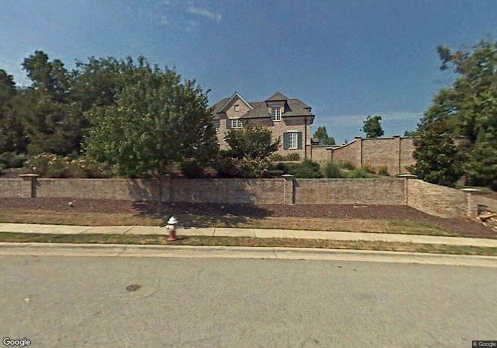
4213 Rock Bridge Rd High Point, NC 27262
Estimated Value: $1,083,391 - $1,413,000
4
Beds
6
Baths
8,926
Sq Ft
$136/Sq Ft
Est. Value
About This Home
This home is located at 4213 Rock Bridge Rd, High Point, NC 27262 and is currently estimated at $1,210,130, approximately $135 per square foot. 4213 Rock Bridge Rd is a home located in Davidson County with nearby schools including Friendship Elementary School, Ledford Middle School, and Ledford High School.
Ownership History
Date
Name
Owned For
Owner Type
Purchase Details
Closed on
Dec 23, 2008
Sold by
Pardy Kerry A
Bought by
Johns Terrance P and Johns Dorothy A
Current Estimated Value
Home Financials for this Owner
Home Financials are based on the most recent Mortgage that was taken out on this home.
Original Mortgage
$700,000
Outstanding Balance
$447,586
Interest Rate
5.48%
Mortgage Type
Purchase Money Mortgage
Estimated Equity
$762,544
Purchase Details
Closed on
Apr 20, 2004
Sold by
Kimsey Miriam O
Bought by
Pardy John J and Pardy Kerry A
Purchase Details
Closed on
Apr 1, 1997
Purchase Details
Closed on
Feb 1, 1995
Purchase Details
Closed on
Apr 1, 1993
Create a Home Valuation Report for This Property
The Home Valuation Report is an in-depth analysis detailing your home's value as well as a comparison with similar homes in the area
Home Values in the Area
Average Home Value in this Area
Purchase History
| Date | Buyer | Sale Price | Title Company |
|---|---|---|---|
| Johns Terrance P | $875,000 | None Available | |
| Pardy John J | $1,100,000 | -- | |
| -- | $106,000 | -- | |
| -- | $112,500 | -- | |
| -- | -- | -- |
Source: Public Records
Mortgage History
| Date | Status | Borrower | Loan Amount |
|---|---|---|---|
| Open | Johns Terrance P | $700,000 |
Source: Public Records
Tax History Compared to Growth
Tax History
| Year | Tax Paid | Tax Assessment Tax Assessment Total Assessment is a certain percentage of the fair market value that is determined by local assessors to be the total taxable value of land and additions on the property. | Land | Improvement |
|---|---|---|---|---|
| 2025 | $11,203 | $957,800 | $0 | $0 |
| 2024 | $11,203 | $957,800 | $0 | $0 |
| 2023 | $10,920 | $957,800 | $0 | $0 |
| 2022 | $10,920 | $957,800 | $0 | $0 |
| 2021 | $11,203 | $957,800 | $0 | $0 |
| 2020 | $10,173 | $869,760 | $0 | $0 |
| 2019 | $10,328 | $869,760 | $0 | $0 |
| 2018 | $10,328 | $869,760 | $0 | $0 |
| 2017 | $10,328 | $869,760 | $0 | $0 |
| 2016 | $10,328 | $869,760 | $0 | $0 |
| 2015 | $10,350 | $869,760 | $0 | $0 |
| 2014 | $10,534 | $874,880 | $0 | $0 |
Source: Public Records
Map
Nearby Homes
- 2908 Maggie Ct
- 2801 Swan Lake Dr
- 2809 Churchill Ct
- 2925 Fernley Ct
- 2729 Croquet Cir
- 2731 Croquet Cir
- 1706 Windsor Dr
- 246 Merry Hills Dr
- 00 Chestnut Street Extension
- 0 Chestnut Street Extension
- 308 Canterbury Rd
- 0 Laura Ln
- 1629 Appaloosa Place
- 1629 Appaloosa Place Unit Lot 11
- 1625 Appaloosa Place
- 1625 Appaloosa Place Unit Lot 12
- 4099 Stallion St
- Bailey Plan at Canter Creek
- Seagrove Plan at Canter Creek
- Richmond Plan at Canter Creek
- 2903 Maggie Ct
- 2904 Swan Lake Dr
- 4201 Rock Bridge Rd
- 2908 Swan Lake Dr
- 4218 Rock Bridge Rd
- 4210 Rock Bridge Rd
- 2912 Swan Lake Dr
- 2909 Maggie Ct
- 2900 Maggie Ct
- 2931 Swan Lake Dr
- 2904 Maggie Ct
- 4224 Rock Bridge Rd
- Lot 54 Swan Lake Dr
- 2800 Swan Lake Dr
- 2916 Swan Lake Dr
- 4214 Rock Bridge Rd
- 2905 Swan Lake Dr
- 2909 Swan Lake Dr
- 4206 Rock Bridge Rd
- 2913 Swan Lake Dr