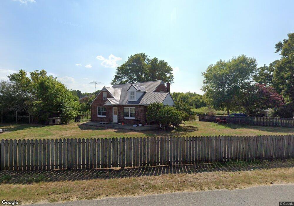
4214 Pollard Rd Walling, TN 38587
Estimated Value: $202,000 - $304,000
4
Beds
1
Bath
1,664
Sq Ft
$150/Sq Ft
Est. Value
About This Home
This home is located at 4214 Pollard Rd, Walling, TN 38587 and is currently estimated at $249,732, approximately $150 per square foot. 4214 Pollard Rd is a home located in White County with nearby schools including Central View Elementary School, White County Middle School, and White County High School.
Ownership History
Date
Name
Owned For
Owner Type
Purchase Details
Closed on
Apr 10, 2023
Sold by
Weatherly John
Bought by
Weatherly Amber
Current Estimated Value
Purchase Details
Closed on
Jan 24, 2017
Sold by
Humphrey Daryl Kevin
Bought by
John Weatherly and Weatherly Amber
Purchase Details
Closed on
Dec 3, 2001
Sold by
Humphrey Dariel W
Bought by
Kevin Humphrey Darryl
Purchase Details
Closed on
Oct 18, 1994
Bought by
Humphrey Elbert
Create a Home Valuation Report for This Property
The Home Valuation Report is an in-depth analysis detailing your home's value as well as a comparison with similar homes in the area
Purchase History
| Date | Buyer | Sale Price | Title Company |
|---|---|---|---|
| Weatherly Amber | -- | None Listed On Document | |
| Weatherly Amber | -- | None Listed On Document | |
| John Weatherly | $40,000 | -- | |
| Kevin Humphrey Darryl | -- | -- | |
| Humphrey Elbert | $100 | -- |
Source: Public Records
Tax History
| Year | Tax Paid | Tax Assessment Tax Assessment Total Assessment is a certain percentage of the fair market value that is determined by local assessors to be the total taxable value of land and additions on the property. | Land | Improvement |
|---|---|---|---|---|
| 2025 | $813 | $57,650 | $7,150 | $50,500 |
| 2024 | $694 | $33,850 | $5,025 | $28,825 |
| 2023 | $694 | $33,850 | $5,025 | $28,825 |
| 2022 | $694 | $33,850 | $5,025 | $28,825 |
| 2021 | $694 | $33,850 | $5,025 | $28,825 |
| 2020 | $694 | $33,850 | $5,025 | $28,825 |
| 2019 | $303 | $14,800 | $1,950 | $12,850 |
| 2018 | $303 | $14,800 | $1,950 | $12,850 |
| 2017 | $303 | $14,800 | $1,950 | $12,850 |
| 2016 | $303 | $14,800 | $1,950 | $12,850 |
| 2015 | $274 | $14,800 | $1,950 | $12,850 |
| 2014 | -- | $14,800 | $1,950 | $12,850 |
| 2013 | -- | $13,050 | $1,775 | $11,275 |
Source: Public Records
Map
Nearby Homes
- 14305 Old Kentucky Rd
- 157 Kirkpatrick Ln SW
- 13723 Old Kentucky Rd
- 13400 Old Kentucky Rd
- 2.28 Acres Pates Ford Rd
- 00 Pollard Cemetery Rd
- 0 Pollard Cemetery Rd
- 2530 Pollard Rd
- 265 N Center Point Acres
- 3297 Three Island Rd
- 1295 Darkey Springs Rd
- 0 Center Point Acres N Unit 1322803
- 0 Center Point Acres N Unit 240744
- 0 Center Point Acres N Unit RTC3050083
- 620 Roberts Cemetery Rd
- 00 Roberts Cemetery Rd
- 151 AC. Roberts Cemetery Rd
- 298 Pollard Rd
- 2.28 Ac Pates Ford Rd
- 2.21 AC Pates Ford Rd
- 4186 Pollard Rd
- 1736 Three Island Rd
- 1840 Betterton Rd
- 1543 3 Island Rd
- 1506 Three Island Rd
- 4087 Pollard Rd
- 1505 Three Island Rd
- 1817 3 Island Rd
- 1755 Betterton Rd
- 1728 Betterton Rd
- 1733 Betterton Rd
- 4009 Pollard Rd
- 1406 Three Island Rd
- 1667 Betterton Rd
- 185 Swindell Mill Rd
- 3943 Pollard Rd
- 203 Swindell Mill Rd
- 130 Swindell Mill Rd
- 162 Swindell Mill Rd
- 1910 Three Island Rd
Your Personal Tour Guide
Ask me questions while you tour the home.