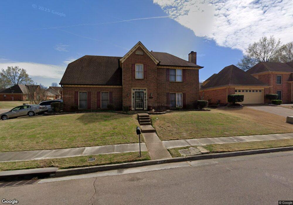
4214 Thunderstone Cir W Memphis, TN 38125
Southern Shelby County NeighborhoodEstimated Value: $262,000 - $311,000
3
Beds
2
Baths
2,657
Sq Ft
$105/Sq Ft
Est. Value
About This Home
This home is located at 4214 Thunderstone Cir W, Memphis, TN 38125 and is currently estimated at $279,199, approximately $105 per square foot. 4214 Thunderstone Cir W is a home located in Shelby County with nearby schools including Lowrance Elementary School, Southwind High School, and Power Center Academy - Southeast.
Ownership History
Date
Name
Owned For
Owner Type
Purchase Details
Closed on
Apr 16, 2007
Sold by
Deutsche Bank National Trust Co
Bought by
Ramirez Ana L
Current Estimated Value
Home Financials for this Owner
Home Financials are based on the most recent Mortgage that was taken out on this home.
Original Mortgage
$140,000
Outstanding Balance
$84,415
Interest Rate
6.1%
Mortgage Type
Purchase Money Mortgage
Estimated Equity
$194,784
Purchase Details
Closed on
Jul 22, 2004
Sold by
Burchfield Henry W and Burchfield Rebecca L
Bought by
Davis Laquita
Home Financials for this Owner
Home Financials are based on the most recent Mortgage that was taken out on this home.
Original Mortgage
$131,760
Interest Rate
6.08%
Mortgage Type
Purchase Money Mortgage
Create a Home Valuation Report for This Property
The Home Valuation Report is an in-depth analysis detailing your home's value as well as a comparison with similar homes in the area
Home Values in the Area
Average Home Value in this Area
Purchase History
| Date | Buyer | Sale Price | Title Company |
|---|---|---|---|
| Ramirez Ana L | $140,000 | None Available | |
| Davis Laquita | $164,700 | -- |
Source: Public Records
Mortgage History
| Date | Status | Borrower | Loan Amount |
|---|---|---|---|
| Open | Ramirez Ana L | $140,000 | |
| Previous Owner | Davis Laquita | $131,760 | |
| Closed | Davis Laquita | $32,940 |
Source: Public Records
Tax History Compared to Growth
Tax History
| Year | Tax Paid | Tax Assessment Tax Assessment Total Assessment is a certain percentage of the fair market value that is determined by local assessors to be the total taxable value of land and additions on the property. | Land | Improvement |
|---|---|---|---|---|
| 2025 | $1,622 | $63,300 | $12,000 | $51,300 |
| 2024 | $1,622 | $47,850 | $8,300 | $39,550 |
| 2023 | $1,622 | $47,850 | $8,300 | $39,550 |
| 2022 | $1,622 | $47,850 | $8,300 | $39,550 |
| 2021 | $1,651 | $47,850 | $8,300 | $39,550 |
| 2020 | $1,454 | $35,900 | $8,300 | $27,600 |
| 2019 | $1,454 | $35,900 | $8,300 | $27,600 |
| 2018 | $1,454 | $35,900 | $8,300 | $27,600 |
| 2017 | $1,475 | $35,900 | $8,300 | $27,600 |
| 2016 | $1,432 | $32,775 | $0 | $0 |
| 2014 | $1,432 | $32,775 | $0 | $0 |
Source: Public Records
Map
Nearby Homes
- 4294 Thunderstone Cir W
- 4028 Long Creek Rd
- 7561 Shelby Cross Cir
- 7527 Wilsford Cove
- 4316 Barry Meadows Cove
- 4419 Berkley Woods Dr
- 4471 Hughes Meadow Dr
- 7579 Baysweet Dr
- 3912 Autumn Harvest Ln
- 4646 Sweet Whisper Ln
- 7421 Richmond Rd
- 4310 Coral Creek Ln
- 7386 Eggleston Rd
- 7296 Germanshire Ln
- 3988 Fern Valley Dr
- 4056 Clovis Cove
- 7286 New Britain Dr
- 7380 Isherwood Rd
- 7218 Barnstable Rd
- 4350 Oak Chase Cove
- 4222 Thunderstone Cir W
- 7757 Thunderstone Cir E
- 4211 Thunderstone Cir W
- 4230 Thunderstone Cir W
- 4219 Thunderstone Cir W
- 7740 Thunderstone Cir E
- 7750 Thunderstone Cir E
- 7740 Meadowside Cove
- 7760 Thunderstone Cir E
- 4195 Thunderstone Cir W
- 4227 Thunderstone Cir W
- 4200 Thunderstone Cir W
- 4240 Thunderstone Cir W
- 7732 Meadowside Cove
- 7770 Thunderstone Cir E
- 7749 Meadowside Cove
- 7733 Evening Shade Cove
- 4212 Evening Star Cove
- 7741 Evening Shade Cove
- 4190 Thunderstone Cir W