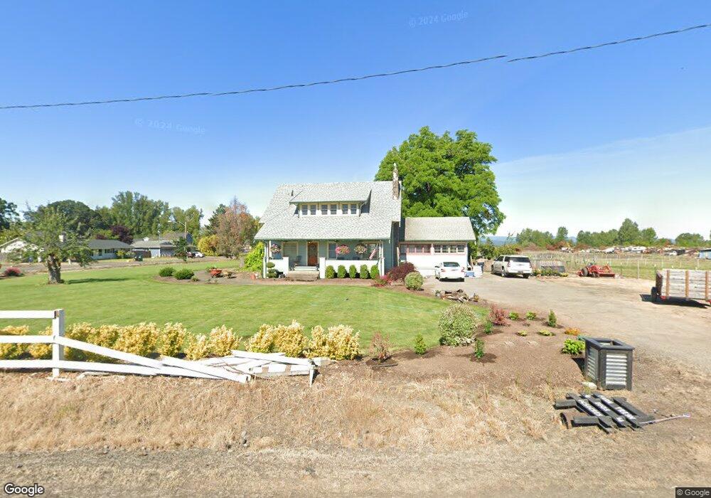
4215 Independence Hwy Independence, OR 97351
Estimated Value: $675,000 - $707,000
6
Beds
2
Baths
2,382
Sq Ft
$289/Sq Ft
Est. Value
About This Home
This home is located at 4215 Independence Hwy, Independence, OR 97351 and is currently estimated at $687,563, approximately $288 per square foot. 4215 Independence Hwy is a home located in Polk County with nearby schools including Independence Elementary School, Talmadge Middle School, and Central High School.
Ownership History
Date
Name
Owned For
Owner Type
Purchase Details
Closed on
Sep 29, 2020
Sold by
Calabrese Carlo C
Bought by
Carlson Matthew Robert and Carlson Nicole L
Current Estimated Value
Home Financials for this Owner
Home Financials are based on the most recent Mortgage that was taken out on this home.
Original Mortgage
$410,000
Outstanding Balance
$364,673
Interest Rate
2.9%
Mortgage Type
New Conventional
Estimated Equity
$322,890
Create a Home Valuation Report for This Property
The Home Valuation Report is an in-depth analysis detailing your home's value as well as a comparison with similar homes in the area
Home Values in the Area
Average Home Value in this Area
Purchase History
| Date | Buyer | Sale Price | Title Company |
|---|---|---|---|
| Carlson Matthew Robert | $485,000 | Amerititle |
Source: Public Records
Mortgage History
| Date | Status | Borrower | Loan Amount |
|---|---|---|---|
| Open | Carlson Matthew Robert | $410,000 |
Source: Public Records
Tax History Compared to Growth
Tax History
| Year | Tax Paid | Tax Assessment Tax Assessment Total Assessment is a certain percentage of the fair market value that is determined by local assessors to be the total taxable value of land and additions on the property. | Land | Improvement |
|---|---|---|---|---|
| 2025 | $4,243 | $340,100 | $158,510 | $181,590 |
| 2024 | $4,243 | $330,200 | $153,890 | $176,310 |
| 2023 | $4,515 | $320,590 | $149,410 | $171,180 |
| 2022 | $3,965 | $311,260 | $145,060 | $166,200 |
| 2021 | $3,937 | $302,200 | $140,840 | $161,360 |
| 2020 | $3,824 | $293,400 | $136,750 | $156,650 |
| 2019 | $3,712 | $284,860 | $132,770 | $152,090 |
| 2018 | $3,576 | $276,570 | $128,900 | $147,670 |
| 2017 | $3,569 | $268,520 | $125,140 | $143,380 |
| 2016 | $3,549 | $260,700 | $121,490 | $139,210 |
| 2015 | $3,354 | $253,110 | $117,950 | $135,160 |
| 2014 | $3,295 | $245,740 | $114,520 | $131,220 |
Source: Public Records
Map
Nearby Homes
- 365 Stryker Rd
- 325 Stryker Rd
- 407 Stryker Rd
- 355 Stryker Rd
- 345 Stryker Rd
- 4245 Independence Hwy
- 447 Stryker Rd
- 4185 Independence Hwy
- 4295 Independence Hwy
- 505 Kbel Yliniemi Ln
- 4305 Independence Hwy
- 515 Kbel Yliniemi Ln
- 525 Kbel Yliniemi Ln
- 4309 Main St
- 4307 Independence Hwy (Next To)
- 4303 Independence Hwy
- 535 Kbel Yliniemi Ln
- 510 Kbel Yliniemi Ln
- 4311-4373 Independence Hwy Vista Ridge
- 520 Kbel Yliniemi Ln