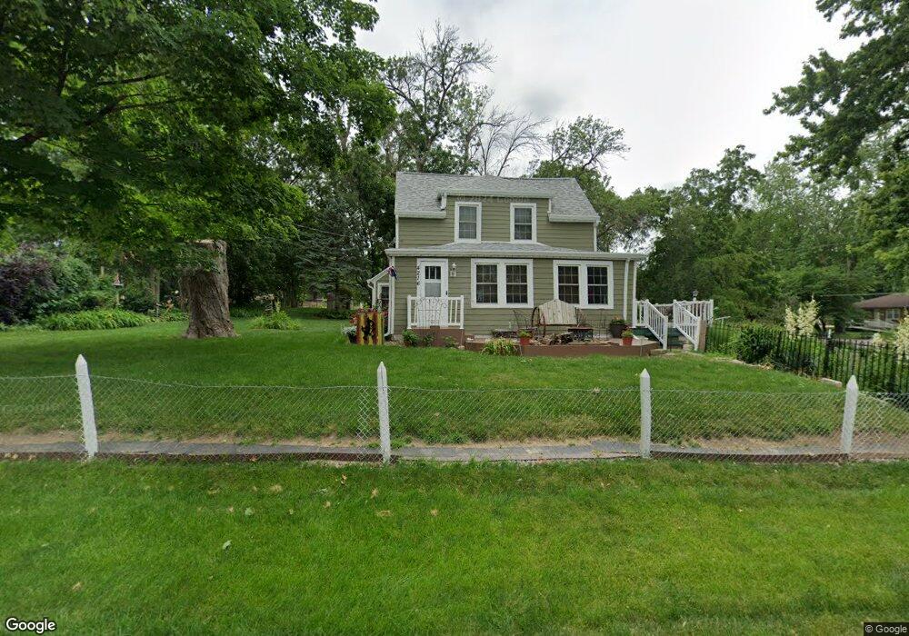
4216 SW 12th St Des Moines, IA 50315
Watrous South NeighborhoodEstimated Value: $236,000 - $269,531
3
Beds
2
Baths
1,692
Sq Ft
$153/Sq Ft
Est. Value
About This Home
This home is located at 4216 SW 12th St, Des Moines, IA 50315 and is currently estimated at $258,383, approximately $152 per square foot. 4216 SW 12th St is a home located in Polk County with nearby schools including Wright Elementary School, Brody Middle School, and Lincoln High School.
Ownership History
Date
Name
Owned For
Owner Type
Purchase Details
Closed on
Jun 27, 2025
Sold by
Doyle Joel P and Doyle Lori L
Bought by
Joel And Lori Doyle Revocable Trust
Current Estimated Value
Create a Home Valuation Report for This Property
The Home Valuation Report is an in-depth analysis detailing your home's value as well as a comparison with similar homes in the area
Home Values in the Area
Average Home Value in this Area
Purchase History
| Date | Buyer | Sale Price | Title Company |
|---|---|---|---|
| Joel And Lori Doyle Revocable Trust | -- | None Listed On Document | |
| Joel And Lori Doyle Revocable Trust | -- | None Listed On Document |
Source: Public Records
Tax History Compared to Growth
Tax History
| Year | Tax Paid | Tax Assessment Tax Assessment Total Assessment is a certain percentage of the fair market value that is determined by local assessors to be the total taxable value of land and additions on the property. | Land | Improvement |
|---|---|---|---|---|
| 2025 | $4,434 | $266,100 | $66,100 | $200,000 |
| 2024 | $4,434 | $235,900 | $58,300 | $177,600 |
| 2023 | $4,272 | $235,900 | $58,300 | $177,600 |
| 2022 | $4,236 | $190,100 | $49,100 | $141,000 |
| 2021 | $4,194 | $190,100 | $49,100 | $141,000 |
| 2020 | $4,352 | $176,700 | $45,900 | $130,800 |
| 2019 | $4,154 | $176,700 | $45,900 | $130,800 |
| 2018 | $4,106 | $163,100 | $41,900 | $121,200 |
| 2017 | $3,664 | $163,100 | $41,900 | $121,200 |
| 2016 | $3,476 | $144,000 | $36,800 | $107,200 |
| 2015 | $3,476 | $140,600 | $36,800 | $103,800 |
| 2014 | $3,292 | $137,500 | $35,600 | $101,900 |
Source: Public Records
Map
Nearby Homes
- 4108 SW 12th St
- 4020 SW 12th St
- 1219 Elder Ln
- 1204 Elder Ln
- 1222 Watrous Ave
- 1207 Emma Ave
- 1223 Emma Ave
- 3808 SW 12th St
- 1203 Herold Ave
- 1109 Herold Ave
- 3724 SW 13th St
- 930 Emma Ave
- 1116 Herold Ave
- 1607 Carrie Ave
- 3903 SW 9th St
- 4204 SW 7th St
- 1229 Evans St
- 3514 SW 12th St
- . Herold Ave
- 3618 SW 9th St
- 4220 SW 12th St
- 1220 Carrie Ave
- 1209 Carrie Ave
- 1203 Carrie Ave
- 1209 Elder Ln
- 1215 Carrie Ave
- 1224 Carrie Ave
- 4205 SW 12th St
- 4211 SW 12th St
- 4203 SW 12th St
- 4219 SW 12th St
- 4201 SW 12th St
- 1221 Carrie Ave
- 1215 Elder Ln
- 1228 Carrie Ave
- 1112 Elder Ln
- 1123 Carrie Ave
- 1109 Elder Ln
- 1118 Carrie Ave
- 1227 Carrie Ave