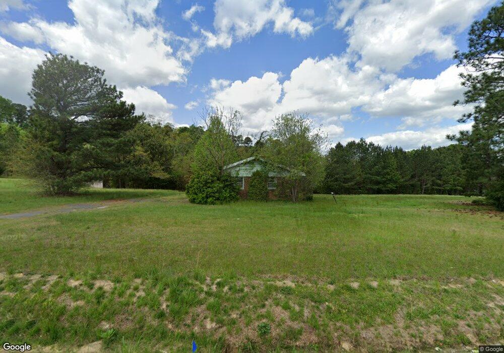
4216 Whitfield Rd Raleigh, NC 27610
Southeast Raleigh NeighborhoodEstimated Value: $250,000 - $443,000
--
Bed
--
Bath
1,080
Sq Ft
$301/Sq Ft
Est. Value
About This Home
This home is located at 4216 Whitfield Rd, Raleigh, NC 27610 and is currently estimated at $324,838, approximately $300 per square foot. 4216 Whitfield Rd is a home located in Wake County with nearby schools including East Garner Elementary School, East Garner Middle School, and South Garner High.
Ownership History
Date
Name
Owned For
Owner Type
Purchase Details
Closed on
Dec 16, 2019
Sold by
Eastern Star Holiness Chr Of Our Lord Je
Bought by
Church On The Rock At Raleigh
Current Estimated Value
Purchase Details
Closed on
Apr 16, 2008
Sold by
Sandy Priscilla G
Bought by
Eastern Star Holiness Church Of Our Lord
Purchase Details
Closed on
Jan 12, 2006
Sold by
Griffis Richard Haywood
Bought by
Sandy Priscilla G
Purchase Details
Closed on
Feb 7, 2003
Sold by
Sandy Priscilla G
Bought by
Sandy Jonny B
Create a Home Valuation Report for This Property
The Home Valuation Report is an in-depth analysis detailing your home's value as well as a comparison with similar homes in the area
Home Values in the Area
Average Home Value in this Area
Purchase History
| Date | Buyer | Sale Price | Title Company |
|---|---|---|---|
| Church On The Rock At Raleigh | $326,000 | None Available | |
| Eastern Star Holiness Church Of Our Lord | $225,000 | None Available | |
| Sandy Priscilla G | -- | None Available | |
| Sandy Jonny B | -- | -- |
Source: Public Records
Tax History Compared to Growth
Tax History
| Year | Tax Paid | Tax Assessment Tax Assessment Total Assessment is a certain percentage of the fair market value that is determined by local assessors to be the total taxable value of land and additions on the property. | Land | Improvement |
|---|---|---|---|---|
| 2025 | $1,904 | $297,737 | $198,600 | $99,137 |
| 2024 | $1,849 | $297,737 | $198,600 | $99,137 |
| 2023 | $1,110 | $142,323 | $102,640 | $39,683 |
| 2022 | $1,028 | $142,323 | $102,640 | $39,683 |
| 2021 | $1,000 | $142,323 | $102,640 | $39,683 |
| 2020 | $983 | $142,323 | $102,640 | $39,683 |
| 2019 | $1,195 | $146,285 | $84,520 | $61,765 |
| 2018 | $1,098 | $146,285 | $84,520 | $61,765 |
| 2017 | $1,040 | $146,285 | $84,520 | $61,765 |
| 2016 | $1,019 | $146,285 | $84,520 | $61,765 |
| 2015 | $1,254 | $177,700 | $93,600 | $84,100 |
| 2014 | $1,189 | $177,700 | $93,600 | $84,100 |
Source: Public Records
Map
Nearby Homes
- 7101 Battle Bridge Rd
- 6839 Harter Ct Unit 35
- 6839 Harter Ct
- 6604 Frogstool Ln
- 6848 Horseback Ln
- 3836 Griffis Glen Dr
- 6516 Battle Bridge Rd
- Litchfield Plan at Battle Bridge
- Winchester Plan at Battle Bridge
- Rochester Plan at Battle Bridge
- 6447 Granite Quarry Dr
- 6445 Granite Quarry Dr
- 4342 Bay Rum Ln
- 6606 Gibraltar Rock Dr
- 6411 Granite Quarry Dr
- 6610 Gibraltar Rock Dr
- 6407 Granite Quarry Dr
- 6409 Granite Quarry Dr
- 6125 Arsenal Ave
- 6620 Gibraltar Rock Dr
- 4200 Whitfield Rd
- 6904 Battle Bridge Rd
- 0 Lady Myrtle Ln
- 7021 Battle Bridge Rd
- 4301 Whitfield Rd
- 7001 Battle Bridge Rd
- 6909 Battle Bridge Rd
- 4128 MacKinac Island Ln
- 6820 Battle Bridge Rd
- 4137 Griffis Glen Dr
- 4105 Griffis Glen Dr
- 4317 Whitfield Rd
- 4141 MacKinac Island Ln
- 4124 MacKinac Island Ln
- 4101 Griffis Glen Dr
- 4137 MacKinac Island Ln
- 4137 Griffis Glen
- 4037 Griffis Glen Dr
- 4133 MacKinac Island Ln
- 0 Whitfield Rd