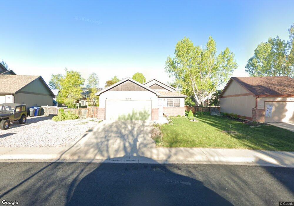
4217 La Veta Dr Loveland, CO 80538
Estimated Value: $402,285 - $529,000
3
Beds
2
Baths
1,378
Sq Ft
$334/Sq Ft
Est. Value
About This Home
This home is located at 4217 La Veta Dr, Loveland, CO 80538 and is currently estimated at $460,571, approximately $334 per square foot. 4217 La Veta Dr is a home located in Larimer County with nearby schools including Ponderosa Elementary School, Lucile Erwin Middle School, and Loveland High School.
Ownership History
Date
Name
Owned For
Owner Type
Purchase Details
Closed on
Feb 23, 2023
Sold by
Calaway Michael Gar
Bought by
Calaway Family Living Trust
Current Estimated Value
Purchase Details
Closed on
Feb 25, 2005
Sold by
Kolander Eugene E and Kolander Marian T
Bought by
Calaway Michael Gar and Calaway Colleen Ann
Home Financials for this Owner
Home Financials are based on the most recent Mortgage that was taken out on this home.
Original Mortgage
$142,300
Interest Rate
6.12%
Mortgage Type
Purchase Money Mortgage
Purchase Details
Closed on
Dec 14, 2001
Sold by
Giuliano & Father Construction Inc
Bought by
Kolander Eugene E and Kolander Marian T
Home Financials for this Owner
Home Financials are based on the most recent Mortgage that was taken out on this home.
Original Mortgage
$146,728
Interest Rate
6.52%
Mortgage Type
VA
Create a Home Valuation Report for This Property
The Home Valuation Report is an in-depth analysis detailing your home's value as well as a comparison with similar homes in the area
Home Values in the Area
Average Home Value in this Area
Purchase History
| Date | Buyer | Sale Price | Title Company |
|---|---|---|---|
| Calaway Family Living Trust | $500 | -- | |
| Calaway Michael Gar | $177,900 | Empire Title & Escrow | |
| Kolander Eugene E | $143,851 | Security Title |
Source: Public Records
Mortgage History
| Date | Status | Borrower | Loan Amount |
|---|---|---|---|
| Previous Owner | Calaway Michael Gar | $142,300 | |
| Previous Owner | Kolander Eugene E | $146,728 | |
| Closed | Calaway Michael Gar | $17,610 |
Source: Public Records
Tax History Compared to Growth
Tax History
| Year | Tax Paid | Tax Assessment Tax Assessment Total Assessment is a certain percentage of the fair market value that is determined by local assessors to be the total taxable value of land and additions on the property. | Land | Improvement |
|---|---|---|---|---|
| 2025 | $1,096 | $24,120 | $3,705 | $20,415 |
| 2024 | $1,057 | $24,120 | $3,705 | $20,415 |
| 2022 | $1,197 | $21,989 | $3,843 | $18,146 |
| 2021 | $1,230 | $22,623 | $3,954 | $18,669 |
| 2020 | $1,034 | $20,156 | $3,954 | $16,202 |
| 2019 | $1,576 | $20,156 | $3,954 | $16,202 |
| 2018 | $1,309 | $15,905 | $3,982 | $11,923 |
| 2017 | $1,127 | $15,905 | $3,982 | $11,923 |
| 2016 | $1,120 | $15,267 | $4,402 | $10,865 |
| 2015 | $1,111 | $15,270 | $4,400 | $10,870 |
| 2014 | $951 | $12,650 | $4,400 | $8,250 |
Source: Public Records
Map
Nearby Homes
- 4135 La Veta Dr
- 4067 Rocky Ford Dr
- 3389 Hewitt St
- 3384 Foster Place
- 4106 Cripple Creek Dr
- 3165 Benfold St
- 3124 Williamsburg St
- 3007 Benfold St
- 3017 Thorn Cir
- 2960 Kincaid Dr Unit 303
- 2958 Donatello St
- 3238 Picasso Dr
- 3115 Da Vinci Dr
- 4705 Whistler Dr
- 4711 Whistler Dr
- 4719 Degas Dr
- 4725 Degas Dr
- 4733 Degas Dr
- 4745 Degas Dr
- The Briggsdale II Plan at Wilson Commons - Detached Single Family Homes
- 4239 La Veta Dr
- 4195 La Veta Dr
- 4206 Rocky Ford Dr
- 4188 Rocky Ford Dr
- 4230 Rocky Ford Dr
- 4253 La Veta Dr
- 4181 La Veta Dr
- 4172 Rocky Ford Dr
- 4226 La Veta Dr
- 4200 La Veta Dr
- 4252 Rocky Ford Dr
- 3282 Coal Creek St
- 4150 Rocky Ford Dr
- 4169 La Veta Dr
- 4174 La Veta Dr
- 4128 Rocky Ford Dr
- 3268 Coal Creek St
- 4201 Rocky Ford Dr
- 4193 Rocky Ford Dr
- 4229 Rocky Ford Dr