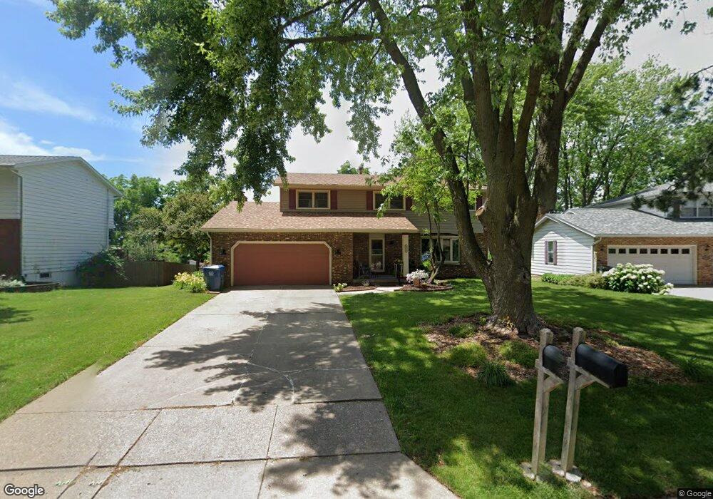
4218 Spring St Davenport, IA 52807
North Side NeighborhoodEstimated Value: $304,031 - $348,000
5
Beds
3
Baths
2,106
Sq Ft
$152/Sq Ft
Est. Value
About This Home
This home is located at 4218 Spring St, Davenport, IA 52807 and is currently estimated at $321,008, approximately $152 per square foot. 4218 Spring St is a home located in Scott County with nearby schools including Eisenhower Elementary School, Sudlow Intermediate School, and Central High School.
Ownership History
Date
Name
Owned For
Owner Type
Purchase Details
Closed on
May 26, 2006
Sold by
Cecil Cheryl L
Bought by
Fer William F and Fer Penny A
Current Estimated Value
Home Financials for this Owner
Home Financials are based on the most recent Mortgage that was taken out on this home.
Original Mortgage
$92,000
Outstanding Balance
$53,108
Interest Rate
6.73%
Mortgage Type
New Conventional
Estimated Equity
$267,900
Create a Home Valuation Report for This Property
The Home Valuation Report is an in-depth analysis detailing your home's value as well as a comparison with similar homes in the area
Home Values in the Area
Average Home Value in this Area
Purchase History
| Date | Buyer | Sale Price | Title Company |
|---|---|---|---|
| Fer William F | $199,000 | None Available |
Source: Public Records
Mortgage History
| Date | Status | Borrower | Loan Amount |
|---|---|---|---|
| Open | Fer William F | $92,000 |
Source: Public Records
Tax History
| Year | Tax Paid | Tax Assessment Tax Assessment Total Assessment is a certain percentage of the fair market value that is determined by local assessors to be the total taxable value of land and additions on the property. | Land | Improvement |
|---|---|---|---|---|
| 2025 | $4,538 | $295,020 | $34,970 | $260,050 |
| 2024 | $4,424 | $264,150 | $34,970 | $229,180 |
| 2023 | $5,324 | $264,150 | $34,970 | $229,180 |
| 2022 | $5,348 | $258,140 | $31,290 | $226,850 |
| 2021 | $5,348 | $258,140 | $31,290 | $226,850 |
| 2020 | $4,916 | $235,080 | $31,290 | $203,790 |
| 2019 | $4,824 | $223,540 | $31,290 | $192,250 |
| 2018 | $4,216 | $223,540 | $31,290 | $192,250 |
| 2017 | $1,116 | $200,720 | $31,290 | $169,430 |
| 2016 | $4,204 | $200,720 | $0 | $0 |
| 2015 | $4,204 | $199,920 | $0 | $0 |
| 2014 | $4,246 | $199,920 | $0 | $0 |
| 2013 | $4,168 | $0 | $0 | $0 |
| 2012 | -- | $187,770 | $30,890 | $156,880 |
Source: Public Records
Map
Nearby Homes
- 0 Eastern Unit MRDQC4247043
- 3818 Belle Ave
- 1227 E Kimberly Rd Unit 5A
- 4732 Pheasant Creek Ave
- 3730 Kenwood Ave
- 2919 E 44th Ct
- 3036 Tremont Ave
- 2515 E George Washington Blvd
- 3001 Davenport Ave
- 104 E Kimberly Rd
- 3105 Jefferson Ave
- 0 E 53rd St Unit Lot 4
- 5810 Indigo Ave
- 2618 Esplanade Ave
- 525 E 53rd St Unit 2
- 1811 Katie Ct
- 2723 Arlington Ave
- 2006 E 59th Ct
- 2716 Davenport Ave
- 1228 E Dover Ct
- 4208 Spring St
- 4226 Spring St
- 1735 E 42nd Ct
- 4202 Spring St
- 4232 Spring St
- 1824 Winding Hill Rd
- 4217 Spring St
- 4205 Spring St
- 1736 E 42nd Ct
- 4227 Spring St
- 1816 Winding Hill Rd
- 1831 E 43rd St
- 1745 E 43rd St
- 1732 E 42nd Ct
- 1914 Winding Hill Rd
- 4237 Spring St
- 1731 E 42nd Ct
- 1808 Winding Hill Rd
- 1737 E 43rd St
- 4245 Spring St
Your Personal Tour Guide
Ask me questions while you tour the home.