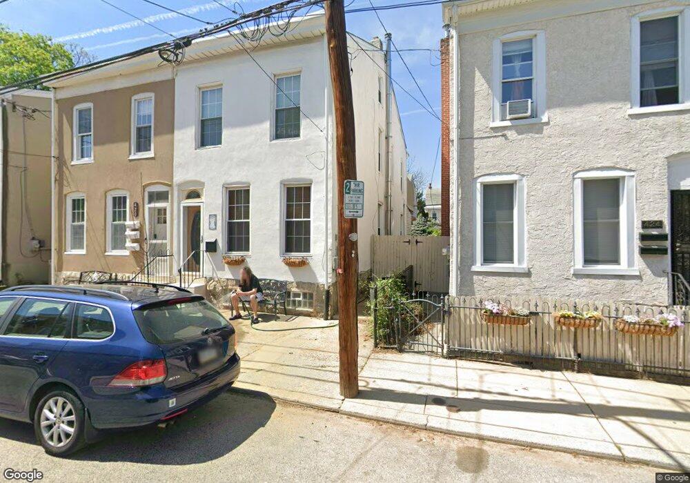
422 Conarroe St Philadelphia, PA 19128
Roxborough NeighborhoodEstimated Value: $353,853 - $415,000
4
Beds
2
Baths
1,520
Sq Ft
$246/Sq Ft
Est. Value
About This Home
This home is located at 422 Conarroe St, Philadelphia, PA 19128 and is currently estimated at $374,463, approximately $246 per square foot. 422 Conarroe St is a home located in Philadelphia County with nearby schools including James Dobson Elementary School, Roxborough High School, and St. John the Baptist School.
Ownership History
Date
Name
Owned For
Owner Type
Purchase Details
Closed on
Jun 26, 2006
Sold by
Parkinson Daniel J and Parkinson Mary Ann
Bought by
Mannion Edith J
Current Estimated Value
Home Financials for this Owner
Home Financials are based on the most recent Mortgage that was taken out on this home.
Original Mortgage
$95,000
Interest Rate
6.88%
Mortgage Type
Purchase Money Mortgage
Create a Home Valuation Report for This Property
The Home Valuation Report is an in-depth analysis detailing your home's value as well as a comparison with similar homes in the area
Home Values in the Area
Average Home Value in this Area
Purchase History
| Date | Buyer | Sale Price | Title Company |
|---|---|---|---|
| Mannion Edith J | $222,000 | None Available |
Source: Public Records
Mortgage History
| Date | Status | Borrower | Loan Amount |
|---|---|---|---|
| Previous Owner | Mannion Edith J | $95,000 |
Source: Public Records
Tax History Compared to Growth
Tax History
| Year | Tax Paid | Tax Assessment Tax Assessment Total Assessment is a certain percentage of the fair market value that is determined by local assessors to be the total taxable value of land and additions on the property. | Land | Improvement |
|---|---|---|---|---|
| 2025 | $3,644 | $308,100 | $61,620 | $246,480 |
| 2024 | $3,644 | $308,100 | $61,620 | $246,480 |
| 2023 | $3,644 | $260,300 | $52,060 | $208,240 |
| 2022 | $2,497 | $215,300 | $52,060 | $163,240 |
| 2021 | $3,127 | $0 | $0 | $0 |
| 2020 | $3,127 | $0 | $0 | $0 |
| 2019 | $3,018 | $0 | $0 | $0 |
| 2018 | $2,300 | $0 | $0 | $0 |
| 2017 | $2,699 | $0 | $0 | $0 |
| 2016 | $2,300 | $0 | $0 | $0 |
| 2015 | $2,202 | $0 | $0 | $0 |
| 2014 | -- | $192,800 | $32,040 | $160,760 |
| 2012 | -- | $19,008 | $3,624 | $15,384 |
Source: Public Records
Map
Nearby Homes
- 407 Conarroe St
- 434-36 Conarroe St
- 389 Conarroe St
- 4416 Pechin St
- 4448 Mitchell St
- 4381-83 Pechin St
- 375 Green Ln
- 432 Martin St
- 452 Green Ln
- 451 Green Ln
- 359 Lyceum Ave
- 481 Conarroe St
- 472 Lyceum Ave
- 444 Dupont St
- 362 Martin St
- 4531 Mitchell St
- 6106 Ridge Ave
- 4538 Mitchell St
- 4359 Mitchell St
- 200 Monastery Ave
- 420 Conarroe St Unit 1
- 420 Conarroe St
- 420 Conarroe St Unit 2
- 420 Conarroe St Unit 3
- 418 Conarroe St
- 424 Conarroe St
- 419 Green Ln
- 419 Green Ln Unit 3
- 419 Green Ln Unit 3RD FLOOR
- 419 Green Ln Unit 2
- 419 Green Ln Unit 1ST FLOOR FRONT
- 419 Green Ln Unit 1ST FLOOR
- 426 Conarroe St
- 416 Conarroe St
- 414 Conarroe St
- 428 Conarroe St
- 430 Conarroe St
- 412 Conarroe St
- 419 Conarroe St
- 432 Conarroe St