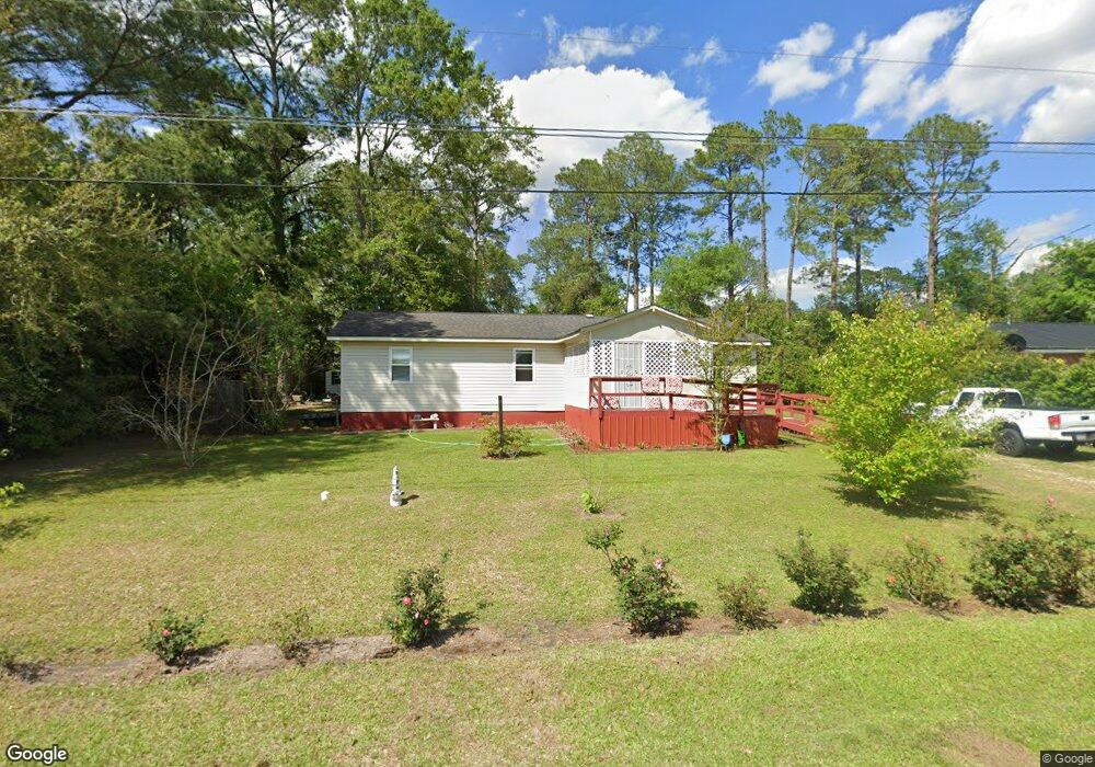
422 Green St E Pelham, GA 31779
Estimated Value: $102,000 - $141,000
4
Beds
2
Baths
1,325
Sq Ft
$94/Sq Ft
Est. Value
About This Home
This home is located at 422 Green St E, Pelham, GA 31779 and is currently estimated at $124,407, approximately $93 per square foot. 422 Green St E is a home located in Mitchell County with nearby schools including Pelham Elementary School, Pelham City Middle School, and Pelham High School.
Ownership History
Date
Name
Owned For
Owner Type
Purchase Details
Closed on
Feb 16, 2009
Sold by
Itson Enterprises Llc
Bought by
Blackledge Sherry and Mcdonald Danielle
Current Estimated Value
Purchase Details
Closed on
Oct 3, 2008
Sold by
Itson John
Bought by
Itson Enterprises Llc
Purchase Details
Closed on
Jul 3, 2008
Sold by
Citimortgage Inc
Bought by
Itson John
Purchase Details
Closed on
May 6, 2008
Sold by
Stewart Mark
Bought by
Citimortgage Inc
Create a Home Valuation Report for This Property
The Home Valuation Report is an in-depth analysis detailing your home's value as well as a comparison with similar homes in the area
Home Values in the Area
Average Home Value in this Area
Purchase History
| Date | Buyer | Sale Price | Title Company |
|---|---|---|---|
| Blackledge Sherry | $60,000 | -- | |
| Itson Enterprises Llc | -- | -- | |
| Itson John | $42,500 | -- | |
| Citimortgage Inc | $57,500 | -- |
Source: Public Records
Tax History Compared to Growth
Tax History
| Year | Tax Paid | Tax Assessment Tax Assessment Total Assessment is a certain percentage of the fair market value that is determined by local assessors to be the total taxable value of land and additions on the property. | Land | Improvement |
|---|---|---|---|---|
| 2024 | $1,614 | $38,200 | $2,400 | $35,800 |
| 2023 | $1,581 | $36,040 | $2,400 | $33,640 |
| 2022 | $1,235 | $27,840 | $2,400 | $25,440 |
| 2021 | $1,117 | $26,040 | $2,400 | $23,640 |
| 2020 | $1,072 | $26,040 | $2,400 | $23,640 |
| 2019 | $1,095 | $26,040 | $2,400 | $23,640 |
| 2018 | $1,177 | $26,040 | $2,400 | $23,640 |
| 2017 | $464 | $25,598 | $2,400 | $23,198 |
| 2016 | $482 | $25,598 | $2,400 | $23,198 |
| 2015 | $482 | $25,598 | $2,400 | $23,198 |
| 2014 | $482 | $25,598 | $2,400 | $23,198 |
| 2013 | $482 | $25,598 | $2,400 | $23,198 |
Source: Public Records
Map
Nearby Homes
- 438 Dogwood Dr NE
- 482 Curry St NE
- 547 Cotton Rd NE
- 375 Baggs Ave SE
- 335 Curry St NE
- 323 Curry St NE
- 199 Carroll St NE
- 183 Baggs Ave SE
- 135 Baggs Ave SE
- 3** Youngs Mill Rd
- 00 Laverne Ln
- 212 Hand Ave W
- 210 Castleberry St NW
- 209 McDonald St SW
- 233 Cannon St NW
- 354 Bennett St NW
- 277 Saunders St SW
- 389 Stewart St SW
- 410 Hollis St SW
- 443 Stewart St SW
- 432 Green St E
- 410 Green St E
- 421 Green St E
- 441 Rosewood Dr NE
- 411 Green St E
- 431 Green St E
- 398 Green St E
- 401 Green St E
- 465 Rosewood Dr NE
- 425 Dogwood Dr NE
- 2179 Hwy 19
- 391 Green St E
- 473 Rosewood Dr NE
- 380 Green St E
- 373 Green St E
- 3139 U S Highway 19
- 000 U S Highway 19
- 00 U S 19
- 0000 U S 19
- 000 U S 19