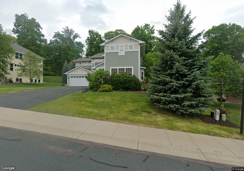
4220 4220 Maple Hurst Dr N Rockford, MN 55373
Estimated Value: $534,000 - $606,000
4
Beds
3
Baths
2,940
Sq Ft
$194/Sq Ft
Est. Value
About This Home
This home is located at 4220 4220 Maple Hurst Dr N, Rockford, MN 55373 and is currently estimated at $570,173, approximately $193 per square foot. 4220 4220 Maple Hurst Dr N is a home located in Wright County with nearby schools including Rockford Elementary Arts Magnet School, Rockford Middle School - Center for Environmental Studies, and Rockford High School.
Ownership History
Date
Name
Owned For
Owner Type
Purchase Details
Closed on
Mar 26, 2021
Sold by
Manthana Sreenivas R and Manthana Jennifer R
Bought by
Cook Megan and Coehlo Beth Ann
Current Estimated Value
Home Financials for this Owner
Home Financials are based on the most recent Mortgage that was taken out on this home.
Original Mortgage
$359,920
Outstanding Balance
$323,910
Interest Rate
2.8%
Mortgage Type
New Conventional
Estimated Equity
$246,263
Purchase Details
Closed on
Feb 27, 2009
Sold by
U S Home Corp
Bought by
Manthana Sreenivas R and Manthana Jennifer R
Purchase Details
Closed on
Dec 22, 2006
Sold by
Dauel A Fare Development Corp
Bought by
Us Home Corp
Create a Home Valuation Report for This Property
The Home Valuation Report is an in-depth analysis detailing your home's value as well as a comparison with similar homes in the area
Home Values in the Area
Average Home Value in this Area
Purchase History
| Date | Buyer | Sale Price | Title Company |
|---|---|---|---|
| Cook Megan | $449,900 | Trademark Title Services Inc | |
| Manthana Sreenivas R | -- | -- | |
| Us Home Corp | $2,592,000 | -- | |
| Cook Megan Megan | $449,900 | -- |
Source: Public Records
Mortgage History
| Date | Status | Borrower | Loan Amount |
|---|---|---|---|
| Open | Cook Megan | $359,920 | |
| Closed | Cook Megan Megan | $359,920 |
Source: Public Records
Tax History Compared to Growth
Tax History
| Year | Tax Paid | Tax Assessment Tax Assessment Total Assessment is a certain percentage of the fair market value that is determined by local assessors to be the total taxable value of land and additions on the property. | Land | Improvement |
|---|---|---|---|---|
| 2025 | $5,682 | $487,800 | $90,000 | $397,800 |
| 2024 | $5,584 | $489,700 | $90,000 | $399,700 |
| 2023 | $5,604 | $495,000 | $90,000 | $405,000 |
| 2022 | $5,638 | $443,200 | $85,000 | $358,200 |
| 2021 | $5,842 | $396,700 | $70,000 | $326,700 |
| 2020 | $6,014 | $401,600 | $70,000 | $331,600 |
| 2019 | $6,002 | $388,800 | $0 | $0 |
| 2018 | $5,146 | $371,700 | $0 | $0 |
| 2017 | $4,824 | $342,000 | $0 | $0 |
| 2016 | $4,688 | $0 | $0 | $0 |
| 2015 | $4,732 | $0 | $0 | $0 |
| 2014 | -- | $0 | $0 | $0 |
Source: Public Records
Map
Nearby Homes
- 4231 Maple Hurst Dr N
- XXX Jansen Ave SE
- 4090 Maple Hurst Dr S
- 4040 Maple Hurst Dr S
- 7021 Meadow Ct
- 8130 Ravenrock Rd
- 6761 Maple Dr
- 8530 Fir St
- 6630 Maple Dr
- 8041 Prairie Trail
- 8098 26th St SE
- 8800 86th Ave N
- 3439 Hall Ave SE
- 7040 Winfield Rd
- 6101 Boulder Ridge Dr
- XX Hamlin Ave SE
- 8833 Walnut Place
- 2169 Ibson Ave SE
- The Madison Plan at Kettering Creek - Kettering Creek Villas
- The Windsor Villa Plan at Kettering Creek - Kettering Creek Villas
- 4220 4220 Maple Hurst-Drive-n
- 4220 Maple Hurst Dr N
- 4210 Maple Hurst Dr N
- 4210 4210 Maple Hurst-Drive-n
- 4210 4210 Maple Hurst Dr N
- 4230 Maple Hurst Dr N
- 4200 Maple Hurst Dr N
- 4240 Maple Hurst Dr N
- 4240 4240 Maple Hurst Dr N
- 4200 4200 Maple Hurst-Drive-n
- 4200 4200 Maple Hurst Dr N
- 4221 Maple Hurst Dr N
- 4221 4221 Maple Hurst-Drive-n
- 3001 Red Maple Ct
- 3001 Red Maple Ct
- 3001 3001 Red Maple Ct N
- 3001 Red Maple Ct N
- 4231 4231 Maple Hurst-Drive-n
- 4250 Maple Hurst Dr N
- 4190 Maple Hurst Dr N