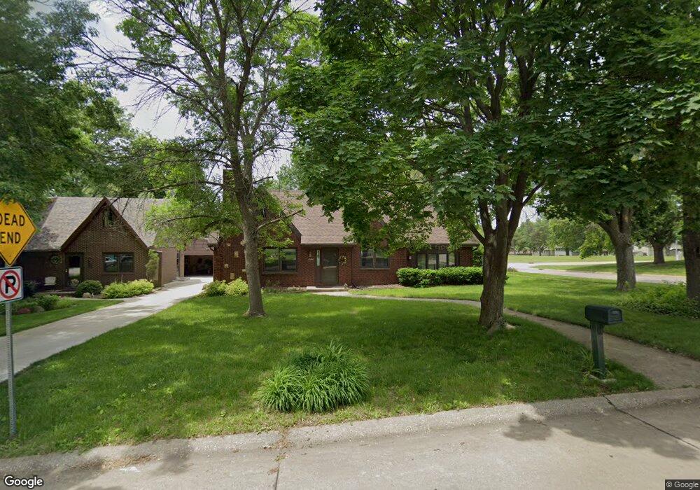
4220 87th St Urbandale, IA 50322
Estimated Value: $272,000 - $364,000
4
Beds
2
Baths
1,894
Sq Ft
$174/Sq Ft
Est. Value
About This Home
This home is located at 4220 87th St, Urbandale, IA 50322 and is currently estimated at $328,897, approximately $173 per square foot. 4220 87th St is a home located in Polk County with nearby schools including Urbandale Middle School, Urbandale High School, and St Pius X School.
Ownership History
Date
Name
Owned For
Owner Type
Purchase Details
Closed on
Nov 30, 2009
Sold by
Smith M E
Bought by
Vaughan Kevin F and Vaughan Anne M
Current Estimated Value
Home Financials for this Owner
Home Financials are based on the most recent Mortgage that was taken out on this home.
Original Mortgage
$103,920
Interest Rate
6.29%
Mortgage Type
Future Advance Clause Open End Mortgage
Purchase Details
Closed on
Jan 3, 2009
Sold by
Brennemen Paul and Brennemen Chris
Bought by
4220 87Th St Land Trust
Purchase Details
Closed on
Nov 17, 2006
Sold by
Marchese Patricia Ann
Bought by
Brennemen Paul and Brennemen Chris
Home Financials for this Owner
Home Financials are based on the most recent Mortgage that was taken out on this home.
Original Mortgage
$202,500
Interest Rate
8.89%
Mortgage Type
Purchase Money Mortgage
Purchase Details
Closed on
Aug 25, 2005
Sold by
Marchese Patricia Ann
Bought by
Brenneman Paul and Brenneman Chris
Home Financials for this Owner
Home Financials are based on the most recent Mortgage that was taken out on this home.
Original Mortgage
$200,700
Interest Rate
8.5%
Mortgage Type
Seller Take Back
Purchase Details
Closed on
Aug 16, 2005
Sold by
Brenneman Paul and Brenneman Christine M
Bought by
Marchese Patricia
Home Financials for this Owner
Home Financials are based on the most recent Mortgage that was taken out on this home.
Original Mortgage
$200,700
Interest Rate
8.5%
Mortgage Type
Seller Take Back
Purchase Details
Closed on
Jul 20, 1999
Sold by
Gralapp Frederick P and Hoffman Julia A
Bought by
The 4220 87Th St Trust and Wolford Rod
Home Financials for this Owner
Home Financials are based on the most recent Mortgage that was taken out on this home.
Original Mortgage
$144,000
Interest Rate
7.17%
Purchase Details
Closed on
Jul 14, 1999
Sold by
The 4220 87Th St Trust and Wolford Rod
Bought by
Brenneman Paul and Brenneman Christine M
Home Financials for this Owner
Home Financials are based on the most recent Mortgage that was taken out on this home.
Original Mortgage
$144,000
Interest Rate
7.17%
Create a Home Valuation Report for This Property
The Home Valuation Report is an in-depth analysis detailing your home's value as well as a comparison with similar homes in the area
Home Values in the Area
Average Home Value in this Area
Purchase History
| Date | Buyer | Sale Price | Title Company |
|---|---|---|---|
| Vaughan Kevin F | $129,500 | None Available | |
| 4220 87Th St Land Trust | -- | None Available | |
| Brennemen Paul | $232,500 | None Available | |
| Brenneman Paul | $233,000 | None Available | |
| Marchese Patricia | $222,500 | -- | |
| The 4220 87Th St Trust | $119,500 | -- | |
| Brenneman Paul | $137,500 | -- |
Source: Public Records
Mortgage History
| Date | Status | Borrower | Loan Amount |
|---|---|---|---|
| Closed | Vaughan Kevin F | $103,920 | |
| Previous Owner | Brennemen Paul | $202,500 | |
| Previous Owner | Brenneman Paul | $200,700 | |
| Previous Owner | Marchese Patricia | $22,300 | |
| Previous Owner | Brenneman Paul | $144,000 |
Source: Public Records
Tax History Compared to Growth
Tax History
| Year | Tax Paid | Tax Assessment Tax Assessment Total Assessment is a certain percentage of the fair market value that is determined by local assessors to be the total taxable value of land and additions on the property. | Land | Improvement |
|---|---|---|---|---|
| 2025 | $4,998 | $302,400 | $74,000 | $228,400 |
| 2024 | $4,998 | $275,900 | $66,500 | $209,400 |
| 2023 | $5,152 | $275,900 | $66,500 | $209,400 |
| 2022 | $5,092 | $240,100 | $55,000 | $185,100 |
| 2021 | $4,884 | $240,100 | $55,000 | $185,100 |
| 2020 | $4,802 | $218,600 | $49,900 | $168,700 |
| 2019 | $4,796 | $218,600 | $49,900 | $168,700 |
| 2018 | $4,622 | $208,600 | $46,700 | $161,900 |
| 2017 | $4,268 | $208,600 | $46,700 | $161,900 |
| 2016 | $4,162 | $189,300 | $41,800 | $147,500 |
| 2015 | $4,162 | $189,300 | $41,800 | $147,500 |
| 2014 | $3,766 | $176,600 | $38,400 | $138,200 |
Source: Public Records
Map
Nearby Homes
- 4221 90th St
- 8914 Valdez Dr
- 8626 Alpine Dr Unit D
- 4460 90th St
- 8220 Twana Dr
- 8641 Alpine Dr Unit E
- 4480 87th St Unit 10
- 4473 89th St
- 9107 Tanglewood Dr
- 4117 83rd St
- 8505 Airline Ave
- 8501 Airline Ave
- 4529 91st St
- 3900 Rolling Green Dr
- 3957 92nd Dr
- 4608 83rd St
- 3889 92nd Dr
- 3924 80th St
- 3916 Greenview Dr
- 4719 84th St Unit A