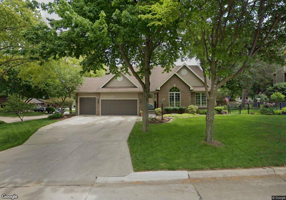
4221 Melanie Dr Urbandale, IA 50322
Estimated Value: $365,000 - $436,000
3
Beds
3
Baths
1,747
Sq Ft
$235/Sq Ft
Est. Value
About This Home
This home is located at 4221 Melanie Dr, Urbandale, IA 50322 and is currently estimated at $409,918, approximately $234 per square foot. 4221 Melanie Dr is a home located in Polk County with nearby schools including Valerius Elementary School, Urbandale Middle School, and Urbandale High School.
Ownership History
Date
Name
Owned For
Owner Type
Purchase Details
Closed on
Oct 25, 2024
Sold by
Mcintire Stephen C and Mcintire Barbara L
Bought by
Stephen C Mcintire And Barbara L Mcintire Fam and Mcintire
Current Estimated Value
Purchase Details
Closed on
Mar 14, 1997
Sold by
Breckenridge Builders Inc and Shima Randall L
Bought by
Mcintire Stephen C and Mcintire Barbara L
Home Financials for this Owner
Home Financials are based on the most recent Mortgage that was taken out on this home.
Original Mortgage
$172,000
Interest Rate
7.95%
Mortgage Type
Construction
Purchase Details
Closed on
Dec 15, 1996
Sold by
Carey Alfred W and Carey Beverly
Bought by
Shima Randall L and Shima Rebecca A
Home Financials for this Owner
Home Financials are based on the most recent Mortgage that was taken out on this home.
Original Mortgage
$144,000
Interest Rate
7.6%
Create a Home Valuation Report for This Property
The Home Valuation Report is an in-depth analysis detailing your home's value as well as a comparison with similar homes in the area
Home Values in the Area
Average Home Value in this Area
Purchase History
| Date | Buyer | Sale Price | Title Company |
|---|---|---|---|
| Stephen C Mcintire And Barbara L Mcintire Fam | -- | None Listed On Document | |
| Mcintire Stephen C | $25,500 | -- | |
| Shima Randall L | -- | -- |
Source: Public Records
Mortgage History
| Date | Status | Borrower | Loan Amount |
|---|---|---|---|
| Previous Owner | Mcintire Stephen C | $172,000 | |
| Previous Owner | Shima Randall L | $144,000 |
Source: Public Records
Tax History Compared to Growth
Tax History
| Year | Tax Paid | Tax Assessment Tax Assessment Total Assessment is a certain percentage of the fair market value that is determined by local assessors to be the total taxable value of land and additions on the property. | Land | Improvement |
|---|---|---|---|---|
| 2025 | $7,748 | $478,700 | $77,800 | $400,900 |
| 2024 | $7,748 | $445,300 | $71,300 | $374,000 |
| 2023 | $7,448 | $445,300 | $71,300 | $374,000 |
| 2022 | $7,360 | $356,000 | $58,700 | $297,300 |
| 2021 | $7,406 | $356,000 | $58,700 | $297,300 |
| 2020 | $7,278 | $340,100 | $56,000 | $284,100 |
| 2019 | $6,962 | $340,100 | $56,000 | $284,100 |
| 2018 | $6,704 | $311,300 | $50,400 | $260,900 |
| 2017 | $6,348 | $311,300 | $50,400 | $260,900 |
| 2016 | $6,188 | $290,100 | $45,800 | $244,300 |
| 2015 | $6,188 | $290,100 | $45,800 | $244,300 |
| 2014 | $5,778 | $269,100 | $41,700 | $227,400 |
Source: Public Records
Map
Nearby Homes
- 4305 98th St
- 2 Quail Ridge
- 3 Quail Ridge
- 8 Quail Ridge
- 7 Quail Ridge
- 4 Quail Ridge
- 5 Quail Ridge
- 1 Quail Ridge
- 6 Quail Ridge
- 4130 98th St
- 4016 Patricia Dr
- 4120 100th St Unit 1
- 4327 101st St
- 4140 100th St Unit 5
- 4130 100th St Unit 9
- 3913 Horton Trail
- 3916 Greenview Dr
- 4500 100th St
- 9107 Tanglewood Dr
- 3957 92nd Dr
- 9604 Aurora Ave
- 4217 Melanie Dr
- 4220 Melanie Dr
- 9600 Aurora Ave
- 4213 Melanie Dr
- 4216 Melanie Dr
- 9605 Aurora Ave
- 9609 Aurora Ave
- 9601 Aurora Ave
- 4212 95th Cir
- 9512 Aurora Ave
- 9613 Aurora Ave
- 9700 Aurora Ave
- 4212 Melanie Dr
- 4209 Melanie Dr
- 9701 Aurora Ave
- 4216 95th Cir
- 9508 Aurora Ave
- 9513 Aurora Ave
- 4208 Melanie Dr