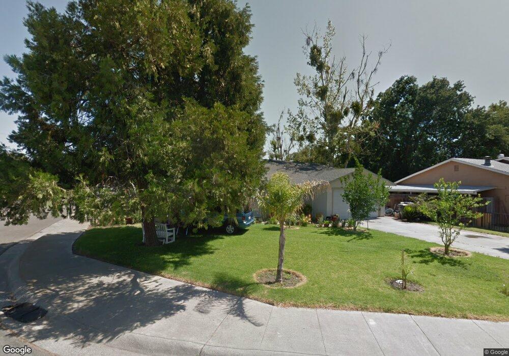
42214 Daniel St Knights Landing, CA 95645
Estimated Value: $242,000 - $387,000
3
Beds
1
Bath
1,092
Sq Ft
$305/Sq Ft
Est. Value
About This Home
This home is located at 42214 Daniel St, Knights Landing, CA 95645 and is currently estimated at $333,582, approximately $305 per square foot. 42214 Daniel St is a home located in Yolo County with nearby schools including Lee Middle School, Woodland Senior High School, and Science & Technology Academy At Knights Landing.
Ownership History
Date
Name
Owned For
Owner Type
Purchase Details
Closed on
Feb 27, 2023
Sold by
Prado Jose
Bought by
Quezada Josefina Prado
Current Estimated Value
Purchase Details
Closed on
Mar 5, 2019
Sold by
Prado Jose and Quezada Josefina Prado
Bought by
Prado Jose and Quezada Josefina Prado
Purchase Details
Closed on
Jun 9, 2010
Sold by
Secretary Of Housing & Urban Development
Bought by
Prado Jose
Purchase Details
Closed on
May 6, 2009
Sold by
Us Bank Na
Bought by
Secretary Of Housing & Urban Development
Purchase Details
Closed on
Sep 27, 2006
Sold by
Dolores Jose L and Luna Gloria
Bought by
Galaz Enrique and Galaz Sylvia
Home Financials for this Owner
Home Financials are based on the most recent Mortgage that was taken out on this home.
Original Mortgage
$9,540
Interest Rate
6.44%
Mortgage Type
Unknown
Create a Home Valuation Report for This Property
The Home Valuation Report is an in-depth analysis detailing your home's value as well as a comparison with similar homes in the area
Purchase History
| Date | Buyer | Sale Price | Title Company |
|---|---|---|---|
| Quezada Josefina Prado | -- | -- | |
| Prado Jose | -- | None Available | |
| Prado Jose | $86,000 | Fidelity National Title Co | |
| Secretary Of Housing & Urban Development | -- | None Available | |
| Us Bank Na | $339,843 | None Available | |
| Galaz Enrique | -- | Financial Title Company |
Source: Public Records
Mortgage History
| Date | Status | Borrower | Loan Amount |
|---|---|---|---|
| Previous Owner | Galaz Enrique | $9,540 | |
| Previous Owner | Galaz Enrique | $313,086 |
Source: Public Records
Tax History
| Year | Tax Paid | Tax Assessment Tax Assessment Total Assessment is a certain percentage of the fair market value that is determined by local assessors to be the total taxable value of land and additions on the property. | Land | Improvement |
|---|---|---|---|---|
| 2025 | $3,164 | $289,894 | $69,608 | $220,286 |
| 2023 | $3,164 | $179,328 | $47,514 | $131,814 |
| 2022 | $1,894 | $175,813 | $46,583 | $129,230 |
| 2021 | $1,864 | $172,367 | $45,670 | $126,697 |
| 2020 | $1,820 | $170,600 | $45,202 | $125,398 |
| 2019 | $1,090 | $99,216 | $34,710 | $64,506 |
| 2018 | $1,079 | $97,272 | $34,030 | $63,242 |
| 2017 | $1,057 | $95,365 | $33,363 | $62,002 |
| 2016 | $1,039 | $93,496 | $32,709 | $60,787 |
| 2015 | $1,006 | $92,092 | $32,218 | $59,874 |
| 2014 | $1,006 | $90,289 | $31,587 | $58,702 |
Source: Public Records
Map
Nearby Homes
- 9888 S Oak Grove Ave
- 42009 Bessie Dyer Ct
- 18598 California 113
- 4729 Santa Rosa Ave
- 0 County Road 18
- 0 W Catlett Rd Unit 18229377
- 16779 County Road 99
- 1000 Kentucky Ave
- 10113 Garden Hwy
- 1007 Woodland Ave
- 116 Sutter St
- 22 Jackson St
- 135 4th St
- 12 Bliss Ave
- 46 Maryland Ave
- 912 Grafton St
- 1 Locust St
- 1 Walnut St
- 118 5th St
- 116 2nd St
- 42228 Daniel St
- 9895 Locust St
- 42242 Daniel St
- 9887 Locust St
- 42219 Daniel St
- 9928 Hershey St
- 9914 Hershey St
- 42254 Daniel St
- 42231 Daniel St
- 9873 Locust St
- 9892 Hershey St
- 9880 Hershey St
- 42243 Daniel St
- 9861 Locust St
- 9868 Hershey St
- 9919 Hershey St
- 9933 Hershey St
- 42255 Daniel St
- 9947 Hershey St
- 9847 Locust St
Your Personal Tour Guide
Ask me questions while you tour the home.