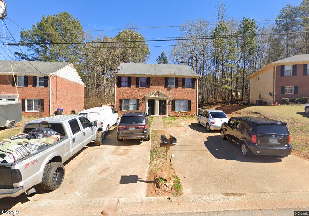
4223 Sturgeon Cir Buford, GA 30518
Estimated Value: $365,000 - $496,165
4
Beds
6
Baths
2,450
Sq Ft
$165/Sq Ft
Est. Value
About This Home
This home is located at 4223 Sturgeon Cir, Buford, GA 30518 and is currently estimated at $405,041, approximately $165 per square foot. 4223 Sturgeon Cir is a home located in Gwinnett County with nearby schools including Buford Elementary School, Buford Senior Academy, and Buford Academy.
Ownership History
Date
Name
Owned For
Owner Type
Purchase Details
Closed on
Aug 27, 2020
Sold by
Bennett Keith
Bought by
Freeport Title & Guaranty Inc Trustee and 4223 4225 Sturgeon Circle Land Trust
Current Estimated Value
Purchase Details
Closed on
Oct 30, 2002
Sold by
Bennett Keith
Bought by
Bennett Keith and Bennett Kari J
Purchase Details
Closed on
Dec 20, 2000
Sold by
Jb Realty Invst Inc
Bought by
Bennett Keith and Bennett Kari J
Home Financials for this Owner
Home Financials are based on the most recent Mortgage that was taken out on this home.
Original Mortgage
$10,620
Interest Rate
7.72%
Mortgage Type
New Conventional
Purchase Details
Closed on
Apr 13, 1999
Sold by
Gowen Walter B
Bought by
Melnicoff James B and Melnicoff Beatri
Home Financials for this Owner
Home Financials are based on the most recent Mortgage that was taken out on this home.
Original Mortgage
$75,600
Interest Rate
7.08%
Mortgage Type
New Conventional
Create a Home Valuation Report for This Property
The Home Valuation Report is an in-depth analysis detailing your home's value as well as a comparison with similar homes in the area
Home Values in the Area
Average Home Value in this Area
Purchase History
| Date | Buyer | Sale Price | Title Company |
|---|---|---|---|
| Freeport Title & Guaranty Inc Trustee | -- | -- | |
| Bennett Keith | -- | -- | |
| Bennett Keith | -- | -- | |
| Melnicoff James B | $84,000 | -- |
Source: Public Records
Mortgage History
| Date | Status | Borrower | Loan Amount |
|---|---|---|---|
| Previous Owner | Bennett Keith | $10,620 | |
| Previous Owner | Melnicoff James B | $75,600 |
Source: Public Records
Tax History Compared to Growth
Tax History
| Year | Tax Paid | Tax Assessment Tax Assessment Total Assessment is a certain percentage of the fair market value that is determined by local assessors to be the total taxable value of land and additions on the property. | Land | Improvement |
|---|---|---|---|---|
| 2025 | $2,254 | $157,040 | $32,400 | $124,640 |
| 2024 | $2,315 | $161,320 | $32,400 | $128,920 |
| 2023 | $2,315 | $109,800 | $21,600 | $88,200 |
| 2022 | $1,955 | $136,240 | $18,000 | $118,240 |
| 2021 | $1,099 | $76,600 | $12,000 | $64,600 |
| 2020 | $1,099 | $76,600 | $12,000 | $64,600 |
| 2019 | $891 | $68,720 | $12,000 | $56,720 |
| 2018 | $850 | $65,600 | $12,000 | $53,600 |
| 2016 | $622 | $48,560 | $8,000 | $40,560 |
| 2015 | $573 | $43,160 | $6,600 | $36,560 |
| 2014 | -- | $43,160 | $6,600 | $36,560 |
Source: Public Records
Map
Nearby Homes
- 103 Maddox Rd
- 0 French Blvd
- 4506 Magnolia Club Cir
- 1669 Centerville Dr
- 190 Maddox Rd
- 1402 Frontier Dr
- 1182 Edwin Ln
- 4895 Sterling Close
- 4173 Chatham Ridge Dr
- 4316 Woodland Bank Blvd
- 4831 Miller Hill Rd
- 1264 Brynhill Ct
- 4245 Woodland Bank Blvd
- 4264 Buford Valley Way
- 742 Kimball Ln
- 2267 Pink Hawthorn Dr
- 1135 W Roberts Dr
- 3735 Fir Dr
- 1717 Castleberry Ln
- 27 Morgan St
- 4233 Sturgeon Cir
- 4213 Sturgeon Cir
- 4243 Sturgeon Cir
- 4203 Sturgeon Cir
- 4226 Dejohns Way
- 4236 Dejohns Way
- 1717 Sturgeon Rd
- 1727 Sturgeon Rd
- 1727 Sturgeon Rd
- 1725 Sturgeon Rd
- 4222 Sturgeon Cir
- 4253 Sturgeon Cir
- 4193 Sturgeon Cir
- 4216 Dejohns Way
- 4246 Dejohns Way
- 4212 Sturgeon Cir
- 4232 Sturgeon Cir
- 4242 Sturgeon Cir
- 4256 Dejohns Way
- 0 Dejohns Way Unit 7141968