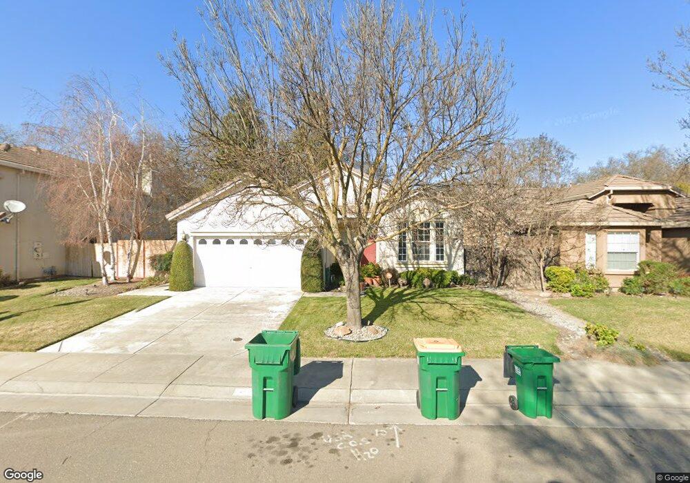
4224 Black Butte Cir Stockton, CA 95209
Spanos Park NeighborhoodEstimated Value: $305,000 - $491,000
3
Beds
2
Baths
1,541
Sq Ft
$286/Sq Ft
Est. Value
About This Home
This home is located at 4224 Black Butte Cir, Stockton, CA 95209 and is currently estimated at $440,441, approximately $285 per square foot. 4224 Black Butte Cir is a home located in San Joaquin County with nearby schools including Julia Morgan Elementary School, Christa McAuliffe Middle School, and Bear Creek High School.
Ownership History
Date
Name
Owned For
Owner Type
Purchase Details
Closed on
Dec 11, 2006
Sold by
Reddin Alan W
Bought by
Reddin Alan and Alan Reddin Revocable Trust
Current Estimated Value
Purchase Details
Closed on
Jun 4, 2002
Sold by
Padilla Tabias and Padilla Jennifer
Bought by
Reddin Alan W
Home Financials for this Owner
Home Financials are based on the most recent Mortgage that was taken out on this home.
Original Mortgage
$150,000
Outstanding Balance
$63,109
Interest Rate
6.74%
Estimated Equity
$377,332
Purchase Details
Closed on
Jan 21, 2000
Sold by
Kimball Hill Homes California Inc
Bought by
Padilla Tabias and Padilla Jennifer
Home Financials for this Owner
Home Financials are based on the most recent Mortgage that was taken out on this home.
Original Mortgage
$145,190
Interest Rate
7.87%
Mortgage Type
FHA
Create a Home Valuation Report for This Property
The Home Valuation Report is an in-depth analysis detailing your home's value as well as a comparison with similar homes in the area
Home Values in the Area
Average Home Value in this Area
Purchase History
| Date | Buyer | Sale Price | Title Company |
|---|---|---|---|
| Reddin Alan | -- | None Available | |
| Reddin Alan W | $225,000 | Chicago Title Co | |
| Padilla Tabias | $147,000 | Central Valley Title Company |
Source: Public Records
Mortgage History
| Date | Status | Borrower | Loan Amount |
|---|---|---|---|
| Open | Reddin Alan W | $150,000 | |
| Previous Owner | Padilla Tabias | $145,190 |
Source: Public Records
Tax History Compared to Growth
Tax History
| Year | Tax Paid | Tax Assessment Tax Assessment Total Assessment is a certain percentage of the fair market value that is determined by local assessors to be the total taxable value of land and additions on the property. | Land | Improvement |
|---|---|---|---|---|
| 2025 | $3,654 | $332,370 | $98,970 | $233,400 |
| 2024 | $3,586 | $325,854 | $97,030 | $228,824 |
| 2023 | $3,544 | $319,466 | $95,128 | $224,338 |
| 2022 | $3,463 | $313,203 | $93,263 | $219,940 |
| 2021 | $3,542 | $307,063 | $91,435 | $215,628 |
| 2020 | $3,457 | $303,915 | $90,498 | $213,417 |
| 2019 | $3,375 | $297,957 | $88,724 | $209,233 |
| 2018 | $3,314 | $292,116 | $86,985 | $205,131 |
| 2017 | $3,234 | $286,389 | $85,280 | $201,109 |
| 2016 | $3,045 | $280,776 | $83,609 | $197,167 |
| 2014 | $2,781 | $210,000 | $63,000 | $147,000 |
Source: Public Records
Map
Nearby Homes
- 4070 Black Butte Cir
- 3462 Sitka Ct
- 9879 Twin Creeks Ave
- 10254 Noyo Ln
- 3920 Vancouver Cir
- 5306 Britton Ave
- 10809 Fire Island Cir
- 9829 Twin Creeks Ave
- 10009 Copco Ln
- 3510 Iron Canyon Cir
- 3520 Grandi Cir
- 10037 Mount Hood Dr
- 5354 Navarro Place
- 10601 Pleasant Valley Cir
- 10816 Pleasant Valley Cir
- 5409 Pasadena Dr
- 4331 Starfish Ct
- 10762 Pleasant Valley Cir
- 10849 Iris Bloom Dr
- 3318 Estate Dr
- 4230 Black Butte Cir
- 4218 Black Butte Cir
- 4236 Black Butte Cir
- 4212 Black Butte Cir Unit 17
- 4227 Black Butte Cir Unit 17
- 4231 Black Butte Cir
- 4215 Black Butte Cir
- 4237 Black Butte Cir
- 4206 Black Butte Cir
- 4243 Black Butte Cir
- 4248 Black Butte Cir
- 4245 Raptor Dr
- 4261 Raptor Dr
- 4196 Black Butte Cir
- 4259 Black Butte Cir
- 4188 Black Butte Cir
- 4233 Raptor Dr
- 4182 Black Butte Cir
- 4254 Black Butte Cir Unit 17