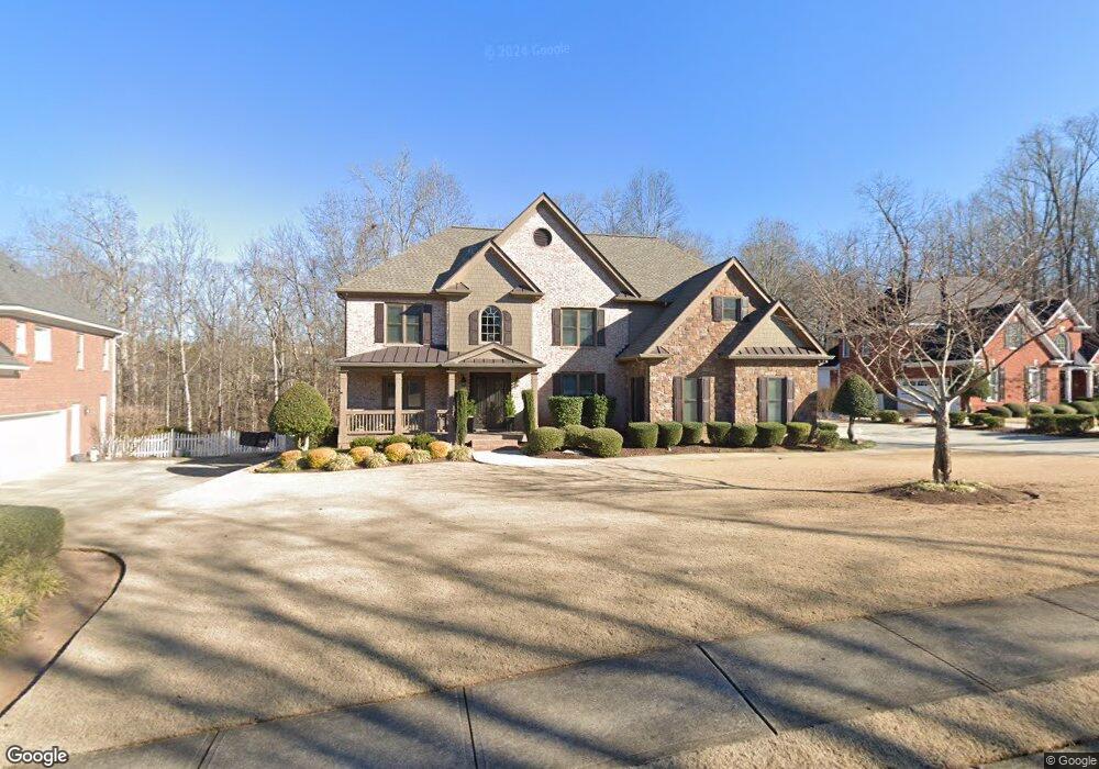
4225 Woodward Way Unit X Cumming, GA 30041
Estimated Value: $887,520 - $1,031,000
5
Beds
4
Baths
3,575
Sq Ft
$268/Sq Ft
Est. Value
About This Home
This home is located at 4225 Woodward Way Unit X, Cumming, GA 30041 and is currently estimated at $957,130, approximately $267 per square foot. 4225 Woodward Way Unit X is a home located in Forsyth County with nearby schools including Sharon Elementary School, South Forsyth Middle School, and South Forsyth High School.
Ownership History
Date
Name
Owned For
Owner Type
Purchase Details
Closed on
Aug 9, 2002
Sold by
Mays Charles L
Bought by
Mays Charles L and Mays Lorna
Current Estimated Value
Home Financials for this Owner
Home Financials are based on the most recent Mortgage that was taken out on this home.
Original Mortgage
$300,000
Interest Rate
6.01%
Mortgage Type
New Conventional
Purchase Details
Closed on
Mar 30, 2001
Sold by
Jim Hogan Homes Inc
Bought by
Mays Charles L and Mays Lorna
Home Financials for this Owner
Home Financials are based on the most recent Mortgage that was taken out on this home.
Original Mortgage
$261,700
Interest Rate
7.01%
Mortgage Type
New Conventional
Create a Home Valuation Report for This Property
The Home Valuation Report is an in-depth analysis detailing your home's value as well as a comparison with similar homes in the area
Home Values in the Area
Average Home Value in this Area
Purchase History
| Date | Buyer | Sale Price | Title Company |
|---|---|---|---|
| Mays Charles L | -- | -- | |
| Mays Charles L | $393,700 | -- |
Source: Public Records
Mortgage History
| Date | Status | Borrower | Loan Amount |
|---|---|---|---|
| Closed | Mays Charles L | $300,000 | |
| Previous Owner | Mays Charles L | $261,700 |
Source: Public Records
Tax History Compared to Growth
Tax History
| Year | Tax Paid | Tax Assessment Tax Assessment Total Assessment is a certain percentage of the fair market value that is determined by local assessors to be the total taxable value of land and additions on the property. | Land | Improvement |
|---|---|---|---|---|
| 2025 | $1,241 | $357,796 | $72,000 | $285,796 |
| 2024 | $1,241 | $359,876 | $68,000 | $291,876 |
| 2023 | $1,169 | $340,396 | $62,000 | $278,396 |
| 2022 | $1,222 | $220,720 | $40,000 | $180,720 |
| 2021 | $1,184 | $220,720 | $40,000 | $180,720 |
| 2020 | $1,174 | $210,656 | $40,000 | $170,656 |
| 2019 | $1,181 | $209,392 | $40,000 | $169,392 |
| 2018 | $1,199 | $204,452 | $32,000 | $172,452 |
| 2017 | $1,216 | $202,180 | $32,000 | $170,180 |
| 2016 | $1,199 | $190,140 | $28,000 | $162,140 |
| 2015 | $1,199 | $190,140 | $28,000 | $162,140 |
| 2014 | $4,384 | $175,916 | $28,000 | $147,916 |
Source: Public Records
Map
Nearby Homes
- 4050 Homestead Ridge Dr
- 4345 Mantle Ridge Dr
- 940 Ambleside Dr
- 3275 Cherry Oak Ln Unit 11
- 740 Mayfair Ct
- 245 Mayfair Ct
- 255 Mayfair Ct
- 1580 Bramble Bush Way
- 7065 Laurel Oak Dr
- 1565 Bramble Bush Way
- 3345 Cherry Oak Ln
- 1750 Cone Flower Way
- 4805 Shelbourne Dr
- 3440 Canyon Oak Way
- 2715 Ivey Crossing Trail
- 355 Laurel Oak Dr
- 510 Hammersmith Dr
- 1310 Settles Rd
- 2405 Bleckley Place
- 451 Nichols Dr
- 4215 Woodward Way
- 4235 Woodward Way Unit X
- 4205 Woodward Way
- 4245 Woodward Way
- 4220 Woodward Way Unit X
- 4230 Woodward Way
- 4215 Old Oak Trace
- 4255 Woodward Way Unit X
- 4210 Woodward Way
- 4225 Old Oak Trace
- 4265 Woodward Way
- 4205 Old Oak Trace
- 4220 Homestead Ridge Dr
- 4280 Woodward Way
- 4235 Old Oak Trace
- 4205 Homestead Ridge Dr
- 4275 Woodward Way
- 4170 Homestead Ridge Dr
- 4175 Homestead Ridge Dr
- 4245 Old Oak Trace