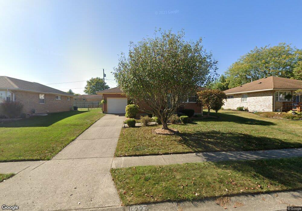
4227 Imperial Dr Springfield, OH 45503
Estimated Value: $190,267 - $230,000
2
Beds
2
Baths
1,075
Sq Ft
$199/Sq Ft
Est. Value
About This Home
This home is located at 4227 Imperial Dr, Springfield, OH 45503 and is currently estimated at $213,567, approximately $198 per square foot. 4227 Imperial Dr is a home located in Clark County with nearby schools including Northridge Elementary School, Kenton Ridge Middle & High School, and Emmanuel Christian Academy.
Ownership History
Date
Name
Owned For
Owner Type
Purchase Details
Closed on
Jun 10, 1996
Sold by
Ault Gerald T
Bought by
Blain William E and Blain Mary
Current Estimated Value
Home Financials for this Owner
Home Financials are based on the most recent Mortgage that was taken out on this home.
Original Mortgage
$90,250
Outstanding Balance
$3,872
Interest Rate
7.97%
Mortgage Type
VA
Estimated Equity
$209,695
Purchase Details
Closed on
Aug 19, 1992
Create a Home Valuation Report for This Property
The Home Valuation Report is an in-depth analysis detailing your home's value as well as a comparison with similar homes in the area
Home Values in the Area
Average Home Value in this Area
Purchase History
| Date | Buyer | Sale Price | Title Company |
|---|---|---|---|
| Blain William E | $88,500 | -- | |
| -- | $62,500 | -- |
Source: Public Records
Mortgage History
| Date | Status | Borrower | Loan Amount |
|---|---|---|---|
| Open | Blain William E | $90,250 |
Source: Public Records
Tax History
| Year | Tax Paid | Tax Assessment Tax Assessment Total Assessment is a certain percentage of the fair market value that is determined by local assessors to be the total taxable value of land and additions on the property. | Land | Improvement |
|---|---|---|---|---|
| 2025 | $1,668 | $68,900 | $17,140 | $51,760 |
| 2024 | $1,640 | $47,950 | $9,980 | $37,970 |
| 2023 | $1,640 | $47,950 | $9,980 | $37,970 |
| 2022 | $1,664 | $47,950 | $9,980 | $37,970 |
| 2021 | $1,632 | $41,310 | $7,390 | $33,920 |
| 2020 | $1,633 | $41,310 | $7,390 | $33,920 |
| 2019 | $1,664 | $41,310 | $7,390 | $33,920 |
| 2018 | $1,836 | $43,090 | $9,420 | $33,670 |
| 2017 | $1,575 | $35,907 | $9,422 | $26,485 |
| 2016 | $1,564 | $35,907 | $9,422 | $26,485 |
| 2015 | $1,377 | $35,543 | $9,058 | $26,485 |
| 2014 | $1,376 | $35,543 | $9,058 | $26,485 |
| 2013 | $1,344 | $35,543 | $9,058 | $26,485 |
Source: Public Records
Map
Nearby Homes
- 4343 Burchill St
- 4446 Ridgewood Rd E Unit 3
- 1033 Westmont Cir
- 4741 Cullen Ave
- 1162 Kingsgate Rd
- 1201 Kingsgate Rd
- 4652 Reno Ln Unit 15
- 862 Brendle Trace Unit 20
- 1327 Kingsgate Rd
- 1500 Kingsgate Rd
- 1502 Kingsgate Rd
- 1500 Kingsgate Rd Unit 19430
- 1502 Kingsgate Rd Unit 19432
- 1509 Kingsgate Rd
- 3631 Kingsgate Ln
- 1503 Kingsgate Rd
- 1505 Kingsgate Rd
- 1709 Thomas Dr
- 1507 Kingsgate Rd
- 593 Hiser Ave
- 4223 Imperial Dr
- 4231 Imperial Dr
- 4240 Anoka St
- 4219 Imperial Dr
- 4235 Imperial Dr
- 4234 Anoka St
- 4248 Anoka St
- 4226 Imperial Dr
- 4226 Anoka St
- 4256 Anoka St
- 4230 Imperial Dr
- 4222 Imperial Dr
- 4215 Imperial Dr
- 4255 Imperial Dr
- 4234 Imperial Dr
- 4218 Imperial Dr
- 4218 Anoka St
- 4263 Imperial Dr
- 4238 Imperial Dr
- 4211 Imperial Dr