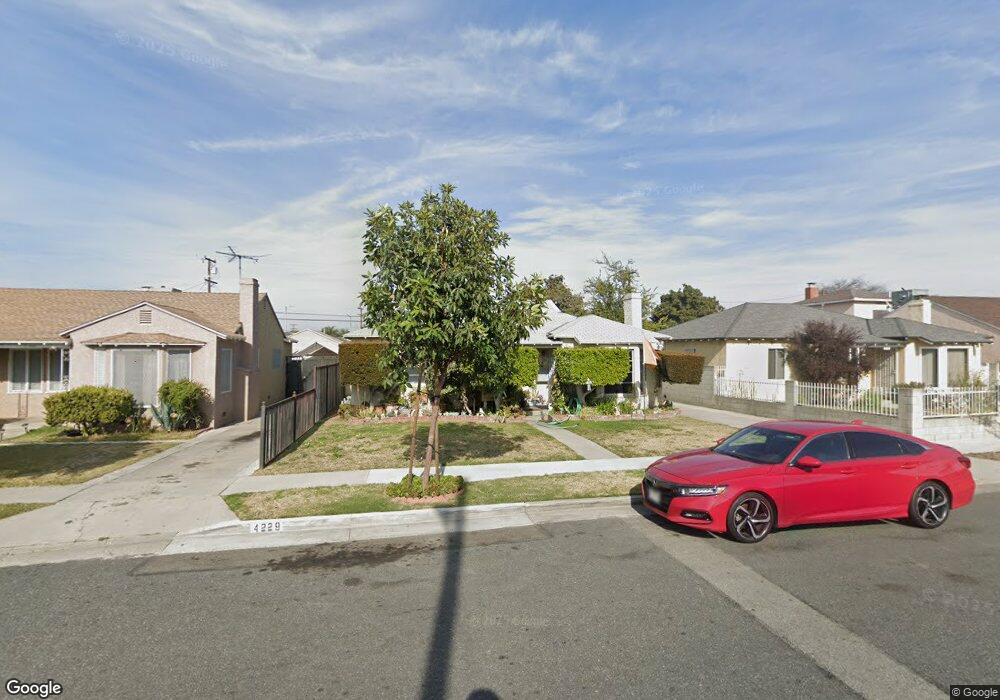
4229 Platt Ave Lynwood, CA 90262
Estimated Value: $860,602 - $1,044,000
7
Beds
4
Baths
2,981
Sq Ft
$311/Sq Ft
Est. Value
About This Home
This home is located at 4229 Platt Ave, Lynwood, CA 90262 and is currently estimated at $926,651, approximately $310 per square foot. 4229 Platt Ave is a home located in Los Angeles County with nearby schools including Washington Elementary School, Hosler Middle School, and Lynwood High School.
Ownership History
Date
Name
Owned For
Owner Type
Purchase Details
Closed on
May 11, 2020
Sold by
Cornelious Dion A
Bought by
Cornelious Dion and Cornelious Lourdes
Current Estimated Value
Purchase Details
Closed on
Aug 25, 1997
Sold by
Cornelious Lourdes
Bought by
Cornelious Dion A
Home Financials for this Owner
Home Financials are based on the most recent Mortgage that was taken out on this home.
Original Mortgage
$105,000
Outstanding Balance
$11,020
Interest Rate
3.95%
Estimated Equity
$915,631
Purchase Details
Closed on
Aug 12, 1997
Sold by
Hardy Mozella and Johnson Jesse
Bought by
Cornelious Dion A
Home Financials for this Owner
Home Financials are based on the most recent Mortgage that was taken out on this home.
Original Mortgage
$105,000
Outstanding Balance
$11,020
Interest Rate
3.95%
Estimated Equity
$915,631
Create a Home Valuation Report for This Property
The Home Valuation Report is an in-depth analysis detailing your home's value as well as a comparison with similar homes in the area
Home Values in the Area
Average Home Value in this Area
Purchase History
| Date | Buyer | Sale Price | Title Company |
|---|---|---|---|
| Cornelious Dion | -- | None Available | |
| Cornelious Dion A | -- | -- | |
| Cornelious Dion A | -- | American Title Ins Co |
Source: Public Records
Mortgage History
| Date | Status | Borrower | Loan Amount |
|---|---|---|---|
| Open | Cornelious Dion A | $105,000 |
Source: Public Records
Tax History Compared to Growth
Tax History
| Year | Tax Paid | Tax Assessment Tax Assessment Total Assessment is a certain percentage of the fair market value that is determined by local assessors to be the total taxable value of land and additions on the property. | Land | Improvement |
|---|---|---|---|---|
| 2025 | $6,352 | $425,019 | $103,428 | $321,591 |
| 2024 | $6,352 | $416,686 | $101,400 | $315,286 |
| 2023 | $6,307 | $408,516 | $99,412 | $309,104 |
| 2022 | $6,087 | $400,507 | $97,463 | $303,044 |
| 2021 | $5,860 | $392,654 | $95,552 | $297,102 |
| 2020 | $5,629 | $388,629 | $94,573 | $294,056 |
| 2019 | $5,995 | $381,010 | $92,719 | $288,291 |
| 2018 | $5,496 | $373,540 | $90,901 | $282,639 |
| 2016 | $5,113 | $359,037 | $87,372 | $271,665 |
| 2015 | $5,013 | $353,645 | $86,060 | $267,585 |
| 2014 | $4,905 | $346,719 | $84,375 | $262,344 |
Source: Public Records
Map
Nearby Homes
- 4296 Platt Ave
- 4245 Lugo Ave
- 4296 Walnut Ave
- 4000 Platt Ave
- 11309 Annetta Ave
- 11267 Sampson Ave
- 4032 Le Sage St
- 11515 Virginia Ave
- 3886 Cortland St
- 3831 Walnut Ave
- 11230 Louise Ave
- 4173 Agnes Ave
- 3805 Lugo Ave
- 5300 Cortland St Unit 40
- 5300 Cortland St Unit 27
- 10933 Sampson Ave
- 12029 2nd Ave
- 3955 Agnes Ave
- 4276 Lavinia Ave
- 10891 Standard Ave
- 4225 Platt Ave
- 4235 Platt Ave
- 4224 Mlk jr Blvd
- 4219 Platt Ave
- 4241 Platt Ave
- 4220 Mlk jr Blvd
- 4215 Platt Ave
- 4245 Platt Ave
- 4212 Mlk jr Blvd Unit A
- 4230 Platt Ave
- 4209 Platt Ave
- 4226 Platt Ave
- 4247 Platt Ave
- 4208 Mlk jr Blvd
- 4236 Platt Ave
- 4220 Platt Ave
- 4242 Platt Ave
- 4216 Platt Ave
- 4204 Mlk jr Blvd
- 4246 Platt Ave