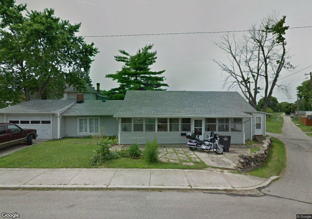
423 N Poplar St Dayton, OH 45449
Estimated Value: $123,000 - $147,195
2
Beds
1
Bath
1,160
Sq Ft
$116/Sq Ft
Est. Value
About This Home
This home is located at 423 N Poplar St, Dayton, OH 45449 and is currently estimated at $135,049, approximately $116 per square foot. 423 N Poplar St is a home located in Montgomery County with nearby schools including West Carrollton High School, Miami Valley Academies, and Bethel Baptist School.
Ownership History
Date
Name
Owned For
Owner Type
Purchase Details
Closed on
Jan 25, 2019
Sold by
Harris Graham T
Bought by
Harris Cheryl R
Current Estimated Value
Purchase Details
Closed on
Jul 30, 2013
Sold by
Kilroy Michael and Kilroy Vickie
Bought by
Harris Cheryl R and Harris Graham T
Purchase Details
Closed on
Jun 16, 2004
Sold by
Pledged Property Ii Llc
Bought by
Kilroy Michael and Kilroy Vickie
Purchase Details
Closed on
Sep 10, 2003
Sold by
Harville Melvin W
Bought by
Pledged Properties Llc
Create a Home Valuation Report for This Property
The Home Valuation Report is an in-depth analysis detailing your home's value as well as a comparison with similar homes in the area
Home Values in the Area
Average Home Value in this Area
Purchase History
| Date | Buyer | Sale Price | Title Company |
|---|---|---|---|
| Harris Cheryl R | -- | None Available | |
| Harris Cheryl R | $28,000 | None Available | |
| Kilroy Michael | $46,000 | Magee Title Agency Llc | |
| Pledged Properties Llc | $55,000 | -- |
Source: Public Records
Tax History Compared to Growth
Tax History
| Year | Tax Paid | Tax Assessment Tax Assessment Total Assessment is a certain percentage of the fair market value that is determined by local assessors to be the total taxable value of land and additions on the property. | Land | Improvement |
|---|---|---|---|---|
| 2024 | $2,472 | $36,300 | $5,750 | $30,550 |
| 2023 | $2,472 | $36,300 | $5,750 | $30,550 |
| 2022 | $2,250 | $25,590 | $4,050 | $21,540 |
| 2021 | $2,255 | $25,590 | $4,050 | $21,540 |
| 2020 | $2,256 | $25,590 | $4,050 | $21,540 |
| 2019 | $2,078 | $21,500 | $3,680 | $17,820 |
| 2018 | $1,964 | $21,500 | $3,680 | $17,820 |
| 2017 | $1,823 | $21,500 | $3,680 | $17,820 |
| 2016 | $1,822 | $20,970 | $3,680 | $17,290 |
| 2015 | $1,684 | $20,970 | $3,680 | $17,290 |
| 2014 | $1,684 | $20,970 | $3,680 | $17,290 |
| 2012 | -- | $19,440 | $4,890 | $14,550 |
Source: Public Records
Map
Nearby Homes
- 209 E Cottage Ave
- 133 E Pease Ave
- 333 E Cottage Ave
- 428 Burns Ave
- 109 Cedar St
- 12 E Main St
- 322 E Main St
- 137 E Central Ave
- 428 E Cottage Ave
- 305 E Central Ave
- 341 E Central Ave
- 426 Catherine Ave
- 133 E Circle Dr
- 201 S Smith St
- 2 Savoy Ave
- 509 Windsor Ave
- 26 Southard Ln
- 3716 Clearview Ave
- 949 Primrose Dr
- 758 Cransberry Dr
- 135 Rusby Ave
- 129 Rusby Ave
- 425 N Poplar St
- 125 Rusby Ave
- 204 E Shannon Ave
- 123 Rusby Ave
- 350 N Poplar St
- 138 E Shannon Ave
- 210 E Shannon Ave
- 146 E Shannon Ave
- 134 Rusby Ave
- 134 E Shannon Ave
- 128 Rusby Ave
- 216 E Shannon Ave
- 344 N Poplar St
- 130 E Shannon Ave
- 124 Rusby Ave
- 120 Rusby Ave
- 338 N Poplar St
- 222 E Shannon Ave