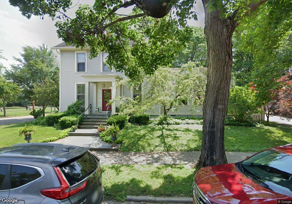
423 Poplar Ave Cincinnati, OH 45215
Estimated Value: $479,000 - $559,000
3
Beds
2
Baths
2,579
Sq Ft
$207/Sq Ft
Est. Value
About This Home
This home is located at 423 Poplar Ave, Cincinnati, OH 45215 and is currently estimated at $534,452, approximately $207 per square foot. 423 Poplar Ave is a home located in Hamilton County with nearby schools including Wyoming High School.
Ownership History
Date
Name
Owned For
Owner Type
Purchase Details
Closed on
Jun 20, 2002
Sold by
Christian William L and Christian Amy M
Bought by
Kite Geoffrey C and Miller Beth
Current Estimated Value
Home Financials for this Owner
Home Financials are based on the most recent Mortgage that was taken out on this home.
Original Mortgage
$185,300
Interest Rate
6.93%
Create a Home Valuation Report for This Property
The Home Valuation Report is an in-depth analysis detailing your home's value as well as a comparison with similar homes in the area
Home Values in the Area
Average Home Value in this Area
Purchase History
| Date | Buyer | Sale Price | Title Company |
|---|---|---|---|
| Kite Geoffrey C | $218,000 | -- |
Source: Public Records
Mortgage History
| Date | Status | Borrower | Loan Amount |
|---|---|---|---|
| Previous Owner | Kite Geoffrey C | $185,300 |
Source: Public Records
Tax History Compared to Growth
Tax History
| Year | Tax Paid | Tax Assessment Tax Assessment Total Assessment is a certain percentage of the fair market value that is determined by local assessors to be the total taxable value of land and additions on the property. | Land | Improvement |
|---|---|---|---|---|
| 2024 | $8,275 | $139,111 | $30,919 | $108,192 |
| 2023 | $7,627 | $139,111 | $30,919 | $108,192 |
| 2022 | $6,634 | $97,846 | $31,549 | $66,297 |
| 2021 | $6,468 | $97,846 | $31,549 | $66,297 |
| 2020 | $6,612 | $97,846 | $31,549 | $66,297 |
| 2019 | $6,686 | $91,445 | $29,484 | $61,961 |
| 2018 | $6,689 | $91,445 | $29,484 | $61,961 |
| 2017 | $6,407 | $91,445 | $29,484 | $61,961 |
| 2016 | $5,627 | $92,695 | $31,252 | $61,443 |
| 2015 | $5,689 | $92,695 | $31,252 | $61,443 |
| 2014 | $5,703 | $92,695 | $31,252 | $61,443 |
| 2013 | $5,368 | $83,507 | $28,154 | $55,353 |
Source: Public Records
Map
Nearby Homes
- 715 Worthington Ave
- 127 Locust St
- 214 Harriet St
- 452 W Wyoming Ave
- 412 N Wayne Ave
- 740 Springfield Pike
- 218 Lock St
- 217 W Wyoming Ave
- 20 Sherry Rd
- 405 Mcewing Dr
- 81 Hillsdale Ave
- 8442 Anthony Wayne Ave
- 8421 Wiswell St
- 334 Williams St
- 8410 Curzon Ave
- 410 Rolef Ave
- 320 Reily Rd
- 310 Westview Ave
- 964 Shepherd Ln
- 230 Carthage Ave
- 422 Worthington Ave
- 418 Worthington Ave
- 415 Poplar Ave
- 412 Worthington Ave
- 410 Poplar Ave
- 416 Grove Ave
- 408 Grove Ave
- 338 Crescent Ave
- 418 Grove Ave
- 404 Grove Ave
- 417 Worthington Ave
- 422 Grove Ave
- 505 Wyoming Ave
- 336 Crescent Ave
- 415 Worthington Ave
- 340 Grove Ave
- 329 Crescent Ave
- 332 Crescent Ave
- 322 Poplar Ave
- 323 Poplar Ave