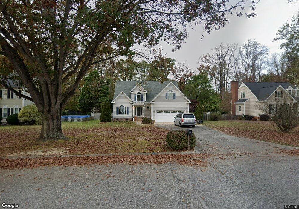
4235 Georgetown Dr N Wilson, NC 27896
Estimated Value: $254,000 - $346,000
3
Beds
3
Baths
2,628
Sq Ft
$117/Sq Ft
Est. Value
About This Home
This home is located at 4235 Georgetown Dr N, Wilson, NC 27896 and is currently estimated at $308,608, approximately $117 per square foot. 4235 Georgetown Dr N is a home located in Wilson County with nearby schools including New Hope Elementary School, Elm City Middle School, and Fike High School.
Ownership History
Date
Name
Owned For
Owner Type
Purchase Details
Closed on
Aug 18, 2017
Sold by
Kelly Pearson
Bought by
Batchelor Albert
Current Estimated Value
Home Financials for this Owner
Home Financials are based on the most recent Mortgage that was taken out on this home.
Original Mortgage
$100,001
Outstanding Balance
$83,285
Interest Rate
3.89%
Estimated Equity
$225,323
Create a Home Valuation Report for This Property
The Home Valuation Report is an in-depth analysis detailing your home's value as well as a comparison with similar homes in the area
Home Values in the Area
Average Home Value in this Area
Purchase History
| Date | Buyer | Sale Price | Title Company |
|---|---|---|---|
| Batchelor Albert | -- | -- |
Source: Public Records
Mortgage History
| Date | Status | Borrower | Loan Amount |
|---|---|---|---|
| Open | Batchelor Albert | $100,001 | |
| Closed | Batchelor Albert | -- |
Source: Public Records
Tax History Compared to Growth
Tax History
| Year | Tax Paid | Tax Assessment Tax Assessment Total Assessment is a certain percentage of the fair market value that is determined by local assessors to be the total taxable value of land and additions on the property. | Land | Improvement |
|---|---|---|---|---|
| 2025 | $3,600 | $321,384 | $45,000 | $276,384 |
| 2024 | $3,600 | $321,384 | $45,000 | $276,384 |
| 2023 | $2,481 | $190,102 | $28,000 | $162,102 |
| 2022 | $2,481 | $190,102 | $28,000 | $162,102 |
| 2021 | $2,481 | $190,102 | $28,000 | $162,102 |
| 2020 | $2,481 | $190,102 | $28,000 | $162,102 |
| 2019 | $2,481 | $190,102 | $28,000 | $162,102 |
| 2018 | $2,481 | $190,102 | $28,000 | $162,102 |
| 2017 | $2,443 | $190,102 | $28,000 | $162,102 |
| 2016 | $2,443 | $190,102 | $28,000 | $162,102 |
| 2014 | $2,251 | $180,830 | $28,000 | $152,830 |
Source: Public Records
Map
Nearby Homes
- 4500 Saint Andrews Dr N
- 4502 Saint Andrews Dr N
- 4629 Dewfield Dr N
- 4702 Nash St N
- 4506 Saint Andrews Dr N
- 4400 Davis Farms Dr N
- 4707 Saint Andrews Dr N Unit B
- 4707 Saint Andrews Dr N Unit B
- 4805 Milliken Close N
- 3902 Redbay Ln
- 4710 Burning Tree Ln N
- 4800 Burning Tree Ln N
- 4804 Burning Tree Ln N
- 4511 Bobwhite Trail N
- 3645 Eagle Farm Dr N
- 4610 Pinehurst Dr N
- 4702 Tamarisk Ln
- 4702 Tamerisk Ln N
- 4106 Lexington Dr NW
- 3702 Arrowwood Dr N
- 4231 Georgetown Dr N
- 4239 Georgetown Dr N
- 4304 Sedgefield Ln N
- 4243 Georgetown Dr N
- 4227 Georgetown Dr N
- 4226 Georgetown Dr N
- 4303 Sedgefield Ln N
- 4230 Georgetown Dr N
- 4222 Georgetown Dr N
- 4234 Georgetown Dr N
- 4302 Sedgefield Ln N
- 4247 Georgetown Dr N
- 4302 Foxfire Ln N
- 4223 Georgetown Dr N
- 4218 Georgetown Dr N
- 4238 Georgetown Dr N
- 4213 Coghill Dr N
- 4217 Coghill Dr N
- 4209 Coghill Dr N
- 4251 Georgetown Dr N