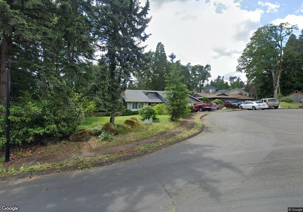
4238 Spring Rock Cir West Linn, OR 97068
Sunset NeighborhoodEstimated Value: $638,588 - $689,000
3
Beds
2
Baths
1,641
Sq Ft
$405/Sq Ft
Est. Value
About This Home
This home is located at 4238 Spring Rock Cir, West Linn, OR 97068 and is currently estimated at $664,397, approximately $404 per square foot. 4238 Spring Rock Cir is a home located in Clackamas County with nearby schools including Sunset Primary School, Rosemont Ridge Middle School, and West Linn High School.
Ownership History
Date
Name
Owned For
Owner Type
Purchase Details
Closed on
Mar 24, 2006
Sold by
Lopez Jonathan J
Bought by
Sally V Hass Revocable Trust
Current Estimated Value
Purchase Details
Closed on
Apr 7, 2005
Sold by
Perrigo Annette F
Bought by
Lopez Jonathan J
Home Financials for this Owner
Home Financials are based on the most recent Mortgage that was taken out on this home.
Original Mortgage
$130,000
Interest Rate
5.62%
Mortgage Type
Purchase Money Mortgage
Create a Home Valuation Report for This Property
The Home Valuation Report is an in-depth analysis detailing your home's value as well as a comparison with similar homes in the area
Home Values in the Area
Average Home Value in this Area
Purchase History
| Date | Buyer | Sale Price | Title Company |
|---|---|---|---|
| Sally V Hass Revocable Trust | $339,000 | Fidelity Natl Title Co Of Or | |
| Lopez Jonathan J | $225,000 | Lawyers |
Source: Public Records
Mortgage History
| Date | Status | Borrower | Loan Amount |
|---|---|---|---|
| Previous Owner | Lopez Jonathan J | $130,000 |
Source: Public Records
Tax History Compared to Growth
Tax History
| Year | Tax Paid | Tax Assessment Tax Assessment Total Assessment is a certain percentage of the fair market value that is determined by local assessors to be the total taxable value of land and additions on the property. | Land | Improvement |
|---|---|---|---|---|
| 2025 | $5,905 | $306,403 | -- | -- |
| 2024 | $5,684 | $297,479 | -- | -- |
| 2023 | $5,684 | $288,815 | $0 | $0 |
| 2022 | $5,365 | $280,403 | $0 | $0 |
| 2021 | $5,093 | $272,236 | $0 | $0 |
| 2020 | $5,127 | $264,307 | $0 | $0 |
| 2019 | $4,889 | $256,609 | $0 | $0 |
| 2018 | $4,671 | $249,135 | $0 | $0 |
| 2017 | $4,490 | $241,879 | $0 | $0 |
| 2016 | $4,374 | $234,834 | $0 | $0 |
| 2015 | $4,145 | $227,994 | $0 | $0 |
| 2014 | $3,957 | $221,353 | $0 | $0 |
Source: Public Records
Map
Nearby Homes
- 4249 Riverview Dr
- 4405 Grant St
- 4253 Sussex St
- 2525 Sunset Ave
- 4578 Norfolk St
- 3900 Edgewood Ct
- 4123 Cornwall St Unit Lot 2
- 4147 Cornwall St
- 1870 Hemlock St
- 3808 Fairhaven Dr
- 4110 Cornwall St
- 4425 Cornwall St Unit 7
- 22881 Oregon City Loop
- 4190 Cornwall St
- 4192 Cornwall St
- 2530 Cambridge St
- 4194 Cornwall St
- 3762 Landis St
- 4645 Pine St
- 3663 Landis St
- 4246 Spring Rock Cir
- 4236 Spring Rock Cir
- 4212 Riverview Dr
- 4226 Riverview Dr
- 4254 Spring Rock Cir
- 4243 Spring Rock Cir
- 2442 Southslope Way
- 4264 Spring Rock Cir
- 4255 Spring Rock Cir
- 2438 Southslope Way
- 2270 Sunset Ave
- 2446 Southslope Way
- 4231 Riverview Dr
- 4258 Riverview Dr
- 4239 Riverview Dr
- 4206 Riverview Dr
- 4272 Spring Rock Cir
- 2450 Southslope Way
- 4227 Riverview Dr
- 4201 Riverview Dr