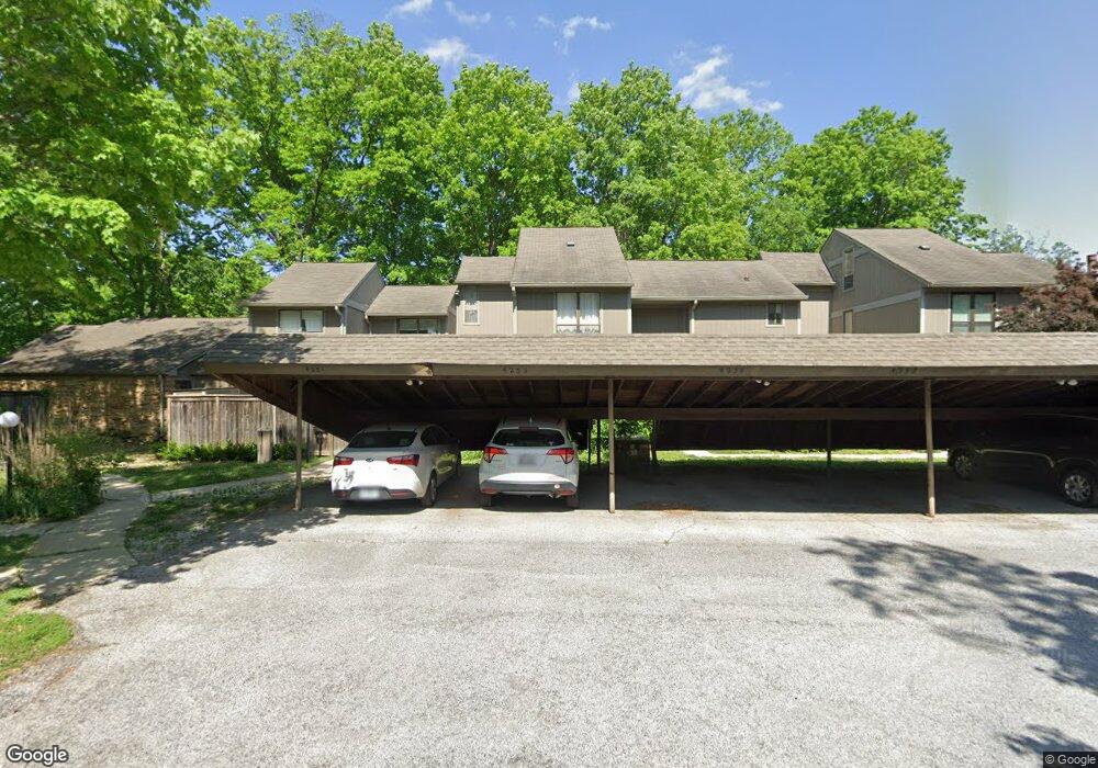
4239 Larkspur Trace Unit 1 Indianapolis, IN 46237
University Heights NeighborhoodEstimated Value: $119,000 - $162,576
3
Beds
3
Baths
1,750
Sq Ft
$76/Sq Ft
Est. Value
About This Home
This home is located at 4239 Larkspur Trace Unit 1, Indianapolis, IN 46237 and is currently estimated at $133,144, approximately $76 per square foot. 4239 Larkspur Trace Unit 1 is a home located in Marion County with nearby schools including Clinton Young Elementary School, Southport 6th Grade Academy, and Southport Middle School.
Ownership History
Date
Name
Owned For
Owner Type
Purchase Details
Closed on
May 20, 2025
Sold by
Hamilton Joseph
Bought by
Robinson Wendy M
Current Estimated Value
Purchase Details
Closed on
Jul 15, 2021
Sold by
Garr Leslie L
Bought by
Hamilton Joseph
Home Financials for this Owner
Home Financials are based on the most recent Mortgage that was taken out on this home.
Original Mortgage
$108,000
Interest Rate
2.96%
Mortgage Type
New Conventional
Purchase Details
Closed on
Oct 20, 2014
Sold by
Garr Leslie L
Bought by
Leslie L Garr Trust Agreement
Create a Home Valuation Report for This Property
The Home Valuation Report is an in-depth analysis detailing your home's value as well as a comparison with similar homes in the area
Home Values in the Area
Average Home Value in this Area
Purchase History
| Date | Buyer | Sale Price | Title Company |
|---|---|---|---|
| Robinson Wendy M | -- | None Listed On Document | |
| Hamilton Joseph | $120,000 | Chicago Title | |
| Leslie L Garr Trust Agreement | -- | None Available |
Source: Public Records
Mortgage History
| Date | Status | Borrower | Loan Amount |
|---|---|---|---|
| Previous Owner | Hamilton Joseph | $108,000 |
Source: Public Records
Tax History Compared to Growth
Tax History
| Year | Tax Paid | Tax Assessment Tax Assessment Total Assessment is a certain percentage of the fair market value that is determined by local assessors to be the total taxable value of land and additions on the property. | Land | Improvement |
|---|---|---|---|---|
| 2024 | $1,677 | $139,200 | $12,500 | $126,700 |
| 2023 | $1,677 | $145,700 | $12,500 | $133,200 |
| 2022 | $1,572 | $128,900 | $12,500 | $116,400 |
| 2021 | $725 | $100,300 | $12,300 | $88,000 |
| 2020 | $497 | $88,600 | $12,300 | $76,300 |
| 2019 | $432 | $83,000 | $12,400 | $70,600 |
| 2018 | $241 | $70,400 | $12,400 | $58,000 |
| 2017 | $183 | $63,300 | $12,300 | $51,000 |
| 2016 | $203 | $65,700 | $12,400 | $53,300 |
| 2014 | $477 | $52,000 | $12,300 | $39,700 |
| 2013 | $477 | $96,300 | $12,300 | $84,000 |
Source: Public Records
Map
Nearby Homes
- 4235 Foxglove Trace
- 4261 Foxglove Trace
- 4219 Terra Dr
- 3731 Owster Ln
- 3510 Chamberlin Dr
- 3830 S Olney St
- 14 Melody Ct
- 3611 Owster Ln
- 508 S 9th Ave
- 703 Redfern Dr
- 3220 Chamberlin Dr
- 402 Cherry St
- 1445 Biloxi Ln
- 602 Memorial Dr
- 725 S 4th Ave
- 1117 Byland Dr
- 619 Memorial Dr
- 1701 S 9th Ave
- 227 S 12th Ave
- 3905 Shelbyville Rd
- 4235 Larkspur Trace
- 4243 Larkspur Trace
- 4243 Larkspur Trace Unit 42
- 4231 Larkspur Trace
- 4231 Larkspur Trace Unit E
- 4238 Woodsage Trace
- 4230 Larkspur Trace
- 4255 Larkspur Trace
- 4242 Woodsage Trace
- 4246 Woodsage Trace
- 4234 Woodsage Trace
- 4250 Woodsage Trace
- 4258 Woodsage Trace
- 4234 Larkspur Trace
- 4259 Larkspur Trace
- 4262 Woodsage Trace
- 4254 Woodsage Trace
- 4230 Woodsage Trace Unit j3
- 4263 Larkspur Trace
- 4266 Woodsage Trace