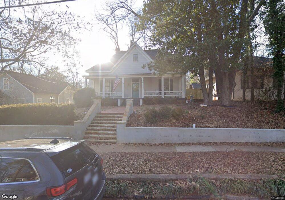
424 Bloomfield St Athens, GA 30605
Midtown-Bloomfield NeighborhoodEstimated Value: $795,000 - $1,239,000
5
Beds
2
Baths
2,922
Sq Ft
$374/Sq Ft
Est. Value
About This Home
This home is located at 424 Bloomfield St, Athens, GA 30605 and is currently estimated at $1,092,731, approximately $373 per square foot. 424 Bloomfield St is a home located in Clarke County with nearby schools including Barrow Elementary School, Clarke Middle School, and Clarke Central High School.
Ownership History
Date
Name
Owned For
Owner Type
Purchase Details
Closed on
Jul 8, 2019
Sold by
424 Bloomfield Llc
Bought by
Winters Albert J and Shockley Kristen M
Current Estimated Value
Purchase Details
Closed on
Jan 11, 2019
Sold by
Winters Albert J
Bought by
424 Bloomfield Llc
Purchase Details
Closed on
Mar 21, 2017
Sold by
Poller Storey Renee
Bought by
Winters Albert Joseph
Purchase Details
Closed on
Jul 26, 1990
Sold by
Teller Robert S and Teller Renee P
Bought by
Teller Renee P
Create a Home Valuation Report for This Property
The Home Valuation Report is an in-depth analysis detailing your home's value as well as a comparison with similar homes in the area
Home Values in the Area
Average Home Value in this Area
Purchase History
| Date | Buyer | Sale Price | Title Company |
|---|---|---|---|
| Winters Albert J | -- | -- | |
| 424 Bloomfield Llc | -- | -- | |
| Winters Albert Joseph | $290,000 | -- | |
| Teller Renee P | -- | -- |
Source: Public Records
Tax History Compared to Growth
Tax History
| Year | Tax Paid | Tax Assessment Tax Assessment Total Assessment is a certain percentage of the fair market value that is determined by local assessors to be the total taxable value of land and additions on the property. | Land | Improvement |
|---|---|---|---|---|
| 2025 | $13,336 | $463,156 | $50,000 | $413,156 |
| 2024 | $13,336 | $418,230 | $40,000 | $378,230 |
| 2023 | $12,570 | $378,328 | $40,000 | $338,328 |
| 2022 | $10,198 | $329,677 | $40,000 | $289,677 |
| 2021 | $8,889 | $273,783 | $40,000 | $233,783 |
| 2020 | $8,118 | $250,897 | $40,000 | $210,897 |
| 2019 | $4,254 | $125,306 | $40,000 | $85,306 |
| 2018 | $3,938 | $128,665 | $40,000 | $88,665 |
| 2017 | $4,453 | $131,149 | $40,000 | $91,149 |
| 2016 | $4,231 | $124,613 | $40,000 | $84,613 |
| 2015 | $3,916 | $115,173 | $40,000 | $75,173 |
| 2014 | $3,886 | $114,136 | $34,000 | $80,136 |
Source: Public Records
Map
Nearby Homes
- 50 Springdale St
- 255 Bloomfield St
- 997 S Milledge Ave Unit 2
- 997 S Milledge Ave Unit 3
- 997 S Milledge Ave Unit 1
- 997 S Milledge Ave Unit 4
- 265 Springdale St
- 338 Springdale St
- 494 Baxter St Unit 32
- 577 W Cloverhurst Ave
- 495 Woodlawn Ave
- 365 S Church St Unit 1A, 1B, 1C
- 221 University Dr
- 1055 Baxter St Unit 504
- 597 Dearing St
- 500 Dearing St Unit 6
- 490 Mcwhorter Dr
- 515 Hampton Ct
- 490 Ofarrell St
- 440 Bloomfield St
- 420 Bloomfield St
- 117 Springdale St
- 120 W Cloverhurst Ave
- 120.5 Cloverhurst Ave W
- 130 W Cloverhurst Ave
- 0 Bloomfield St Unit 7259420
- 121 Springdale St
- 124 W Cloverhurst Ave
- 166 W Cloverhurst Ave
- 437 Bloomfield St
- 427 Bloomfield St
- 45 Mell St
- 188 W Cloverhurst Ave
- 441 Bloomfield St
- 127 Springdale St
- 320 Bloomfield St
- 120 Springdale St
- 397 Bloomfield St Unit 3
- 397 Bloomfield St Unit 2