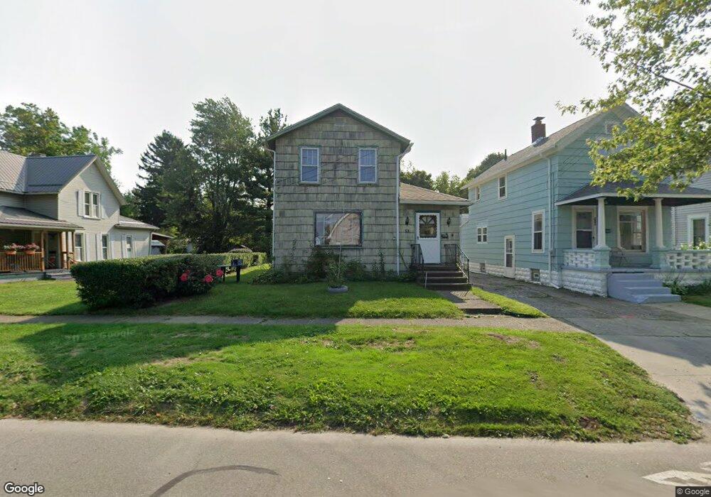
424 Broad St Conneaut, OH 44030
Estimated Value: $79,866 - $128,000
3
Beds
2
Baths
1,440
Sq Ft
$70/Sq Ft
Est. Value
About This Home
This home is located at 424 Broad St, Conneaut, OH 44030 and is currently estimated at $101,467, approximately $70 per square foot. 424 Broad St is a home located in Ashtabula County with nearby schools including Lakeshore Primary Elementary School, Gateway Elementary School, and Conneaut Middle School.
Ownership History
Date
Name
Owned For
Owner Type
Purchase Details
Closed on
Feb 22, 2011
Sold by
Hwc Enterprises Llc
Bought by
Andover Holding Llc
Current Estimated Value
Purchase Details
Closed on
Jun 18, 2002
Sold by
Conneaut Savings Bank
Bought by
Hwc Enterprises Llc
Home Financials for this Owner
Home Financials are based on the most recent Mortgage that was taken out on this home.
Original Mortgage
$38,000
Interest Rate
6.87%
Mortgage Type
New Conventional
Purchase Details
Closed on
Jul 19, 1994
Sold by
Daugherty Lena K
Bought by
Worley Karen L
Home Financials for this Owner
Home Financials are based on the most recent Mortgage that was taken out on this home.
Original Mortgage
$20,000
Interest Rate
8.6%
Mortgage Type
New Conventional
Create a Home Valuation Report for This Property
The Home Valuation Report is an in-depth analysis detailing your home's value as well as a comparison with similar homes in the area
Home Values in the Area
Average Home Value in this Area
Purchase History
| Date | Buyer | Sale Price | Title Company |
|---|---|---|---|
| Andover Holding Llc | $19,500 | Chicago Title | |
| Hwc Enterprises Llc | $36,000 | -- | |
| Worley Karen L | $21,000 | -- |
Source: Public Records
Mortgage History
| Date | Status | Borrower | Loan Amount |
|---|---|---|---|
| Previous Owner | Hwc Enterprises Llc | $38,000 | |
| Previous Owner | Worley Karen L | $20,000 |
Source: Public Records
Tax History
| Year | Tax Paid | Tax Assessment Tax Assessment Total Assessment is a certain percentage of the fair market value that is determined by local assessors to be the total taxable value of land and additions on the property. | Land | Improvement |
|---|---|---|---|---|
| 2024 | $968 | $13,230 | $1,890 | $11,340 |
| 2023 | $632 | $13,230 | $1,890 | $11,340 |
| 2022 | $552 | $10,160 | $1,440 | $8,720 |
| 2021 | $561 | $10,160 | $1,440 | $8,720 |
| 2020 | $561 | $10,160 | $1,440 | $8,720 |
| 2019 | $520 | $9,240 | $980 | $8,260 |
| 2018 | $497 | $9,240 | $980 | $8,260 |
| 2017 | $0 | $9,240 | $980 | $8,260 |
| 2016 | $660 | $13,480 | $1,440 | $12,040 |
| 2015 | $666 | $13,480 | $1,440 | $12,040 |
| 2014 | $590 | $13,480 | $1,440 | $12,040 |
| 2013 | $493 | $11,560 | $1,440 | $10,120 |
Source: Public Records
Map
Nearby Homes
- 386 Washington St
- 450 Buffalo St
- 179 Marshall St
- 375 Bliss Ave
- 146 Nickle Plate Ave
- 284 Clay St
- 555 Wrights Ave
- 169 River St
- 475 State St
- 536 Madison St
- 716 Chestnut St
- 404 Viaduct St
- 474 Sherman St
- 166 Welton Rd
- 681 Madison St
- 992 Mill St
- 745 Maple Ave
- 238 Whitney St
- 855 Spring St Unit S9
- 18 Hillcrest Ct
- 432 Broad St
- 418 Broad St
- 412 Broad St
- 403 Washington St
- 407 Washington St
- 440 Broad St
- 399 Washington St
- 408 Broad St
- 409 Washington St
- 393 Washington St
- 444 Broad St
- 406 Broad St
- 406 Broad State Rd 7 St
- 245 Depot St
- 387 Washington St
- 423 Broad St
- 427 Broad St
- 417 Broad St
- 439 Broad St
- 396 Broad St
Your Personal Tour Guide
Ask me questions while you tour the home.