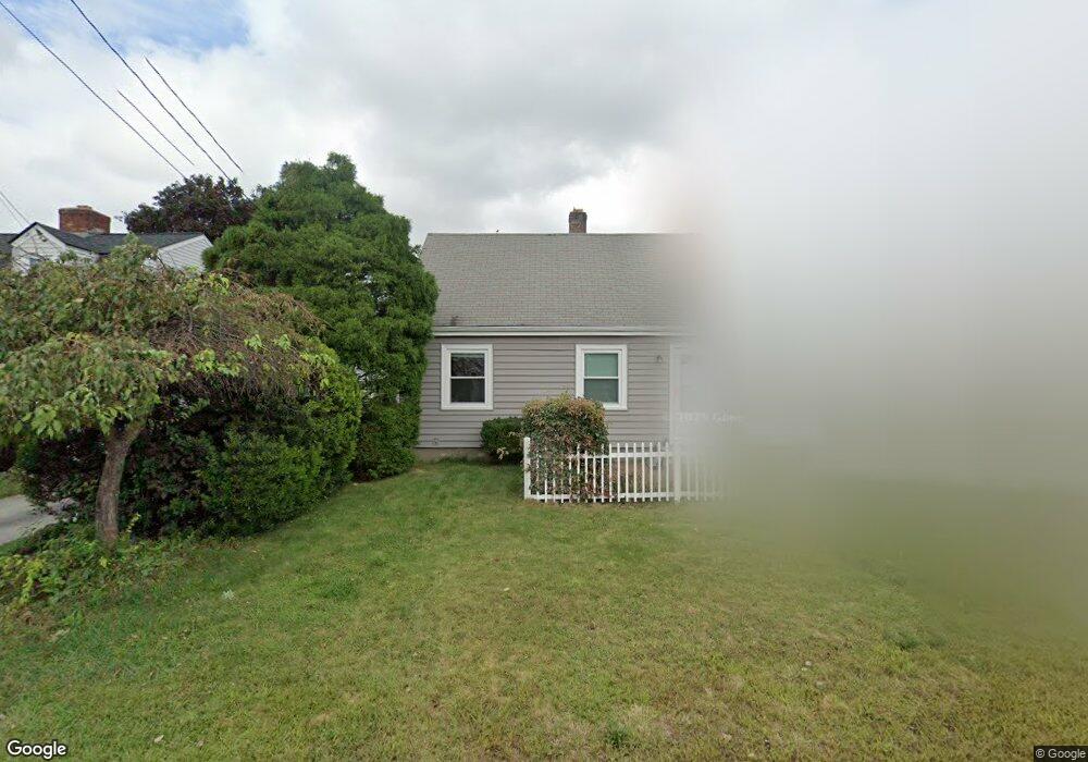
424 Carter Ave Pawtucket, RI 02861
Darlington NeighborhoodEstimated Value: $351,857 - $415,000
1
Bed
1
Bath
1,137
Sq Ft
$335/Sq Ft
Est. Value
About This Home
This home is located at 424 Carter Ave, Pawtucket, RI 02861 and is currently estimated at $380,964, approximately $335 per square foot. 424 Carter Ave is a home located in Providence County with nearby schools including St Cecilia School and Saint Teresa Catholic Elementary School.
Ownership History
Date
Name
Owned For
Owner Type
Purchase Details
Closed on
Jul 21, 2006
Sold by
Brouwer Claire M
Bought by
Peavey Teresa A and Peavey Joseph A
Current Estimated Value
Home Financials for this Owner
Home Financials are based on the most recent Mortgage that was taken out on this home.
Original Mortgage
$240,000
Interest Rate
6.67%
Mortgage Type
Purchase Money Mortgage
Purchase Details
Closed on
Jul 25, 1995
Sold by
Leach Robert and Leach Gerald
Bought by
Brouwer Claire
Home Financials for this Owner
Home Financials are based on the most recent Mortgage that was taken out on this home.
Original Mortgage
$71,645
Interest Rate
7.49%
Create a Home Valuation Report for This Property
The Home Valuation Report is an in-depth analysis detailing your home's value as well as a comparison with similar homes in the area
Home Values in the Area
Average Home Value in this Area
Purchase History
| Date | Buyer | Sale Price | Title Company |
|---|---|---|---|
| Peavey Teresa A | $240,000 | -- | |
| Brouwer Claire | $80,000 | -- |
Source: Public Records
Mortgage History
| Date | Status | Borrower | Loan Amount |
|---|---|---|---|
| Open | Brouwer Claire | $226,900 | |
| Closed | Brouwer Claire | $240,000 | |
| Previous Owner | Brouwer Claire | $64,000 | |
| Previous Owner | Brouwer Claire | $71,645 |
Source: Public Records
Tax History
| Year | Tax Paid | Tax Assessment Tax Assessment Total Assessment is a certain percentage of the fair market value that is determined by local assessors to be the total taxable value of land and additions on the property. | Land | Improvement |
|---|---|---|---|---|
| 2025 | $3,624 | $275,600 | $139,000 | $136,600 |
| 2024 | $3,401 | $275,600 | $139,000 | $136,600 |
| 2023 | $3,359 | $198,300 | $82,400 | $115,900 |
| 2022 | $3,288 | $198,300 | $82,400 | $115,900 |
| 2021 | $3,288 | $198,300 | $82,400 | $115,900 |
| 2020 | $3,438 | $164,600 | $78,900 | $85,700 |
| 2019 | $3,438 | $164,600 | $78,900 | $85,700 |
| 2018 | $3,313 | $164,600 | $78,900 | $85,700 |
| 2017 | $2,904 | $127,800 | $57,100 | $70,700 |
| 2016 | $2,798 | $127,800 | $57,100 | $70,700 |
| 2015 | $2,798 | $127,800 | $57,100 | $70,700 |
| 2014 | $2,767 | $120,000 | $51,100 | $68,900 |
Source: Public Records
Map
Nearby Homes
- 3 Hutchinson Ave
- 128 Warwick Rd
- 30 Eddington St
- 43 Warwick Rd
- 76 London Ave
- 214 Grand Ave
- 141 Hanover Ave
- 619 Armistice Blvd
- 64 Brookdale Blvd
- 200 Carter Ave
- 139 Suffolk Ave
- 496 Daggett Ave
- 15 Draper St
- 888 Central Ave
- 84 Bellevue Ave
- 140 Robinson Ave
- 105 Metropolitan Park Ave
- 41 Calder St
- 99 Roosevelt St
- 127 Ricard St
Your Personal Tour Guide
Ask me questions while you tour the home.