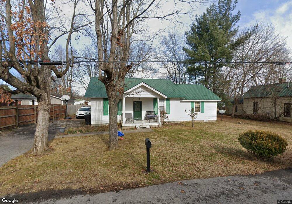
424 Forrest St Franklin, TN 37064
Central Franklin NeighborhoodEstimated Value: $572,607 - $651,000
Studio
1
Bath
1,296
Sq Ft
$472/Sq Ft
Est. Value
About This Home
This home is located at 424 Forrest St, Franklin, TN 37064 and is currently estimated at $611,152, approximately $471 per square foot. 424 Forrest St is a home located in Williamson County with nearby schools including Franklin Elementary School, Freedom Intermediate School, and Freedom Middle School.
Ownership History
Date
Name
Owned For
Owner Type
Purchase Details
Closed on
Sep 18, 2014
Sold by
Joseph Solomon Llc
Bought by
Claiborne And Hughes Center
Current Estimated Value
Purchase Details
Closed on
Feb 20, 2002
Sold by
Osborne Margree and Tennessee Convetional Loans In
Bought by
Derryberry William Michael and Derryberry Helen M
Purchase Details
Closed on
Oct 5, 1999
Sold by
Osborne Margree
Bought by
Osborne Robert Dale
Create a Home Valuation Report for This Property
The Home Valuation Report is an in-depth analysis detailing your home's value as well as a comparison with similar homes in the area
Home Values in the Area
Average Home Value in this Area
Purchase History
| Date | Buyer | Sale Price | Title Company |
|---|---|---|---|
| Claiborne And Hughes Center | -- | None Available | |
| Derryberry William Michael | $70,323 | -- | |
| Osborne Robert Dale | $37,500 | -- |
Source: Public Records
Tax History
| Year | Tax Paid | Tax Assessment Tax Assessment Total Assessment is a certain percentage of the fair market value that is determined by local assessors to be the total taxable value of land and additions on the property. | Land | Improvement |
|---|---|---|---|---|
| 2025 | -- | $138,750 | $93,450 | $45,300 |
| 2024 | -- | $78,325 | $38,475 | $39,850 |
| 2023 | $0 | $78,325 | $38,475 | $39,850 |
| 2022 | $2,131 | $78,325 | $38,475 | $39,850 |
| 2021 | $2,131 | $78,325 | $38,475 | $39,850 |
| 2020 | $1,515 | $46,950 | $17,100 | $29,850 |
| 2019 | $1,515 | $46,950 | $17,100 | $29,850 |
| 2018 | $1,482 | $46,950 | $17,100 | $29,850 |
| 2017 | $1,458 | $46,950 | $17,100 | $29,850 |
Source: Public Records
Map
Nearby Homes
- 804 W End Cir
- 1164 Brookwood Ave
- 503 N Petway St
- 704 W End Cir
- 1191 W Main St
- 1319 W Main St Unit 108
- 1319 W Main St Unit 104
- 1319 W Main St Unit 303
- 1319 W Main St Unit 105
- 1303 Chickering Dr Unit 101 & 102
- 6057 Stone Cliff Ln
- 6065 Stone Cliff Ln Unit Tr 7
- 6065 Stone Cliff Ln
- 6057 Stone Cliff Ln Unit Tr 6
- 1023 Benelli Park Ct
- 312 Everbright St Unit B
- 601 Boyd Mill Ave Unit A2
- 601 Boyd Mill Ave Unit N7
- 601 Boyd Mill Ave Unit Q5
- 601 Boyd Mill Ave Unit M3
- 420 Forrest St
- 426 Forrest St
- 418 Forrest St
- 1165 Brookwood Ave
- 428 Forrest St
- 416 Forrest St
- 423 N Petway St
- 427 N Petway St
- 421 N Petway St
- 429 N Petway St
- 419 N Petway St
- 421 Forrest St
- 1203 Brookwood Ave
- 417 Forrest St
- 417 Forrest St Unit B
- 417 Forrest St Unit A
- 427 Forrest St
- 431 N Petway St
- 419 Forrest St
- 417 N Petway St
Your Personal Tour Guide
Ask me questions while you tour the home.