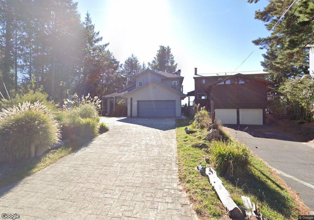
424 Humboldt Loop Whitethorn, CA 95589
Estimated Value: $413,000 - $531,000
3
Beds
3
Baths
2,100
Sq Ft
$223/Sq Ft
Est. Value
About This Home
This home is located at 424 Humboldt Loop, Whitethorn, CA 95589 and is currently estimated at $468,121, approximately $222 per square foot. 424 Humboldt Loop is a home located in Humboldt County.
Ownership History
Date
Name
Owned For
Owner Type
Purchase Details
Closed on
Nov 18, 2015
Sold by
Boedecker Willard R and Boedecker Douglas M
Bought by
Giles Allison
Current Estimated Value
Home Financials for this Owner
Home Financials are based on the most recent Mortgage that was taken out on this home.
Original Mortgage
$235,000
Outstanding Balance
$184,461
Interest Rate
3.73%
Mortgage Type
Purchase Money Mortgage
Estimated Equity
$283,660
Purchase Details
Closed on
May 20, 2015
Sold by
Boedecker Willard R and Estate Of Willard Roger Boedec
Bought by
Boedecker Williard R and Boedecker Douglas M
Create a Home Valuation Report for This Property
The Home Valuation Report is an in-depth analysis detailing your home's value as well as a comparison with similar homes in the area
Home Values in the Area
Average Home Value in this Area
Purchase History
| Date | Buyer | Sale Price | Title Company |
|---|---|---|---|
| Giles Allison | $275,000 | Fidelity Natl Title Co Of Ca | |
| Boedecker Williard R | -- | None Available |
Source: Public Records
Mortgage History
| Date | Status | Borrower | Loan Amount |
|---|---|---|---|
| Open | Giles Allison | $235,000 |
Source: Public Records
Tax History
| Year | Tax Paid | Tax Assessment Tax Assessment Total Assessment is a certain percentage of the fair market value that is determined by local assessors to be the total taxable value of land and additions on the property. | Land | Improvement |
|---|---|---|---|---|
| 2025 | $3,745 | $325,537 | $59,186 | $266,351 |
| 2024 | $3,745 | $319,155 | $58,026 | $261,129 |
| 2023 | $3,759 | $312,898 | $56,889 | $256,009 |
| 2022 | $3,704 | $306,764 | $55,774 | $250,990 |
| 2021 | $3,572 | $300,750 | $54,681 | $246,069 |
| 2020 | $3,592 | $297,667 | $54,121 | $243,546 |
| 2019 | $3,508 | $291,831 | $53,060 | $238,771 |
| 2018 | $3,451 | $286,110 | $52,020 | $234,090 |
| 2017 | $3,290 | $280,500 | $51,000 | $229,500 |
| 2016 | $3,272 | $275,000 | $50,000 | $225,000 |
| 2015 | $2,983 | $246,472 | $66,203 | $180,269 |
| 2014 | $2,813 | $241,645 | $64,907 | $176,738 |
Source: Public Records
Map
Nearby Homes
- 420 Humboldt Loop
- 440 Humboldt Loop
- 6 Seaview Point
- 443 Humboldt Loop
- 415 Humboldt Loop
- 14 Seaview Point
- 490 Humboldt Loop
- 7 Seaview Point
- 37 Tern Rd
- 13 Tern Rd
- 479 Humboldt Loop
- 19 Seaview Point
- 30 Seaview Point
- 478 Humboldt Loop
- 464 Humboldt Loop
- 385 Humboldt Loop
- 489 & 508 Humboldt Loop Rd
- 16 Eel Ct
- 508 Humboldt Loop Rd
- 63 Tern Rd
Your Personal Tour Guide
Ask me questions while you tour the home.