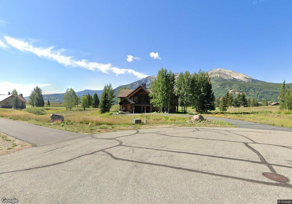
424 Par Ln Crested Butte, CO 81224
Estimated Value: $3,816,469 - $4,311,000
4
Beds
6
Baths
4,530
Sq Ft
$885/Sq Ft
Est. Value
About This Home
This home is located at 424 Par Ln, Crested Butte, CO 81224 and is currently estimated at $4,008,867, approximately $884 per square foot. 424 Par Ln is a home located in Gunnison County with nearby schools including Gunnison Elementary School, Crested Butte Community School, and Gunnison Middle School.
Ownership History
Date
Name
Owned For
Owner Type
Purchase Details
Closed on
Jun 9, 2000
Sold by
Hulsey Ben
Bought by
Hulsey Burl Benson Jr And Corrine H Trus
Current Estimated Value
Purchase Details
Closed on
Jun 8, 2000
Sold by
Hulsey Ben
Bought by
Hulsey Burl Benson and Hulsey Mary Gwnedoly
Purchase Details
Closed on
May 20, 1998
Sold by
Koyen Gary
Bought by
Hulsey Ben
Purchase Details
Closed on
Dec 21, 1993
Create a Home Valuation Report for This Property
The Home Valuation Report is an in-depth analysis detailing your home's value as well as a comparison with similar homes in the area
Home Values in the Area
Average Home Value in this Area
Purchase History
| Date | Buyer | Sale Price | Title Company |
|---|---|---|---|
| Hulsey Burl Benson Jr And Corrine H Trus | -- | -- | |
| Hulsey Burl Benson | -- | -- | |
| Hulsey Ben | $135,800 | -- | |
| -- | $85,000 | -- |
Source: Public Records
Tax History Compared to Growth
Tax History
| Year | Tax Paid | Tax Assessment Tax Assessment Total Assessment is a certain percentage of the fair market value that is determined by local assessors to be the total taxable value of land and additions on the property. | Land | Improvement |
|---|---|---|---|---|
| 2024 | $14,267 | $188,810 | $38,600 | $150,210 |
| 2023 | $14,126 | $185,120 | $37,850 | $147,270 |
| 2022 | $13,214 | $148,000 | $23,280 | $124,720 |
| 2021 | $12,164 | $152,260 | $23,950 | $128,310 |
| 2020 | $8,549 | $101,560 | $20,110 | $81,450 |
| 2019 | $8,431 | $101,560 | $20,110 | $81,450 |
| 2018 | $8,660 | $96,270 | $17,500 | $78,770 |
| 2017 | $8,717 | $96,270 | $17,500 | $78,770 |
| 2016 | $8,431 | $96,980 | $19,900 | $77,080 |
| 2015 | -- | $96,980 | $19,900 | $77,080 |
| 2014 | -- | $77,630 | $18,100 | $59,530 |
Source: Public Records
Map
Nearby Homes
- 315 Par Ln
- 262 Larkspur Loop
- 412 Ridge Rd
- 365 Larkspur Loop
- 350 Country Club Dr Unit 217A
- 350 Country Club Dr Unit 218A
- 350 Country Club Dr Unit 402A
- 115 Larkspur Loop
- 402 Eagle Ln
- 77 S Avion Dr
- 42 Lexie Ct
- 166 & 168 Coyote Cir
- 44 County Road 738a Brush Creek Rd
- 360 Wapiti Ln
- 434 Country Club Dr
- 136 N Avion Dr
- 163 N Avion Dr
- 64 Vista Ct
- 0 Tbd Saddle Ridge Rd
- 214 Elk Valley Rd
- 374 Par Ln
- 346 Par Ln
- 346 Par Ln Unit Par Lane Townhomes a
- 457 Par Ln
- 492 Par Ln
- 244 Par Ln
- 290 Par Ln
- 416 Par Ln
- 152 Par Ln
- 371 Par Ln
- 182 Par Ln
- 0 Par Ln Unit on 1st Fariway of go
- 0 Par Ln Unit On 4th green of Robe
- 0 Par Ln Unit On 3rd green of Robe
- 0 Par Ln Unit 2171
- 0 Par Ln Unit Par Lane Townhomes a
- 0 Par Ln Unit 2 13068
- 0 Par Ln Unit 3479
- 0 Par Ln Unit 3500
- 0 Par Ln Unit 3721