Estimated Value: $384,000 - $419,000
4
Beds
3
Baths
2,497
Sq Ft
$160/Sq Ft
Est. Value
About This Home
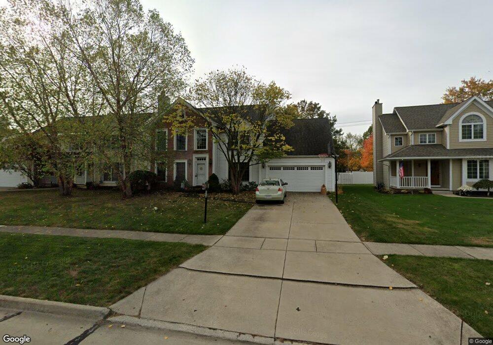
This home is located at 424 Park Place, Berea, OH 44017 and is currently estimated at $398,990, approximately $159 per square foot. 424 Park Place is a home located in Cuyahoga County with nearby schools including Grindstone Elementary School, Berea-Midpark Middle School, and Berea-Midpark High School.
Ownership History
Date
Name
Owned For
Owner Type
Purchase Details
Closed on
Oct 3, 2002
Sold by
Hays Margaret C and Paul Hays W
Bought by
Chapman John S and Chapman Ana M
Current Estimated Value
Home Financials for this Owner
Home Financials are based on the most recent Mortgage that was taken out on this home.
Original Mortgage
$156,000
Outstanding Balance
$62,239
Interest Rate
5.5%
Mortgage Type
Purchase Money Mortgage
Estimated Equity
$336,751
Purchase Details
Closed on
Apr 6, 1994
Sold by
Hays W C and M C
Bought by
Hays Margaret C
Purchase Details
Closed on
Jan 1, 1992
Bought by
Hays W C and M C
Create a Home Valuation Report for This Property
The Home Valuation Report is an in-depth analysis detailing your home's value as well as a comparison with similar homes in the area
Home Values in the Area
Average Home Value in this Area
Purchase History
| Date | Buyer | Sale Price | Title Company |
|---|---|---|---|
| Chapman John S | $195,000 | Midland Title Security Inc | |
| Hays Margaret C | -- | -- | |
| Hays W C | -- | -- |
Source: Public Records
Mortgage History
| Date | Status | Borrower | Loan Amount |
|---|---|---|---|
| Open | Chapman John S | $156,000 |
Source: Public Records
Tax History
| Year | Tax Paid | Tax Assessment Tax Assessment Total Assessment is a certain percentage of the fair market value that is determined by local assessors to be the total taxable value of land and additions on the property. | Land | Improvement |
|---|---|---|---|---|
| 2024 | $7,842 | $118,790 | $20,125 | $98,665 |
| 2023 | $6,689 | $91,010 | $17,260 | $73,750 |
| 2022 | $6,246 | $91,000 | $17,260 | $73,750 |
| 2021 | $6,193 | $91,000 | $17,260 | $73,750 |
| 2020 | $7,279 | $77,140 | $14,630 | $62,510 |
| 2019 | $7,606 | $220,400 | $41,800 | $178,600 |
| 2018 | $5,982 | $77,140 | $14,630 | $62,510 |
| 2017 | $5,285 | $66,050 | $13,720 | $52,330 |
| 2016 | $5,246 | $66,050 | $13,720 | $52,330 |
| 2015 | $4,813 | $66,050 | $13,720 | $52,330 |
| 2014 | $4,813 | $64,130 | $13,340 | $50,790 |
Source: Public Records
Map
Nearby Homes
- 428 Park Place
- 379 Laurel Dr
- 446 Redwood Dr
- 487 Karen Dr
- 452 N Rocky River Dr
- 160 Stonepointe Dr
- 725 Shakespeare Dr
- 445 Berea St
- 93 W 5th Ave
- 6574 Burton Dr
- 121 Slippery Rock Ln
- 146 Marian Ln
- 41 W 5th Ave
- 628 Lindbergh Blvd
- 404 Crescent Dr
- 160 Marian Ln Unit 6A
- 56 3rd Ave
- 211 W Bridge St
- 216 Kraft St
- 209 Gibson St
Your Personal Tour Guide
Ask me questions while you tour the home.