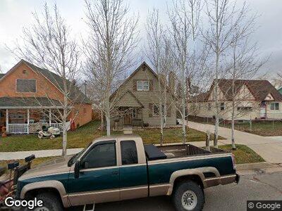
424 Sage St Evanston, WY 82930
Estimated Value: $318,000 - $371,000
3
Beds
3
Baths
2,222
Sq Ft
$155/Sq Ft
Est. Value
About This Home
This home is located at 424 Sage St, Evanston, WY 82930 and is currently estimated at $344,919, approximately $155 per square foot. 424 Sage St is a home located in Uinta County with nearby schools including Evanston High School and Evanston Child Development Center.
Ownership History
Date
Name
Owned For
Owner Type
Purchase Details
Closed on
Apr 25, 2014
Sold by
Mennsing Steven A
Bought by
Mensing Steven A and Mensing Jessica W
Current Estimated Value
Home Financials for this Owner
Home Financials are based on the most recent Mortgage that was taken out on this home.
Original Mortgage
$195,412
Outstanding Balance
$153,746
Interest Rate
4.36%
Mortgage Type
Purchase Money Mortgage
Purchase Details
Closed on
Nov 13, 2008
Sold by
Scarborough Roger Nelson and Scarborough Patricia Lynn
Bought by
Mensing Steven A
Home Financials for this Owner
Home Financials are based on the most recent Mortgage that was taken out on this home.
Original Mortgage
$199,328
Interest Rate
6.18%
Mortgage Type
FHA
Create a Home Valuation Report for This Property
The Home Valuation Report is an in-depth analysis detailing your home's value as well as a comparison with similar homes in the area
Home Values in the Area
Average Home Value in this Area
Purchase History
| Date | Buyer | Sale Price | Title Company |
|---|---|---|---|
| Mensing Steven A | -- | None Available | |
| Mensing Steven A | -- | None Available |
Source: Public Records
Mortgage History
| Date | Status | Borrower | Loan Amount |
|---|---|---|---|
| Open | Mensing Steven A | $195,412 | |
| Closed | Mensing Steve A | $197,903 | |
| Closed | Mensing Steven A | $200,914 | |
| Closed | Mensing Steven A | $202,314 | |
| Closed | Mensing Steven A | $199,328 | |
| Previous Owner | Scarborough Rober Nelson | $140,694 | |
| Previous Owner | Scarborogh Roger Nelson | $26,000 | |
| Previous Owner | Scarborough Roger | $14,970 | |
| Previous Owner | Scarborough Roger Nelson | $14,000 |
Source: Public Records
Tax History Compared to Growth
Tax History
| Year | Tax Paid | Tax Assessment Tax Assessment Total Assessment is a certain percentage of the fair market value that is determined by local assessors to be the total taxable value of land and additions on the property. | Land | Improvement |
|---|---|---|---|---|
| 2024 | $2,284 | $33,609 | $2,824 | $30,785 |
| 2023 | $2,240 | $33,109 | $2,824 | $30,285 |
| 2022 | $2,254 | $27,975 | $1,879 | $26,096 |
| 2021 | $1,415 | $20,761 | $1,879 | $18,882 |
| 2020 | $1,391 | $20,421 | $1,859 | $18,562 |
| 2019 | $1,308 | $19,231 | $1,859 | $17,372 |
| 2018 | $1,005 | $18,523 | $1,956 | $16,567 |
| 2017 | $1,200 | $17,663 | $1,956 | $15,707 |
| 2016 | $1,174 | $17,255 | $1,783 | $15,472 |
| 2015 | -- | $17,245 | $1,783 | $15,462 |
| 2014 | -- | $18,277 | $0 | $0 |
Source: Public Records
Map
Nearby Homes
- 237 4th St
- 341 Main St
- 325 Main St
- 318 8th St
- 203 Cheyenne Dr
- 924 Sage St
- 26 Providence Way
- Lot 73 High Point Ranch
- 814 Lombard St
- 147 Apache Dr
- 108 Cherokee Ct
- 725 12th St
- 723 Sioux Dr
- 1348 Center St
- 432 15th St
- 1617 W Center St
- 252 Jared Ln
- 222 Roosevelt Ave
- 0 B&j Estates Lot#10 Unit 20252274
- 509 County Rd