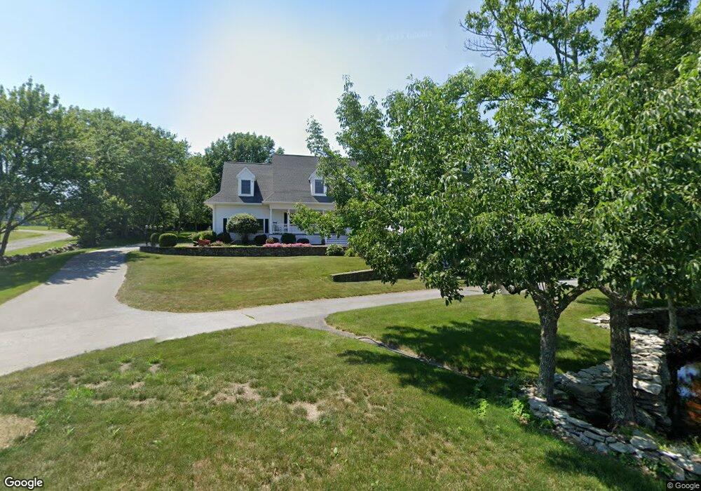
424 Sharps Lot Rd Swansea, MA 02777
Northeast Swansea NeighborhoodEstimated Value: $920,000 - $1,293,000
4
Beds
3
Baths
4,064
Sq Ft
$274/Sq Ft
Est. Value
About This Home
This home is located at 424 Sharps Lot Rd, Swansea, MA 02777 and is currently estimated at $1,112,255, approximately $273 per square foot. 424 Sharps Lot Rd is a home located in Bristol County with nearby schools including Joseph Case High School, SCEC Life Academy, and Swansea Wood School.
Ownership History
Date
Name
Owned For
Owner Type
Purchase Details
Closed on
Feb 10, 2003
Sold by
Ledoux Robert
Bought by
Bisbano John D and Bisbano Shelley A
Current Estimated Value
Purchase Details
Closed on
Mar 20, 1995
Sold by
Shaw Jeanne and Montplaisir Cecile J
Bought by
Ledoux Robert
Create a Home Valuation Report for This Property
The Home Valuation Report is an in-depth analysis detailing your home's value as well as a comparison with similar homes in the area
Home Values in the Area
Average Home Value in this Area
Purchase History
| Date | Buyer | Sale Price | Title Company |
|---|---|---|---|
| Bisbano John D | $90,000 | -- | |
| Ledoux Robert | $59,400 | -- |
Source: Public Records
Mortgage History
| Date | Status | Borrower | Loan Amount |
|---|---|---|---|
| Open | Ledoux Robert | $219,500 |
Source: Public Records
Tax History Compared to Growth
Tax History
| Year | Tax Paid | Tax Assessment Tax Assessment Total Assessment is a certain percentage of the fair market value that is determined by local assessors to be the total taxable value of land and additions on the property. | Land | Improvement |
|---|---|---|---|---|
| 2025 | $13,350 | $1,120,000 | $178,000 | $942,000 |
| 2024 | $13,201 | $1,101,000 | $178,000 | $923,000 |
| 2023 | $11,529 | $878,100 | $130,200 | $747,900 |
| 2022 | $11,233 | $780,600 | $118,500 | $662,100 |
| 2021 | $5,042 | $643,500 | $118,500 | $525,000 |
| 2020 | $10,012 | $642,600 | $118,500 | $524,100 |
| 2019 | $4,770 | $618,100 | $105,900 | $512,200 |
| 2018 | $9,423 | $616,700 | $104,500 | $512,200 |
| 2017 | $8,506 | $640,500 | $104,500 | $536,000 |
| 2016 | $8,196 | $606,200 | $90,200 | $516,000 |
| 2015 | $7,496 | $570,900 | $90,200 | $480,700 |
| 2014 | $7,171 | $558,500 | $90,200 | $468,300 |
Source: Public Records
Map
Nearby Homes
- 745 Bark St
- 265 Stevens Rd
- 1067 Bark St
- 0B Cummings Rd
- 0A Cummings Rd
- 34 Base Lodge Ln
- 0 Bark St Unit 1342599
- 0 Bark St Unit 73152576
- 194 Hortonville Rd
- 122 Robin Ln
- 171 Marvel St
- 850 Hortonville Rd
- 95 Brookside Rd
- 65 Marvel St
- 0 Hortonville Rd Unit 73242268
- 490 Dillon Ln
- 602 Regan Rd
- 33 Rhinecliffe Rd
- 95 Samson Ave
- 112 Rounseville Ave
- 428 Sharps Lot Rd
- 404 Sharps Lot Rd
- 445 Sharps Lot Rd
- 374 Sharps Lot Rd
- 410 Sharps Lot Rd
- 448 Sharps Lot Rd
- 450 Sharps Lot Rd
- 468 Sharps Lot Rd
- 414 Sharps Lot Rd
- 350 Sharps Lot Rd
- 463 Sharps Lot Rd
- 480 Sharps Lot Rd
- 370 Sharps Lot Rd
- 333 Sharps Lot Rd
- 348 Sharps Lot Rd
- 457 Sharps Lot Rd
- 485 Sharps Lot Rd
- 494 Sharps Lot Rd
- 325 Sharps Lot Rd
- 502 Sharps Lot Rd