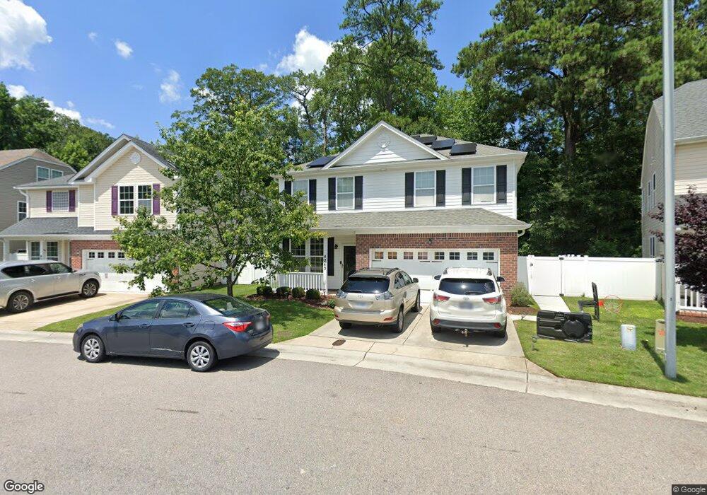
4243 White Cap Crest Chesapeake, VA 23321
Western Branch NeighborhoodEstimated Value: $373,000 - $405,000
4
Beds
3
Baths
2,240
Sq Ft
$173/Sq Ft
Est. Value
About This Home
This home is located at 4243 White Cap Crest, Chesapeake, VA 23321 and is currently estimated at $388,163, approximately $173 per square foot. 4243 White Cap Crest is a home located in Chesapeake City with nearby schools including Southwestern Elementary School, Jolliff Middle School, and Western Branch High School.
Ownership History
Date
Name
Owned For
Owner Type
Purchase Details
Closed on
Aug 20, 2018
Sold by
Murril Dion
Bought by
Ndipisiri Adeline M
Current Estimated Value
Home Financials for this Owner
Home Financials are based on the most recent Mortgage that was taken out on this home.
Original Mortgage
$244,440
Outstanding Balance
$212,286
Interest Rate
4.5%
Mortgage Type
New Conventional
Estimated Equity
$175,877
Purchase Details
Closed on
Oct 27, 2011
Sold by
Towne Park Building Llc
Bought by
Murril Dion
Home Financials for this Owner
Home Financials are based on the most recent Mortgage that was taken out on this home.
Original Mortgage
$252,550
Interest Rate
4.11%
Mortgage Type
VA
Create a Home Valuation Report for This Property
The Home Valuation Report is an in-depth analysis detailing your home's value as well as a comparison with similar homes in the area
Home Values in the Area
Average Home Value in this Area
Purchase History
| Date | Buyer | Sale Price | Title Company |
|---|---|---|---|
| Ndipisiri Adeline M | $252,000 | Attorney | |
| Murril Dion | $247,260 | -- |
Source: Public Records
Mortgage History
| Date | Status | Borrower | Loan Amount |
|---|---|---|---|
| Open | Ndipisiri Adeline M | $244,440 | |
| Previous Owner | Murril Dion | $252,550 |
Source: Public Records
Tax History
| Year | Tax Paid | Tax Assessment Tax Assessment Total Assessment is a certain percentage of the fair market value that is determined by local assessors to be the total taxable value of land and additions on the property. | Land | Improvement |
|---|---|---|---|---|
| 2025 | $3,465 | $379,100 | $100,000 | $279,100 |
| 2024 | $3,465 | $343,100 | $95,000 | $248,100 |
| 2023 | $3,011 | $330,500 | $85,000 | $245,500 |
| 2022 | $2,997 | $296,700 | $75,000 | $221,700 |
| 2021 | $2,714 | $258,500 | $65,000 | $193,500 |
| 2020 | $2,582 | $245,900 | $60,000 | $185,900 |
| 2019 | $2,544 | $242,300 | $60,000 | $182,300 |
| 2018 | $2,548 | $239,700 | $60,000 | $179,700 |
| 2017 | $2,517 | $239,700 | $60,000 | $179,700 |
| 2016 | $2,517 | $239,700 | $60,000 | $179,700 |
| 2015 | $2,427 | $231,100 | $55,000 | $176,100 |
| 2014 | $2,464 | $234,700 | $55,000 | $179,700 |
Source: Public Records
Map
Nearby Homes
- 4304 Center Mast Crest
- 3932 Pierce Ln
- 3860 Schooner Trail
- 4008 Sloop Trail
- 3980 Port Rd
- 3912 Holly Cove Dr
- .2ac Airline Blvd
- 3931 Port Rd
- 3924 Port Rd
- 4301 Airline Blvd
- 3861 Ahoy Dr
- 4004 River Breeze Cir
- 1908 Rosemary Ln
- 1432 Pine Grove Ln
- 3917 Rex Cir
- 3943 Rex Cir
- MM Bayberry
- MM the Grove (Laurel)
- MM Myrtle II
- 305 Bobby Jones Dr
- 4247 White Cap Crest Unit 73
- 4247 White Cap Crest
- 4239 White Cap Crest
- 4225 High Tide Way Unit 111
- 4225 High Tide Way
- 4251 White Cap Crest
- 4221 High Tide Way
- 4221 High Tide Way Unit 110
- 4255 White Cap Crest Unit 75
- 4255 White Cap Crest
- 4220 High Tide Way Unit 83
- 4220 High Tide Way
- 4217 High Tide Way
- 4217 High Tide Way Unit 109
- 4259 White Cap Crest Unit 76
- 4259 White Cap Crest
- 4216 High Tide Way
- 4216 High Tide Way Unit 84
- 4233 White Cap Crescent
- 4233 White Cap Crescent Unit 70
Your Personal Tour Guide
Ask me questions while you tour the home.