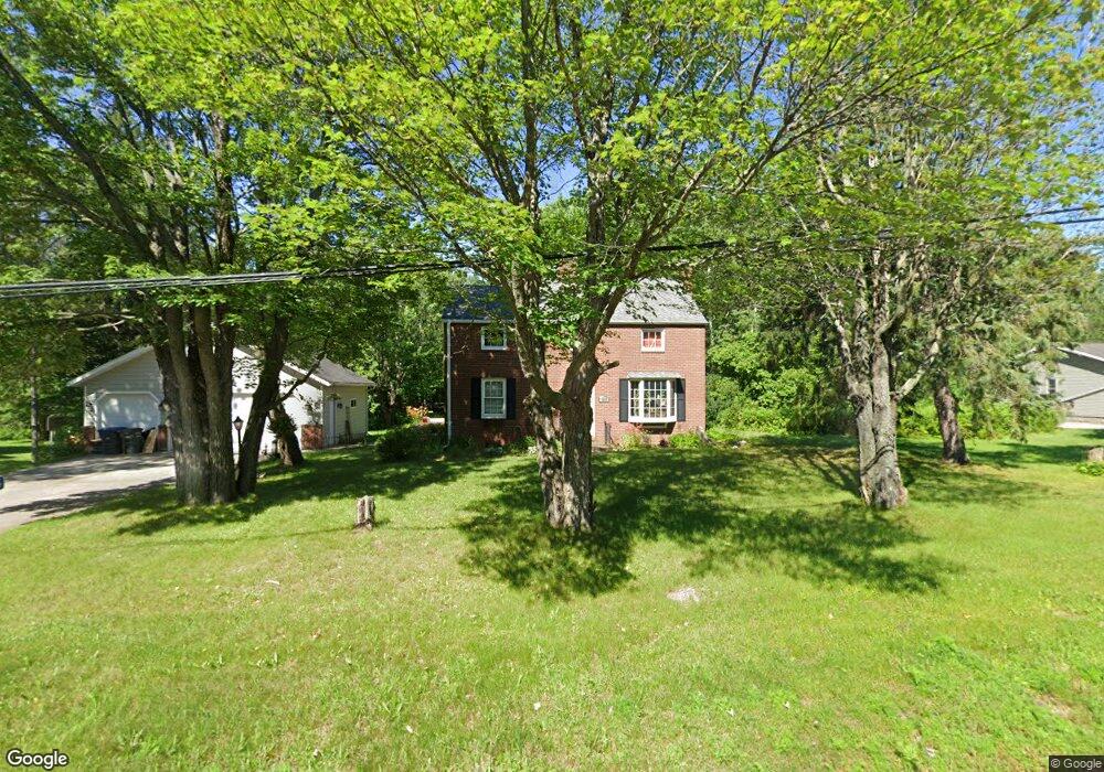
4245 Ugstad Rd Hermantown, MN 55811
Estimated Value: $421,000 - $467,000
4
Beds
2
Baths
2,005
Sq Ft
$221/Sq Ft
Est. Value
About This Home
This home is located at 4245 Ugstad Rd, Hermantown, MN 55811 and is currently estimated at $443,064, approximately $220 per square foot. 4245 Ugstad Rd is a home located in St. Louis County with nearby schools including Hermantown Elementary School, Hermantown Middle School, and Hermantown Middle - Senior High School.
Ownership History
Date
Name
Owned For
Owner Type
Purchase Details
Closed on
Jul 14, 2008
Sold by
Tiburzi Daniel and Tiburzi Lucille
Bought by
Tiburzi Daniel and Tiburzi Lucille
Current Estimated Value
Purchase Details
Closed on
Jul 22, 2005
Sold by
Lent Steven J and Lent Kristi Jo
Bought by
Tiburzi Daniel and Tiburzi Lucille
Purchase Details
Closed on
Jun 30, 2004
Sold by
Baker Mark J and Baker Sharon M
Bought by
Lent Steven J and Lent Kristi Jo
Home Financials for this Owner
Home Financials are based on the most recent Mortgage that was taken out on this home.
Original Mortgage
$166,400
Interest Rate
6.42%
Mortgage Type
Purchase Money Mortgage
Create a Home Valuation Report for This Property
The Home Valuation Report is an in-depth analysis detailing your home's value as well as a comparison with similar homes in the area
Home Values in the Area
Average Home Value in this Area
Purchase History
| Date | Buyer | Sale Price | Title Company |
|---|---|---|---|
| Tiburzi Daniel | -- | First American Title Ins Co | |
| Tiburzi Daniel | $204,500 | Rels Title | |
| Lent Steven J | $184,900 | Ati Title Company |
Source: Public Records
Mortgage History
| Date | Status | Borrower | Loan Amount |
|---|---|---|---|
| Previous Owner | Lent Steven J | $166,400 |
Source: Public Records
Tax History
| Year | Tax Paid | Tax Assessment Tax Assessment Total Assessment is a certain percentage of the fair market value that is determined by local assessors to be the total taxable value of land and additions on the property. | Land | Improvement |
|---|---|---|---|---|
| 2024 | $5,738 | $366,600 | $30,600 | $336,000 |
| 2023 | $5,738 | $335,800 | $29,400 | $306,400 |
| 2022 | $4,148 | $312,600 | $29,100 | $283,500 |
| 2021 | $3,960 | $272,800 | $28,200 | $244,600 |
| 2020 | $4,946 | $268,000 | $28,000 | $240,000 |
| 2019 | $4,418 | $320,900 | $60,400 | $260,500 |
| 2018 | $4,166 | $295,100 | $53,600 | $241,500 |
| 2017 | $2,566 | $280,700 | $50,100 | $230,600 |
| 2016 | $2,332 | $187,900 | $50,100 | $137,800 |
| 2015 | $2,874 | $156,800 | $40,100 | $116,700 |
| 2014 | $2,874 | $149,900 | $39,700 | $110,200 |
Source: Public Records
Map
Nearby Homes
- 52XX W Arrowhead Rd
- 4099 Maple Grove Rd
- 507X Maple Grove Rd
- 4391 Grouse Ridge Dr
- xxxx Maple Grove Rd
- 5093 W Arrowhead Rd
- 56xx Minnesota 194 Unit 5666 Hwy 194
- 5241 Miller Trunk Hwy
- 45xx - Lot B1 Norway Pines Place
- 45xx - Lot B2 Norway Pines Place
- 47xx Miller Trunk Hwy
- 5014 Maple Grove Rd
- 4976 Maribe Dr
- 4993 Maple Grove Rd
- 5186 Hermantown Rd
- 4344 Midway Rd
- 4235 Stebner Rd
- 4957 Evergreen Ln
- 51xx Lindahl Rd
- 4183 W Pond Dr
- 4241 Ugstad Rd
- 4239 Ugstad Rd
- 4239 Ugstad Rd
- 4251 Ugstad Rd
- 4242 Ugstad Rd
- 4234 Ugstad Rd
- 4255 Ugstad Rd
- 5290 Lavaque Junction Rd
- 5319 Roosevelt Dr
- 4230 Ugstad Rd
- 5321 Roosevelt Dr
- 4219 Ugstad Rd
- 5312 Roosevelt Dr
- 5314 Roosevelt Dr
- 4218 Ugstad Rd
- 5275 Lavaque Junction Rd
- 4264 Ugstad Rd
- 5320 Roosevelt Dr
- 4211 Ugstad Rd
- xxxx Roosevelt Dr