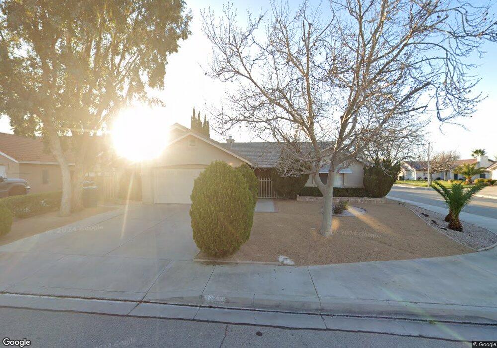
42459 Boulder Dr Lancaster, CA 93536
West Lancaster NeighborhoodEstimated Value: $503,044 - $568,000
3
Beds
2
Baths
1,809
Sq Ft
$296/Sq Ft
Est. Value
About This Home
This home is located at 42459 Boulder Dr, Lancaster, CA 93536 and is currently estimated at $535,761, approximately $296 per square foot. 42459 Boulder Dr is a home located in Los Angeles County with nearby schools including Sundown Elementary School, Joe Walker Middle School, and Quartz Hill High School.
Ownership History
Date
Name
Owned For
Owner Type
Purchase Details
Closed on
Nov 21, 2017
Sold by
Pecaro Gina J
Bought by
Pecaro Gina J and Bass Sharon B
Current Estimated Value
Purchase Details
Closed on
Oct 5, 1999
Sold by
Federal Home Loan Mortgage Corporation
Bought by
Pecaro Michael J and Pecaro Gina J
Purchase Details
Closed on
Jun 7, 1999
Sold by
Bowlin John M and Bowlin Cheryl A
Bought by
Federal Home Loan Mortgage Corporation
Purchase Details
Closed on
Jul 3, 1998
Sold by
Bowlin Ernest E
Bought by
Bowlin John M and Bowlin Cheryl A
Create a Home Valuation Report for This Property
The Home Valuation Report is an in-depth analysis detailing your home's value as well as a comparison with similar homes in the area
Home Values in the Area
Average Home Value in this Area
Purchase History
| Date | Buyer | Sale Price | Title Company |
|---|---|---|---|
| Pecaro Gina J | -- | None Available | |
| Pecaro Michael J | $137,500 | First American Title Co | |
| Federal Home Loan Mortgage Corporation | $126,874 | Fidelity National Title | |
| Bowlin John M | -- | -- |
Source: Public Records
Tax History
| Year | Tax Paid | Tax Assessment Tax Assessment Total Assessment is a certain percentage of the fair market value that is determined by local assessors to be the total taxable value of land and additions on the property. | Land | Improvement |
|---|---|---|---|---|
| 2025 | $2,399 | $90,036 | $41,887 | $48,149 |
| 2024 | $2,399 | $88,271 | $41,066 | $47,205 |
| 2023 | $2,370 | $86,541 | $40,261 | $46,280 |
| 2022 | $2,304 | $84,845 | $39,472 | $45,373 |
| 2021 | $1,927 | $83,183 | $38,699 | $44,484 |
| 2019 | $1,889 | $80,717 | $37,552 | $43,165 |
| 2018 | $1,865 | $79,135 | $36,816 | $42,319 |
| 2017 | $1,841 | $77,585 | $36,095 | $41,490 |
| 2016 | $1,776 | $76,065 | $35,388 | $40,677 |
| 2015 | $1,760 | $74,923 | $34,857 | $40,066 |
| 2014 | $1,778 | $73,457 | $34,175 | $39,282 |
Source: Public Records
Map
Nearby Homes
- 42350 Encanto Way
- 42427 61st St W
- 42453 Surrey Ct
- 6001 Brougham St
- 6652 Lacolle Place
- 6608 Teasdale St
- 42252 Blueflax Ave
- 5842 Corinthian Place
- 0 65th St W
- 0 Cor Ave L Pav 70th Stw Unit 22008217
- 42519 Cinnabar Ct
- 42428 Camden Way
- 42344 Camden Way
- 2000 Avenue L-4
- 42243 Camden Way
- 5817 Gem Ct
- 5619 W Avenue l4
- 43029 59th St W
- 6727 Miramar Ln
- 5711 Columbia Way Unit Spc 137
- 42451 Boulder Dr
- 42476 Plains Dr
- 42445 Boulder Dr
- 42472 Plains Dr
- 6259 W Avenue l6
- 6253 W Avenue l6
- 6242 W Avenue l6
- 42468 Plains Dr
- 6267 W Avenue l6
- 42437 Boulder Dr
- 6273 W Avenue l6
- 42446 Boulder Dr
- 6239 W Avenue l6
- 42460 Plains Dr
- 6234 W Avenue l6
- 42519 Boulder Dr
- 42431 Boulder Dr
- 42438 Boulder Dr
- 42536 Plains Dr
- 42454 Plains Dr